
-
2:06

Staying sunny until Thursday
-
0:58

Goshen City Council amends DORA rules amid community concerns
-
1:20

SB Common Council adopts Downtown 2045 Plan
-
2:39

Friends and family celebrate life of Jamecia Moffitt
-
1:15

St. Joseph County Council updates residents on Affordability...
-
0:51

Locals gather to recognize farmworkers across Northern Indiana
-
2:07

Impact of higher gas prices for delivery drivers
-
3:43

ND Eviction Clinic exposes ’shameful’ living conditions at...
-
3:59

Neighbors share traffic, noise concerns about proposed Capital...
-
1:50

Leaf pick up resumes in South Bend after weather postpones service...
-
1:02

Another rollercoaster ride to end the week
-
3:41

Present Pillars to host “Dad Strong 5K“ to support fathers...

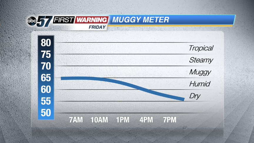 The humidity drops sharply Friday
Very muggy overnight into early Friday. Showers and storms increase in coverage becoming widespread after midnight and lasting through Friday morning. Storms are likely to be loud with thunder, heavy rain and possibly gusty wind. Some storms could be severe.
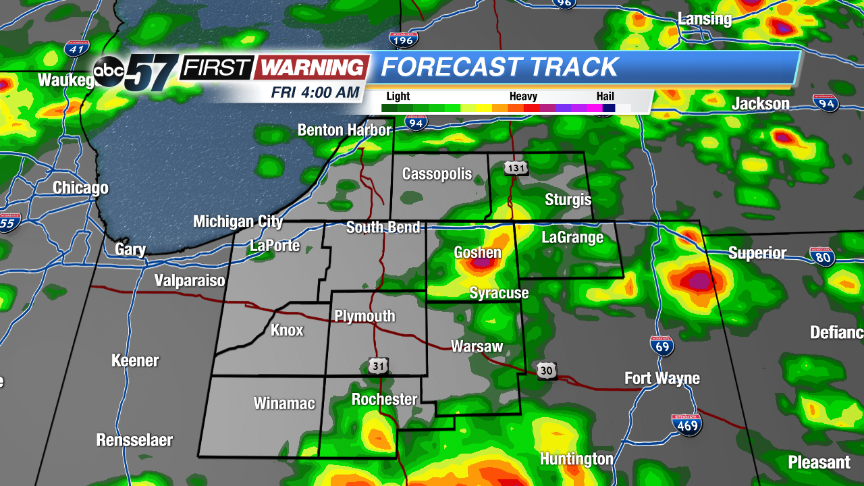 High resolution run of Forecast Track show storms coming together in the early morning Friday.
Morning showers and storms clear Friday and temperatures and the humidity drops. Skies will clear into Saturday and the weather will be unseasonably mild for the end of June. Highs will be in the low 70s through early next week before warming back into the 80s.
Tonight: Showers and storm likely, some could be strong, low of 68.
Friday: Morning showers and storms, then mostly to partly cloudy, high 76.
Saturday: Mostly sunny, high 74.
Sunday: Partly cloudy, highs in the low 70s.
Sign up for the ABC 57 Newsletter