
-
0:58

Indiana Football trophies tour stops by IUSB
-
0:57

How the town of Bourbon shapes up one year after EF-1 tornado
-
0:54

School City of Mishawaka announce Teachers of the Year
-
1:36

Severe threat not over
-
2:19

St. Joseph County officials address fax service hack
-
1:28

Round two around midnight
-
1:53

Local churches gearing up for the easter holiday amid a possible...
-
1:48

Preparations underway as Indiana University football trophies...
-
3:09

Indiana Utility Regulatory Commission collecting consumer data...
-
1:18

St. Joseph County officials host Election 101 Workshop on voting...
-
5:36

Hannah Hidalgo wins Naismith Defensive Player of the Year
-
2:50

New South Bend Cubs manager Daniel Wasinger ready for opening...

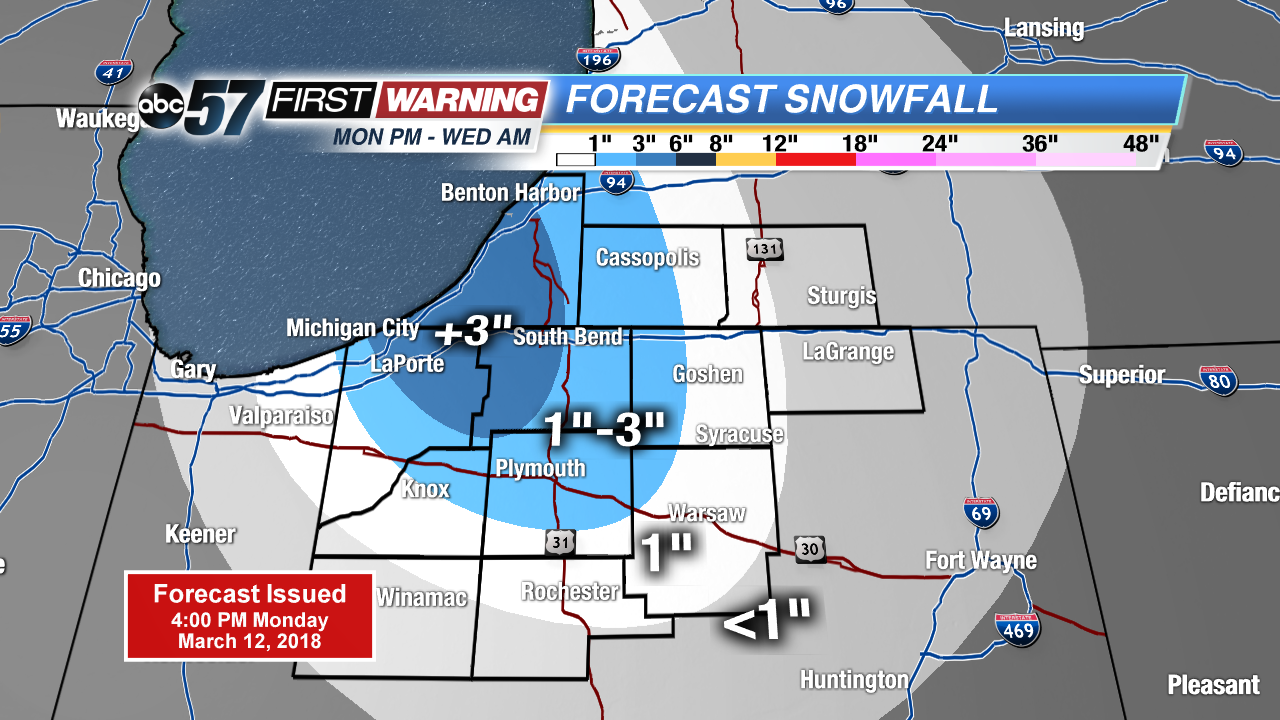
Snow squalls intensify after midnight, accumulation of more than three inches is possible in parts of Berrien, La Porte and St. Joseph counties. Greatest concern will be slick roads for the morning drive Tuesday.
Snowy start to Tuesday, roads may be slick with a few inches on the ground and a coating of snow or slush on the roads. Snow showers wane a bit during the day as temperatures warm towards the freezing mark. Snow showers may bring an additional inch Tuesday night as temperatures fall back into the 20s. Sunshine and a slow warm-up are in store the rest of the week.
Tonight: Lake effect snow showers, low 26.
Tuesday: Lake effect snow showers, high of 32.
Wednesday: Morning snow showers, high of 38.
Thursday: Mostly sunny, highs in the low 40s.