Snow starts again Monday

-
1:16

’IvyCares’ program setting students up for success in and...
-
1:45

Windy and wet this weekend, but unseasonable warmth as well
-
3:13

Local players react to $3 million investment in Byer Softball...
-
0:32

Layoffs at Whirlpool could affect workers in Benton Harbor
-
1:03

Annual District Sisterhood Conference at Ivy Tech empowers students
-
1:49

Back home in downtown South Bend, YMCA to open new location
-
2:16

This week’s ABC57 Cub Reporter is Nicholas Zentz
-
3:05

Amazon Web Services invests $11 billion to build data center...
-
4:05

Riley High School student center stage at the NFL Draft
-
1:35

Rain, wind, and milder temperatures forecast this weekend
-
2:49

Joe Alt expected to be drafted in the first round of NFL Draft
-
2:11

Students gearing up for local careers in Manufacturing

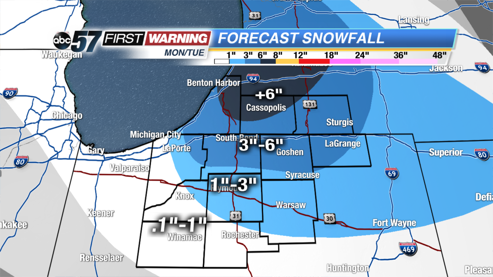
We have a snowy week ahead of us! The next winter system will bring snow showers and then lake effect snow, starting Monday and lasting until Wednesday. The system will bring light snow showers during the midday on Monday, mainly for our Michigan counties, and far northern Indiana counties. The snow will intensify for this area during the evening. Then, on Tuesday, a lake effect snow band will develop in the north/south direction. This will bring the snow further south to parts of Starke, Marshall, and Kosciusko counties.
Overall from Monday through early Wednesday morning, up 5-almost 8” will fall for Berrien and Cass counties. 3-5” for parts of Berrien, LaPorte, St. Joseph (IN), Elkhart, LaGrange, and St. Joseph (MI) counties. 1-3” for the northeast corner of Starke, Marshall, Kosciusko and eastern LaGrange counties. Less than or equal to 1” for parts of Starke, Pulaski, Fulton and far south Kosciusko counties.
Tonight: Mostly cloudy. Flurries possible. Low of 22.
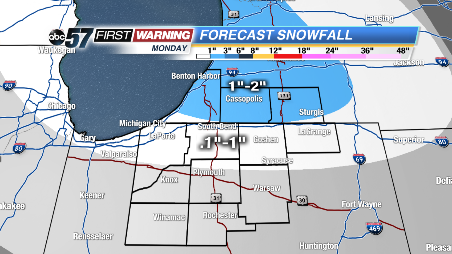
Monday: Mostly cloudy with snow showers developing midday. High of 34.
Tuesday: Mostly cloudy with L.E. snow. Highs in the mid 20s.