Slick spots possible Tuesday morning, watching the weekend snow

-
1:23

City of South Bend presents an ’Age-Friendly Plan’ to better...
-
0:54

South Bend Venues Parks and Arts hosts ’Adult Recess’
-
2:27

Why Aneyas Williams turned down the transfer portal and stayed...
-
2:21

Bourbon community rallies around Triton boys’ basketball team...
-
5:02

Dave Matthews shares details about LLC bankruptcy filings
-
1:00

Warming up this weekend before more storms next week
-
1:46

A chilly and calm start to the weekend
-
1:00

NIPSCO workers rally in South Bend for new contract
-
1:53

Severe weather threat is over, MUCH colder Friday
-
3:43

South Bend Mayor James Mueller delivers 2026 State of the City...
-
0:52

Family and friends of Adrian Cruz voice frustration in sentencing...
-
2:13

Potawatomi Zoo prepares for opening day with new attractions

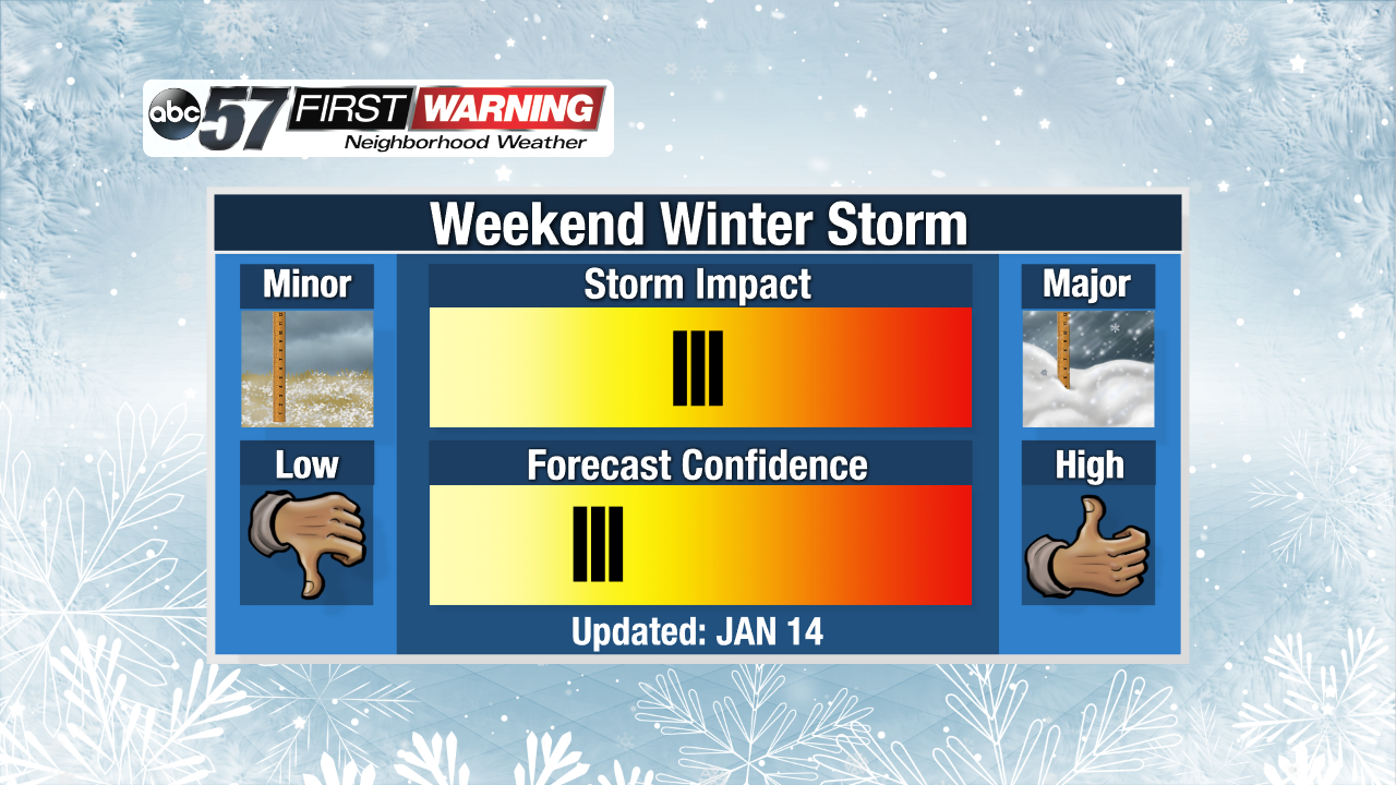
Light freezing drizzle or fog may develop overnight into early Tuesday leading to a glaze of ice and slick spots early Tuesday.
Cold and cloudy weather continues Tuesday and Wednesday with highs peaking just above freezing and the possibility of freezing fog or drizzle. A weak system will bring a chance of snow Thursday, followed by a lull Friday. The focus will be on a system that could bring widespread snow Saturday and lake effect Sunday. Snow looks likely but the finer details will become more clear later this week.
Tonight: Cloudy, patchy freezing fog / drizzle. Low of 22.
Tuesday: Cloudy, patchy freezing fog / drizzle. High of 34.
Wednesday: Mostly cloudy, patchy freezing fog / drizzle / snow. High of 34.
Thursday: Light snow showers, high of 32.