
-
0:32

Granger residents share input on proposed S.R. 23 roundabout
-
2:59

Seven local boards unanimously approve fire territory merger...
-
2:05

JobSpark helps inspire career exploration for middle school students
-
2:01

MPHPL launches new bookmobile to extend library access
-
2:17

Will Pauling shines, Jadarian Price shows versatility at Notre...
-
2:55

Notre Dame’s Pro Day gives 16 seniors one more shot to impress...
-
2:57

South Bend residents voice concerns over proposed pedestrian...
-
3:03

Prices at the pump continue to rise across Michiana
-
1:35

Warming up before storms arrive Thursday
-
2:06

Staying sunny until Thursday
-
0:58

Goshen City Council amends DORA rules amid community concerns
-
1:20

SB Common Council adopts Downtown 2045 Plan

Update 10 PM -- After strong storms, heavy rain continues overnight. Storms could be loud but are unlikely to be severe. Be aware of flooded roads or downed limbs in the morning.
The chance of showers and thunderstorms increases overnight through Thursday morning. A few cells could produce strong wind gusts or hail.
Showers and thunderstorms are likely through Thursday and into Friday morning. This is much needed rain that could bring more than an inch in total with higher amounts under thunder cells. The forecast stays muggy through Friday morning, before a front clears skies and drops the humidity Friday afternoon. The weekend looks mostly fair with a small chance of rain Sunday.
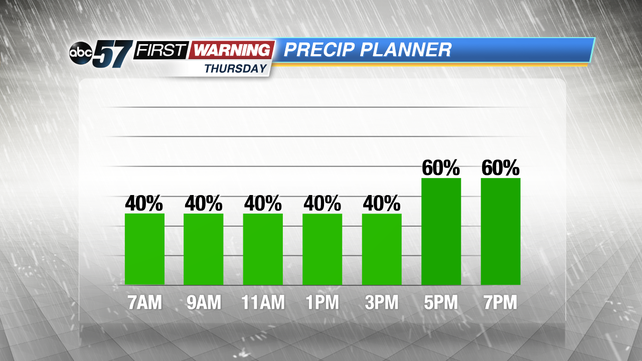
Tonight: Chance of showers and storms, low of 64.
Thursday: Showers and thunderstorms likely, high of 76.
Friday: Showers likely through noon, high of 70.
Saturday: Sunny, high of 70.