
-
2:43

Cubs clobber White Sox in first game of ’Crosstown Classic’
-
2:00

South Bend Police Department honors the fallen
-
0:52

St. Joe/Benton Harbor Rotary holds ribbon-cutting ceremony for...
-
2:25

Irish lacrosse head to NCAA quarterfinals with Johns Hopkins...
-
3:09

Cubs, White Sox open first Crosstown Classic series of summer...
-
3:45

South Bend Cubs dedicate plaque to Indiana born composer of ’Take...
-
1:52

Concord fourth graders launch weather balloon following months...
-
4:55

Gus Macker 3-on-3 basketball tournament returns to Benton Harbor
-
4:38

Discon at the Carousel 2026
-
2:28

Registration open for ’Gus Macker on The River’
-
3:01

Makers Collective Market features local small businesses
-
1:01

Breezy but warming up today

Wednesday is the last mild day before the humidity surges and we begin a summertime stormy pattern. Thursday through Saturday highs warm into the 80s, the mugginess will fuel the cycle of scattered showers and thunderstorms, mostly in the afternoon and evening. Heavy downpours and strong storms are possible but there is no clear timing on a specific event at this time, just the possibility.
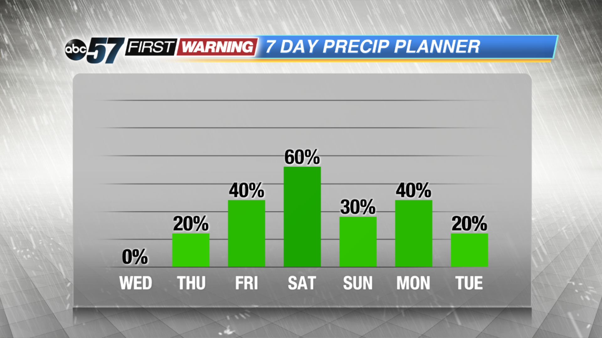
Tonight: Mostly clear, low of 48.
Wednesday: Mostly sunny, high of 76.
Thursday: Partly to mostly cloudy, chance of showers late, highs of 82.
Friday: Scattered showers and storms, highs in the mid-80s.
Sign up for the ABC 57 Newsletter