
-
2:14

Why summer travel prices may spike due to the ongoing war in...
-
1:49

Heavy rain, high winds, and hail are main severe concerns today
-
1:26

Amidst several rounds of storms, some could be severe today
-
0:34

South Bend Community Review Board hosts open discussion on youth...
-
2:19

INDOT walks through a proposed diverging diamond intersection...
-
1:08

Notre Dame’s Leonard Moore highlights student success and raises...
-
1:05

Mayflower Bridge set to close beginning April 6
-
0:21

Colfax Avenue eastbound lane closed for water and sewer work
-
0:46

Madison Street closed for lifestyle district project
-
4:11

Non-profit organization provides deep dive into Blackstone, a...
-
1:52

Storms possible overnight, strong storms by Tuesday evening
-
3:48

New partnership aims to help fight food insecurity across Elkhart...

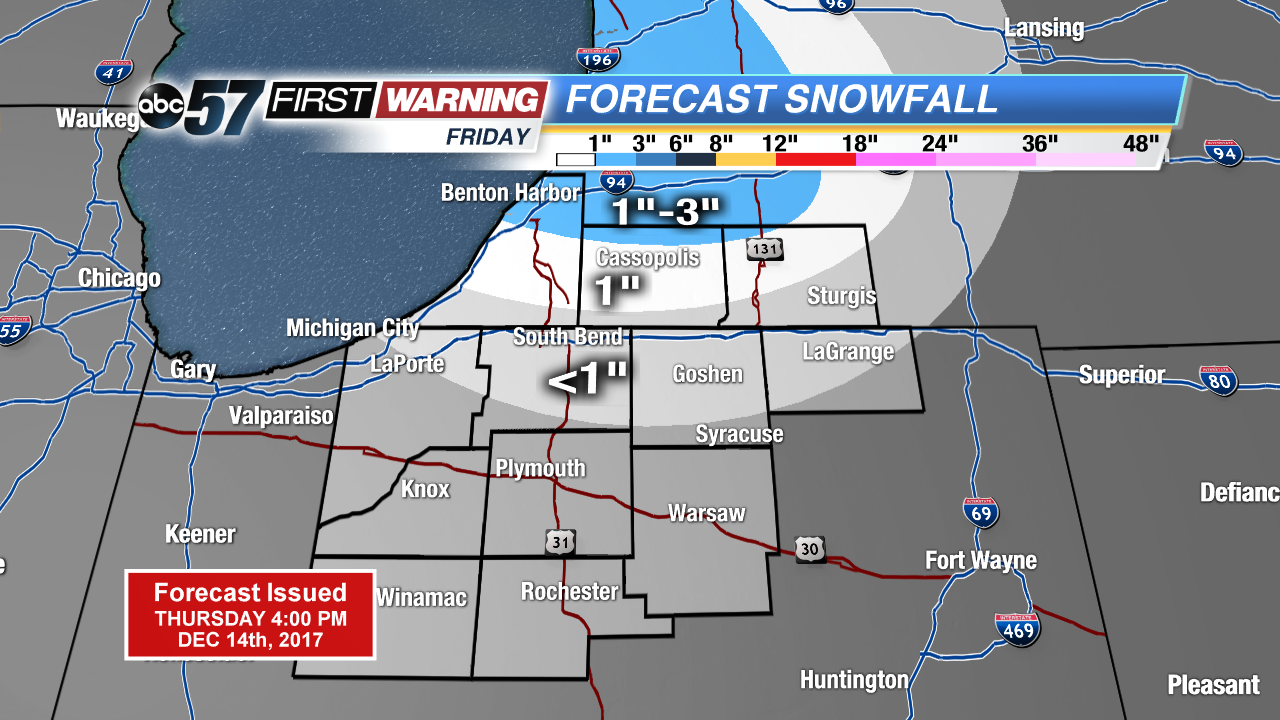
One more cold and snowy day before the pattern changes this weekend and early next week. Friday will start in the teens and lower 20s with a chance of light snow near the state line and northward, ending by midday. Weekend highs will be above freezing, melting snow with a chance of rain by Sunday evening.
Next week looks milder with highs mostly above freezing and little snow in the forecast. We’ll switch back to the cold weather pattern just before Christmas.
Tonight: Mostly cloudy, low of 18.
Friday: Morning snow showers, high of 28.
Saturday: Partly cloudy, high of 38.
Sunday: Mostly cloudy, chance of rain late, highs in the upper 30s.
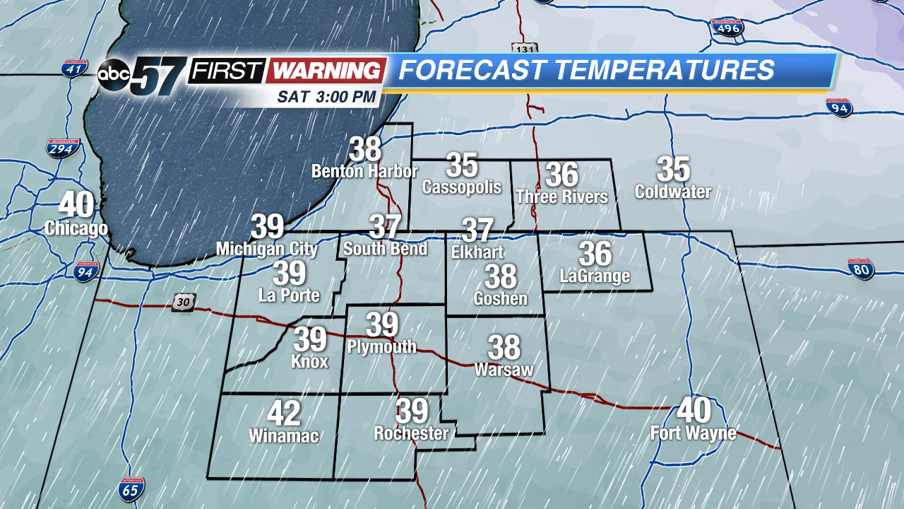 Highs Saturday will be above freezing
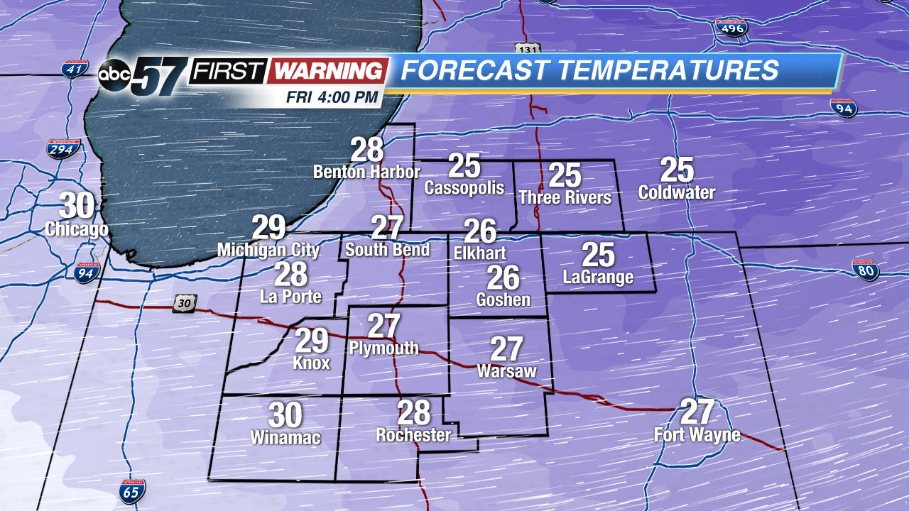 Highs Friday will not break 30°
Sign up for the ABC 57 Newsletter