
-
0:44

Indiana and Illinois set record for tornadoes
-
1:27

Community Build underway at Kathryn Park
-
2:34

Day two of searching for a missing child continues
-
3:47

The Elkhart community is searching for answers after a 2-year-old...
-
1:04

Overall pleasant for Michiana
-
1:52

South Bend Common Council issues an official apology to residents...
-
0:54

Slightly cool out the door
-
1:54

Suspect identified, charged in fatal hit-and-run of Timothy Johnson
-
0:39

Prairie Street Cemetery works to clear storm damage
-
1:36

Reaching out for support gives father a second chance in life
-
2:08

St. Joseph County police investigating Bypass incident from Saturday...
-
2:07

Color guard coach charged with Sexual Misconduct with a Minor

Showers and storms continue overnight, the main threat being flooding with more heavy rain expected after midnight.
Thursday is the last muggy and stormy day. Shower and storms are still likely through the first half of the day, gradually clearing by evening. The humidity drops into Friday, a more pleasant and dry day. The weekend also looks pretty fair and milder with lower humidity. There is a chance of an isolated shower Sunday.
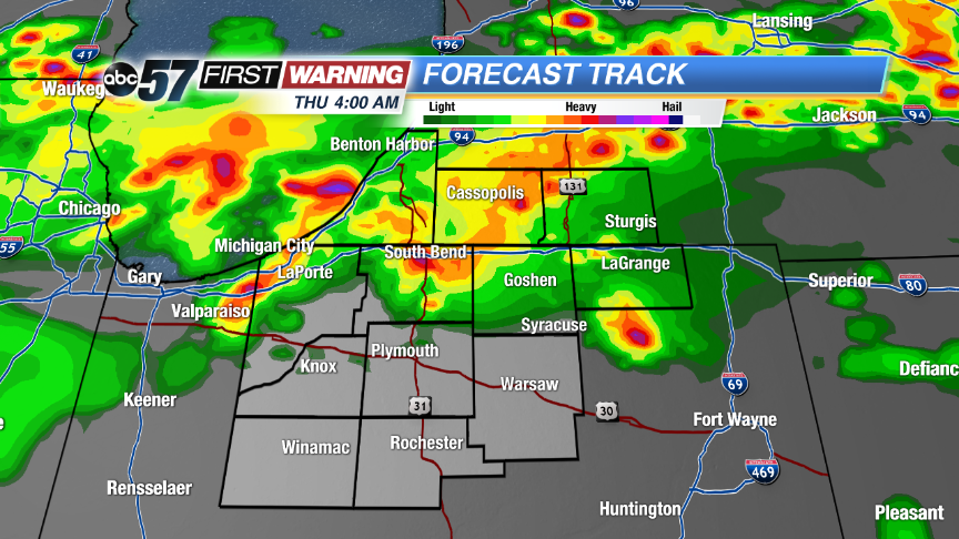 High resolution run of Forecast Track plots another round of heavy rain early Thursday.
Tonight: Scattered storms, low 72.
Thursday: AM showers and storms, mostly cloudy, high 84.
Friday: Partly cloudy, highs 76.
Saturday: Mostly sunny, highs in the low 80s.
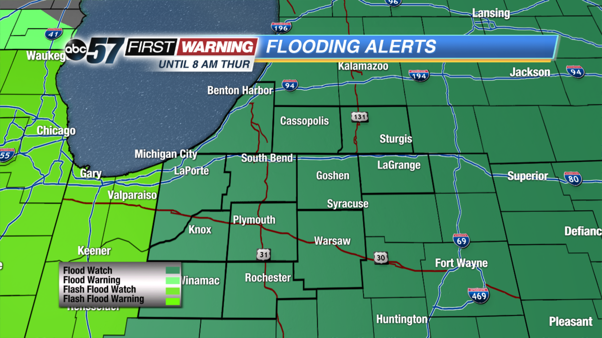 FLOOD WATCH: Expanded time until 8 AM EDT, expanded area all of Michiana.
Sign up for the ABC 57 Newsletter