Minor winter weather impacts before significant weekend storm

-
3:13

Local players react to $3 million investment in Byer Softball...
-
0:32

Layoffs at Whirlpool could affect workers in Benton Harbor
-
1:03

Annual District Sisterhood Conference at Ivy Tech empowers students
-
1:49

Back home in downtown South Bend, YMCA to open new location
-
2:16

This week’s ABC57 Cub Reporter is Nicholas Zentz
-
3:05

Amazon Web Services invests $11 billion to build data center...
-
4:05

Riley High School student center stage at the NFL Draft
-
1:35

Rain, wind, and milder temperatures forecast this weekend
-
2:49

Joe Alt expected to be drafted in the first round of NFL Draft
-
2:11

Students gearing up for local careers in Manufacturing
-
2:13

Sunny today, but expect a wetter and warmer weekend
-
0:54

Goodwill ’Little Black Dress’ event raises funds for community...

The concern for freezing drizzle and fog continues Tuesday night into Wednesday morning. Slick spots are possible as black ice could form on roads.
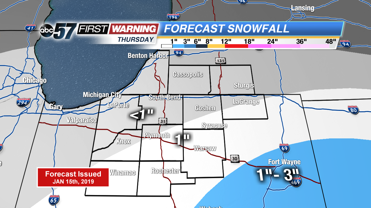
There’s little change in the weather Wednesday, cloudy with highs just peaking above freezing. A weak system brings light snow Thursday, with up to an inch possible. Friday is the lull before the storm. Widespread snow Saturday looks likely, significant snowfall through the Saturday evening. Temperatures fall into the single digits Saturday night and lake effect snow is possible Sunday. The coldest air of the season lasts through early next week.
Tonight: Freezing fog/drizzle possible, cloudy, low of 28.
Wednesday: Cloudy, high of 34.
Thursday: Light snow showers, mostly cloudy, high of 32.
Friday: Mostly cloudy, high of 30.