
-
2:34

Warm to start the week, Rainy week ahead
-
2:44

Warmer, breezier, and cloudier than yesterday
-
0:46

Crowds gather for Fins and Feathers Fest at La Porte City Fairgrounds
-
0:46

Paramount School of Excellence hosts teacher fair
-
2:30

Voting advocacy, peaceful demonstrations and donations: South...
-
2:04

Warming to start the week, Showers and storms by Tuesday
-
2:10

Cool, but calm, today
-
1:23

City of South Bend presents an ’Age-Friendly Plan’ to better...
-
0:54

South Bend Venues Parks and Arts hosts ’Adult Recess’
-
2:27

Why Aneyas Williams turned down the transfer portal and stayed...
-
2:21

Bourbon community rallies around Triton boys’ basketball team...
-
5:02

Dave Matthews shares details about LLC bankruptcy filings

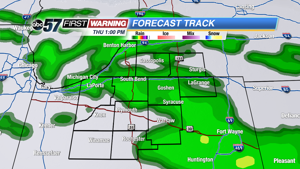
The midweek melt continues, warmer Wednesday and Thursday with highs in the 40s. Sunshine will give way to fog, drizzle and rain Thursday. Minor flooding is still a concern Thursday, with over two inches of water locked in the snowpack that will melt. A quick cool-down Friday, before another warm-up through the weekend.
Tonight: Partly to mostly clear, low of 26.
Wednesday: Mostly sunny, rain late, high of 42.
Thursday: Rain, drizzle and fog, high of 45.
Friday: Mostly cloudy, chance of snow showers, highs in the low 30s.
Sign up for the ABC 57 Newsletter