Mid-winter thaw brings threat of black ice and fog.
Posted: Jan 8, 2018 4:29 PM EDT

-
4:24

Michiana Crime Stopper shredding event
-
1:16

’IvyCares’ program setting students up for success in and...
-
1:45

Windy and wet this weekend, but unseasonable warmth as well
-
3:13

Local players react to $3 million investment in Byer Softball...
-
0:32

Layoffs at Whirlpool could affect workers in Benton Harbor
-
1:03

Annual District Sisterhood Conference at Ivy Tech empowers students
-
1:49

Back home in downtown South Bend, YMCA to open new location
-
2:16

This week’s ABC57 Cub Reporter is Nicholas Zentz
-
3:05

Amazon Web Services invests $11 billion to build data center...
-
4:05

Riley High School student center stage at the NFL Draft
-
1:35

Rain, wind, and milder temperatures forecast this weekend
-
2:49

Joe Alt expected to be drafted in the first round of NFL Draft

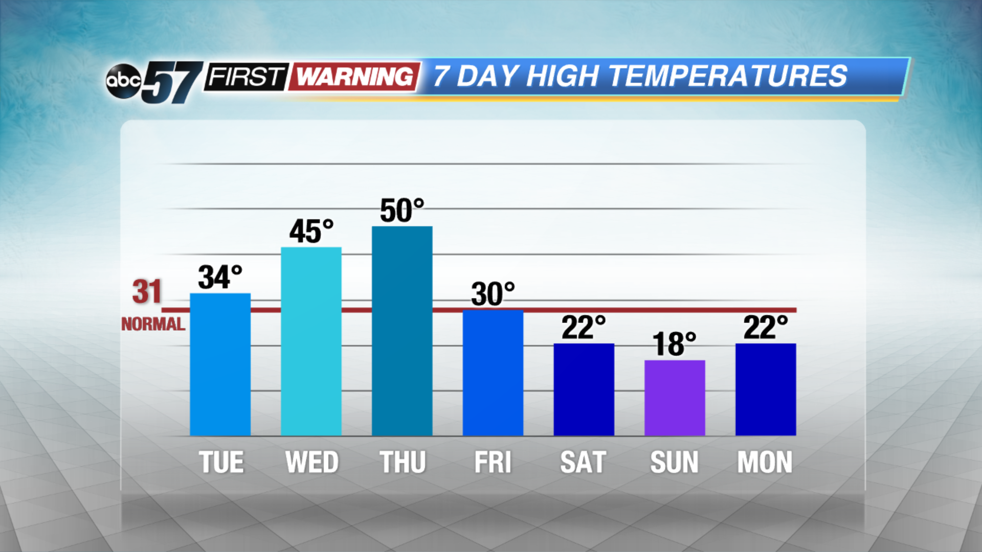
A mid-winter warm-up this week will bring a new set of hazards. The freeze-thaw cycle increases the chance of black ice, fog and potholes, mostly in the morning hours. Highs will rise from just above freezing Tuesday to possibly the 50s on Thursday. We’ll watch for a potential snow-maker later this week before another crash in temperatures this weekend.
Tonight: Partly cloudy with morning fog developing, low 22.
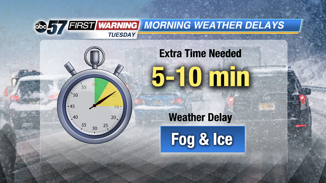 Watch for fog and black ice in the morning
Tuesday: Partly cloudy, high of 34.
Wednesday: Fog and drizzle, high of 45.
Thursday: Rain and fog, highs near 50.
 A quick thaw will melt a lot but not all of our snow pack.
Sign up for the ABC 57Newsletter