
-
1:15

Cold and bleak weather to start off the day
-
3:49

Asking for Accountability: Michiana Elected Officials on on-going...
-
3:37

South Bend Cubs explain weekend washout
-
4:02

Early voting is underway as Indiana prepare for its May 5 primary...
-
3:27

Tax-related scams to watch out for
-
0:09

Crews repair weekend washout under Coloma train track
-
0:58

Chilly and sunny Tuesday ahead
-
0:41

Elkhart police investigating Monday night shooting
-
3:47

Elkhart Police Department accepting applications to Citizens...
-
0:52

A slight warm-up but chilly weather still dominates
-
1:09

Bitterly cold out the door
-
3:03

Looking to younger generations to keep Dyngus Day thriving

A cold rain changing to a wet snow overnight, slushy accumulation of less than one inch possible by Thursday morning.
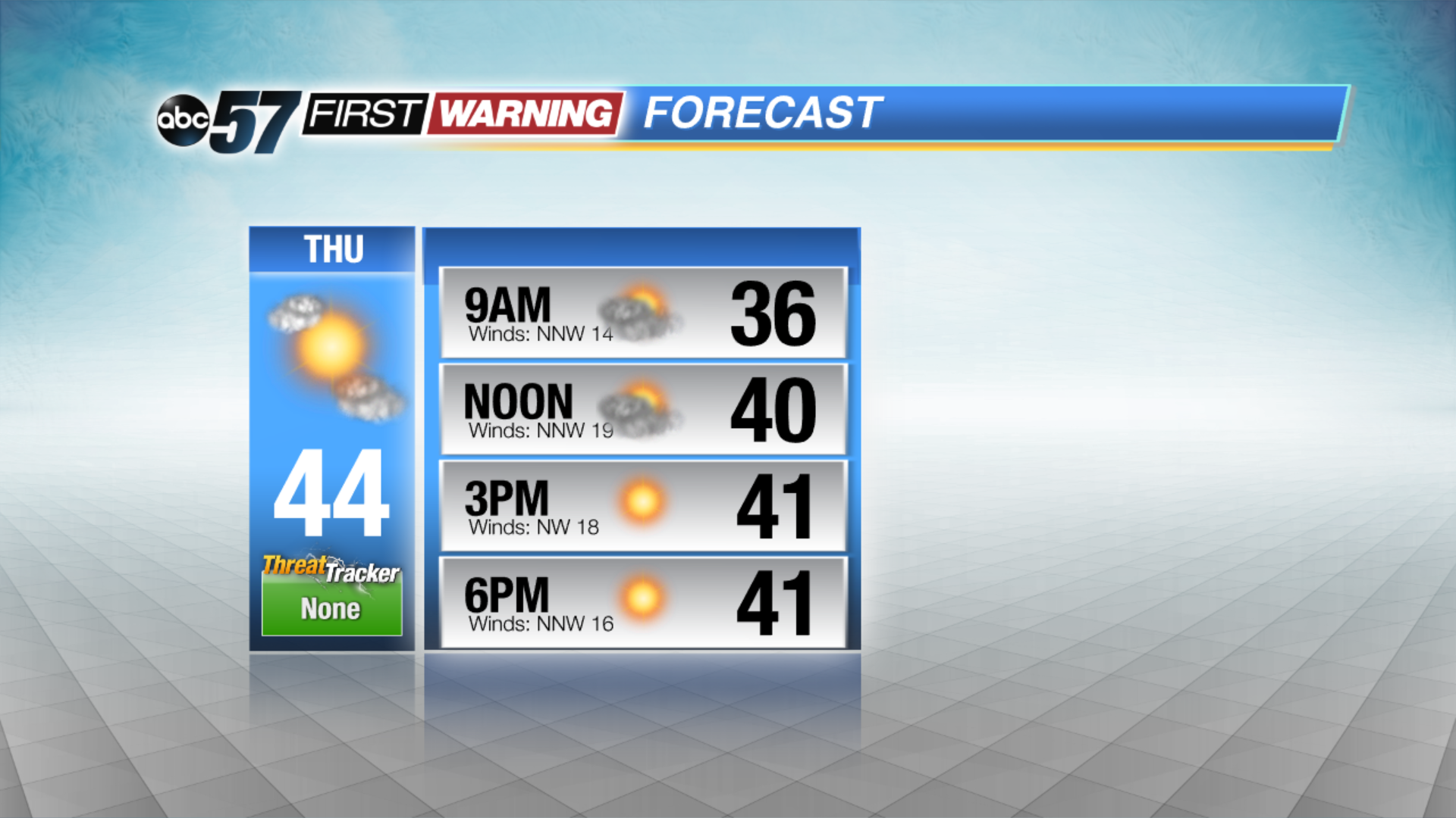
Skies clear Thursday but temperatures are slow to warm, highs struggle to make the mid-40s with a northwest breeze. The forecast improves greatly through the weekend with sunshine and a steady warm-up through the 50s. There’s little chance of rain until the middle of next week.
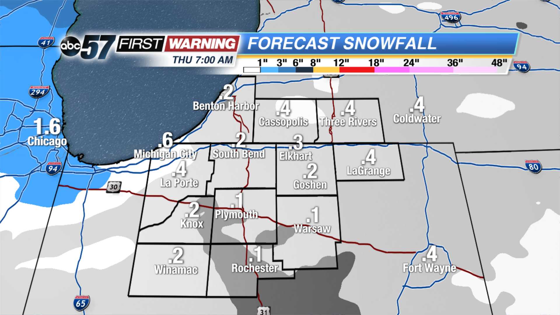
Tonight: Rain turns to a wet snow, low of 33.
Thursday: Clearing, cool and breezy, high of 44.
Friday: Sunny, high of 50.
Saturday: Partly cloudy, high of 54.
Sign up for the ABC 57 Newsletter