Light lake effect snow and cold
By: Emily Kennedy
Posted: Nov 27, 2018 3:00 AM EDT

-
1:47

Hot and smoky today
-
2:07

Locals have big visions for new skatepark in St. Joseph
-
2:29

Elkhart County residents still waiting for repair help a month...
-
1:13

Sinkhole develops on the Southwest side of South Bend
-
3:13

Local restaurants taking extra precautions to try and keep Cyclosporiasis...
-
3:39

World Series of Baton Twirling returns to Notre Dame, bringing...
-
2:37

Historic State Theater project awarded millions of dollars towards...
-
2:05

Building Nicholas Stanley’s defense in the final weeks before...
-
2:03

Fatal June officer-involved shooting of Jujuan Bates deemed justified,...
-
1:15

IDEM forecasts Air Quality Action Day for Northern Indiana due...
-
1:43

Unhealthy smoke headed our way
-
1:23

Kamm Island Pavilion dedicated to former mayor

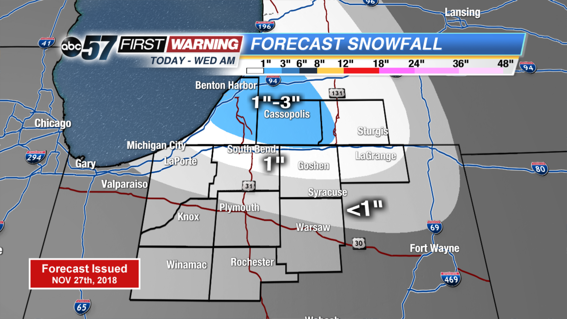
Lake effect snow shower pick back up today but remain light. Some in our Michigan counties could see 1” to 3” of snow but most will be on the lower end. Up to 1” is possible just south of the state line. It stays cold today and tomorrow with highs only in the upper 20s. We could see a couple peeks of sunshine tomorrow afternoon. Otherwise clouds move right back in Thursday along with a wintry mix. Temperatures warm up into the low to mid 40s over the weekend with a chance of rain Saturday.
Today: Mostly cloudy, lake effect snow showers possible, high of 27.
Tonight: Mostly cloudy, light lake effect snow, low of 18.
Wednesday: AM flurries, mostly to partly cloudy, high of 28.
Thursday: Cloudy, wintry mix possible, high of 35.
Sign up for the ABC 57 Newsletter