
-
2:34

Open House for a new pedestrian bridge leaves Riverside Residents...
-
2:16

Notre Dame’s CJ Carr embraces growing expectations while leading...
-
2:34

Injuries sideline key linebackers as Notre Dame leans on depth...
-
0:58

U.S. Army increases maximum enlistment age from 35 to 42
-
2:08

Large hail, damaging winds and tornadoes possible Thursday
-
1:40

Nicholas Stanley appears in court, prosecutors push to prevent...
-
3:18

Expert breaks down high gas prices and factors impacting price...
-
2:08

Westview community rallies around boys’ basketball team headed...
-
2:06

The threat for severe weather has increased
-
2:16

More sunshine today with a severe risk tomorrow
-
0:32

Granger residents share input on proposed S.R. 23 roundabout
-
2:59

Seven local boards unanimously approve fire territory merger...

Lake effect snow showers continue overnight through Thursday morning. An additional one to three inches are possible.
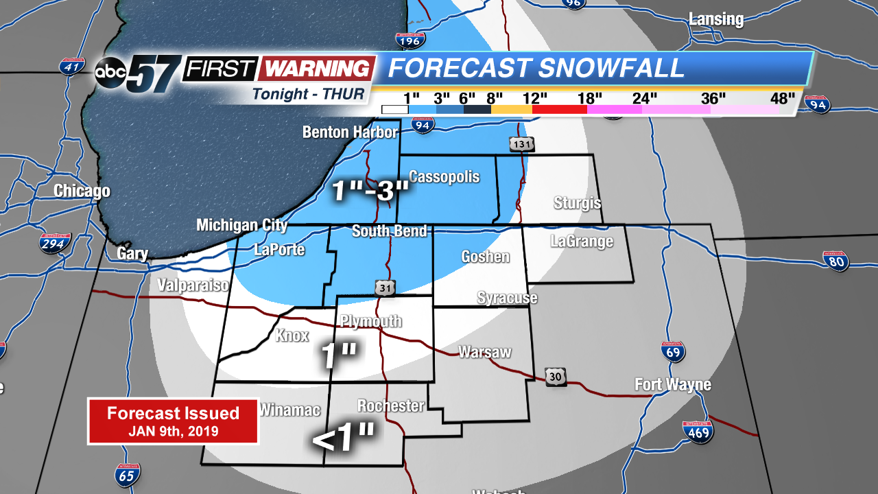
Lake effect snow showers will slow the morning drive again Thursday before waning during the day. Temperatures rise gradually in to the mid-20s, with a break from the snow that lasts through Friday. A storm system looks to bring widespread snow to the Midwest, with an increasing potential for at least three inches area wide Saturday. Stay tuned for updates as finer details come into focus.
Tonight: Lake effect snow, breezy. Low of 20.
Thursday: Morning snow showers, mostly to partly cloudy. High of 28.
Friday: Partly to mostly cloudy. High of 32.
Saturday: Snow showers, high of 32.
Sign up for the ABC 57 Newsletter