
-
2:10

Cool, but calm, today
-
1:23

City of South Bend presents an ’Age-Friendly Plan’ to better...
-
0:54

South Bend Venues Parks and Arts hosts ’Adult Recess’
-
2:27

Why Aneyas Williams turned down the transfer portal and stayed...
-
2:21

Bourbon community rallies around Triton boys’ basketball team...
-
5:02

Dave Matthews shares details about LLC bankruptcy filings
-
1:00

Warming up this weekend before more storms next week
-
1:46

A chilly and calm start to the weekend
-
1:00

NIPSCO workers rally in South Bend for new contract
-
1:53

Severe weather threat is over, MUCH colder Friday
-
3:43

South Bend Mayor James Mueller delivers 2026 State of the City...
-
0:52

Family and friends of Adrian Cruz voice frustration in sentencing...

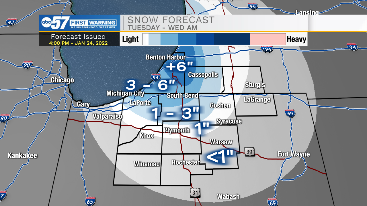
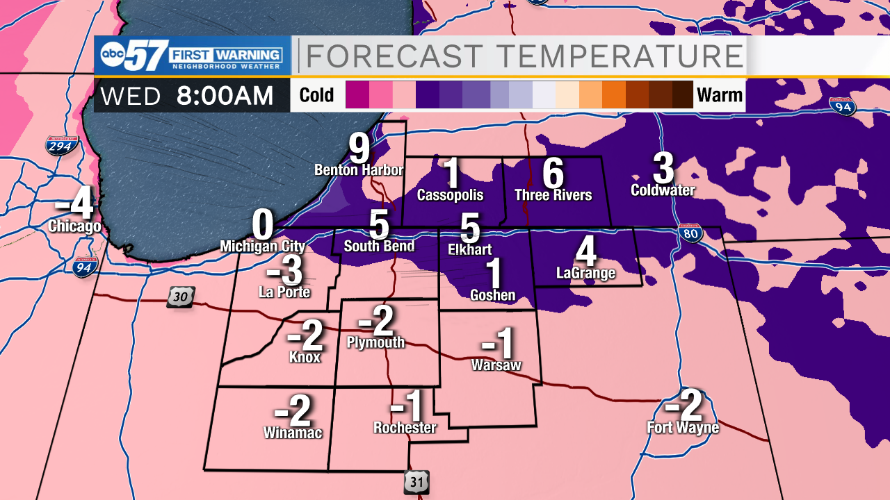
Lake effect snow and bitter cold midweek. Lake effect snow will gradually ramp up-and-down Tuesday. A surge of snow develops in the snow belt early Tuesday morning, then wanes during the day, surging again Tuesday night as temperatures drop again. In total, most the snow belt will see more than three inches of snow, with some in Berrien county getting more than six inches. Wednesday is the coldest day, with temperatures nearing zero at night. The pattern stays cold through the weekend.
Tonight: Lake effect snow. Low 12.
Tuesday: Lake effect snow. High 18.
Wednesday: Partly cloudy and cold. High 12.
Thursday: Evening snow showers. High 30.
Sign up for the ABC 57 Newsletter