
-
1:05

New non-profit campaign aims to educate parents and kids about...
-
0:56

Press conference held regarding the future of Portage Manor
-
0:56

Fans thrilled by Mishawaka meet and greet with Notre Dame football...
-
6:03

Notre Dame unveils ’The Shirt’ ahead of tomorrow’s Blue-Gold...
-
2:31

Berrien County natives crowned World Champions at Axe and Knife...
-
0:37

Shooting in 200 block of Studebaker Street leaves one injured
-
1:59

63rd annual Pancake Day
-
1:10

Morning sun, afternoon rain
-
1:15

Grab an umbrella before you head out
-
0:47

Families turn out to paint the ice and hang out with Notre Dame...
-
3:16

One-on-one interview with No. 3 pick Jeremiyah Love
-
0:43

Military Veterans and Portage Township representatives honor...

The humidity continues to creep higher Wednesday and Thursday, along with it the chance of showers and thunderstorms. High in the low to mid 80s midweek, the best chance for showers and storms will be Wednesday evening and Thursday night, the latter being the most widespread and heavy. Temperatures drop to end the week with highs in the low to mid 70s going into the weekend.
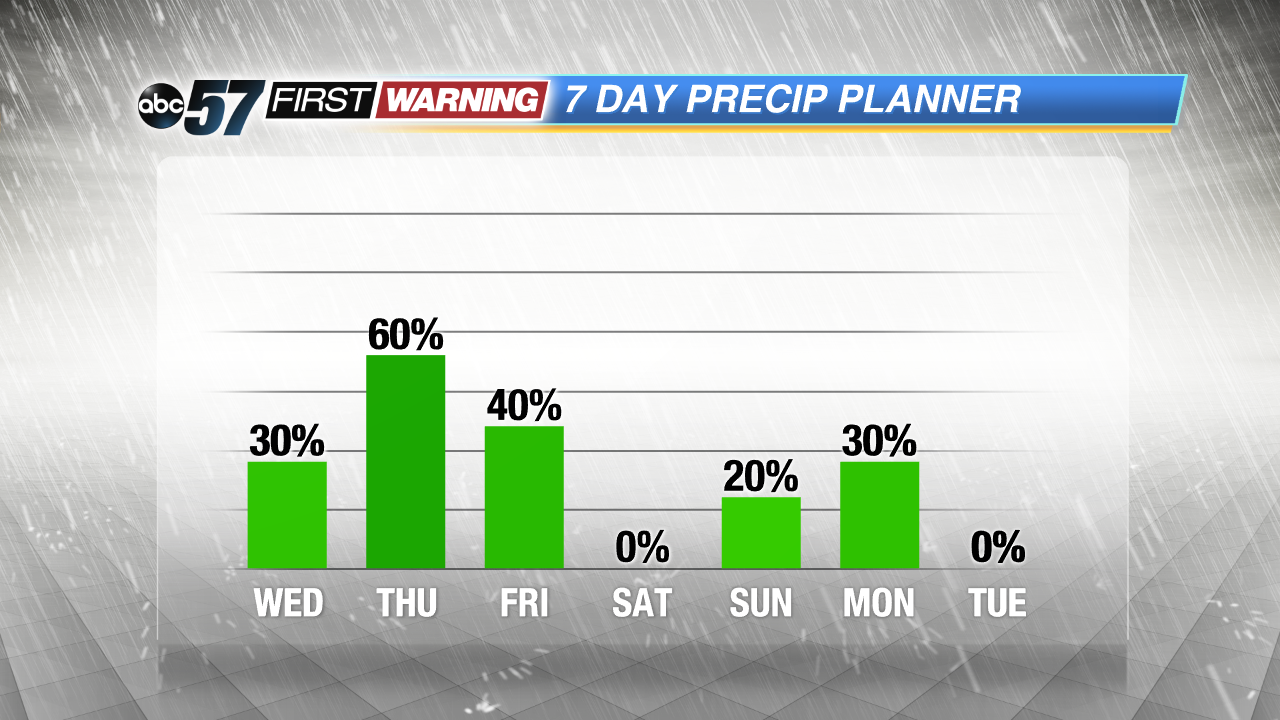 Thursday night into Friday is the most likely time for widespread storms.
Tonight: Partly cloudy, low 64.
Wednesday: Partly cloudy, a bit humid, high of 84, chance of PM storms.
Thursday: Showers and storm likely, high of 82.
Friday: Showers, highs in the low 70s.
Sign up for the ABC 57 Newsletter