
-
1:44

Temperatures rise and fall to end the week, rain Friday
-
3:19

National College Decision Day is pushed back this year
-
5:25

Michigan State Representative Joey Andrews joins ABC57
-
1:29

A new chapter for the Cass District Library Edwardsburg Branch
-
1:59

Few showers this morning, then quiet again today
-
2:23

PGA and Whirlpool prepare for one last KitchenAid Senior Championship...
-
1:49

Two people killed in plane crash near Bristol
-
2:44

The new plan to transform much of Potawatomi Park in South Bend
-
2:49

Parts of Michiana to be pestered soon
-
6:56

The realities of rapidly rising rent
-
1:20

Mild midweek, rain likely Friday
-
1:10

Local dance company promotes healthy social media habits to students

The threat of rain overnight is minimal with only isolated pop-up showers.
No relief from the humidity Friday, hot and very humid with a head index 95 to 100. Friday night and early Saturday is the time frame for the next round of storms. The latest set models predict a one-two punch, Friday evening and again Saturday morning. Both could bring severe weather and combined the total rainfall could produce flooding with more the two inches possible. The steamy and stormy pattern end Sunday into Monday.
Tonight: Partly cloudy, extremely muggy, low 70
Friday: Very humid, high of 90, evening thunderstorms
Saturday: Morning thunderstorms, highs in the mid-80s.
 Heat index Friday forecast back between 95 and 100.
Sunday: Mostly sunny, high in the mid-80s.
 Round 1 of storms Friday evening
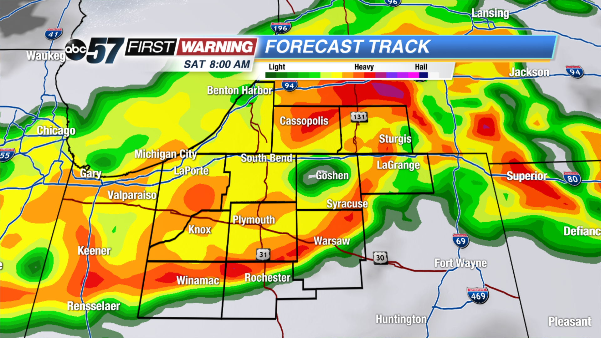 Round 2 of storms Saturday morning.
Sign up for the ABC 57Newsletter