
-
0:56

Elkhart Rotary Club hosts 10th annual First Responders Luncheon
-
3:11

South Bend Police Department, local law enforcement honor fallen...
-
3:48

Neighbors react to after-prom shooting in Town of Pine
-
2:17

Blame Mother Nature for slow start to Michigan planting season
-
2:28

Ivy Alley Social House cites lack of business as reason for closing
-
1:16

Police chase in St. Joseph County under investigation after officer...
-
2:24

South Bend Clinic to offer free full body skin cancer screening...
-
0:42

Pleasant today, storms tomorrow
-
2:51

High school prom party ends with gunfire, one dead, two injured
-
0:44

Viral clunker makes reappearance Sunday for charity event
-
1:40

Potawatomi Zoo hosts Mother’s Day Crafting with Creatures
-
0:49

Sunny, but cool for Mother’s Day

Scattered showers and storms Tuesday night will continue the threat of heavy rain and flooding through Wednesday morning. The humidity lasts for one more night.
The forecast trends drier and less humid Wednesday afternoon and Thursday, skies start to break and the humidity drops through midweek. Friday another round of showers and storms will bring the potential for more heavy rain and possible flooding. This weekend will not be as hot with highs in the 70s.
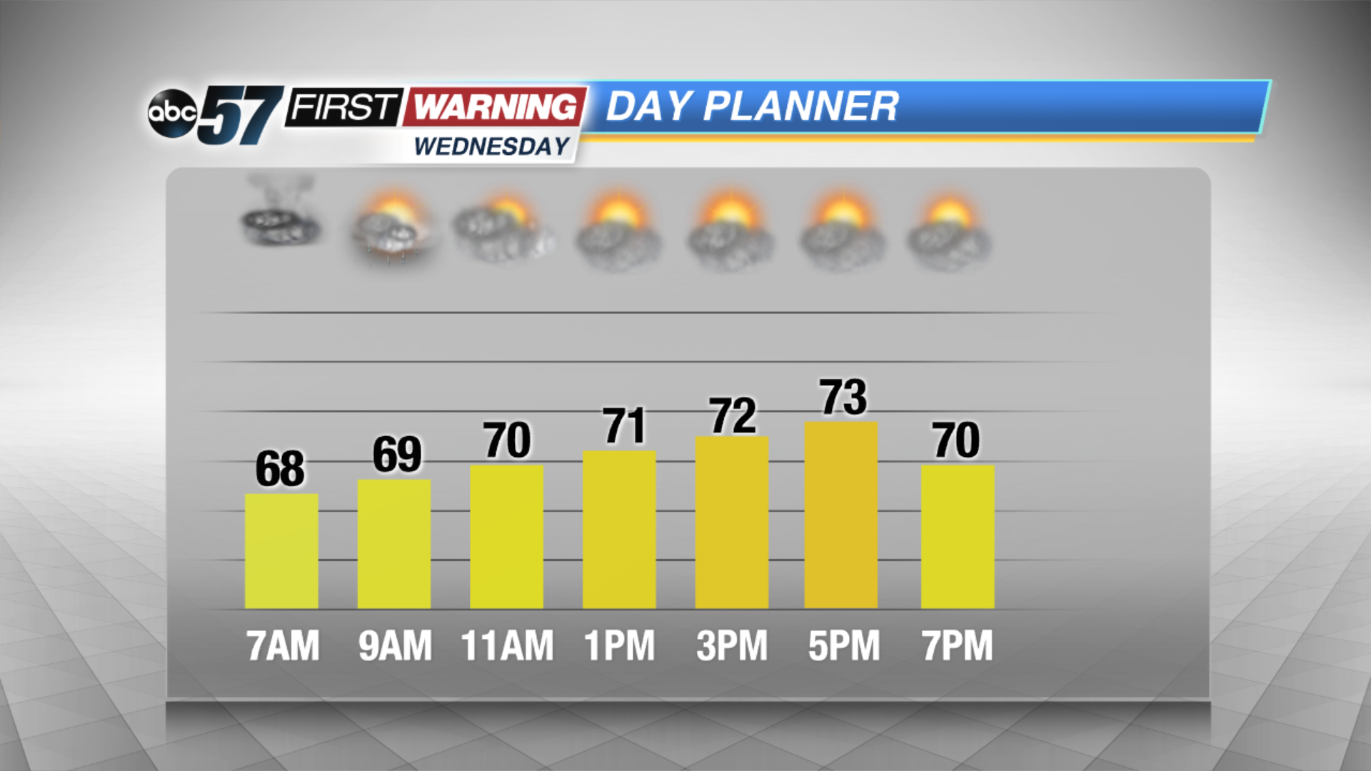
Tonight: Scattered showers and storms, low of 68.
Wednesday: Morning showers and storms, high of 74.
Thursday: Partly cloudy, high of 80.
Friday: Scattered showers and storms, high of 76.
Sign up for the ABC 57 Newsletter