Foggy start to Tuesday, active weather week

-
4:24

Michiana Crime Stopper shredding event
-
1:16

’IvyCares’ program setting students up for success in and...
-
1:45

Windy and wet this weekend, but unseasonable warmth as well
-
3:13

Local players react to $3 million investment in Byer Softball...
-
0:32

Layoffs at Whirlpool could affect workers in Benton Harbor
-
1:03

Annual District Sisterhood Conference at Ivy Tech empowers students
-
1:49

Back home in downtown South Bend, YMCA to open new location
-
2:16

This week’s ABC57 Cub Reporter is Nicholas Zentz
-
3:05

Amazon Web Services invests $11 billion to build data center...
-
4:05

Riley High School student center stage at the NFL Draft
-
1:35

Rain, wind, and milder temperatures forecast this weekend
-
2:49

Joe Alt expected to be drafted in the first round of NFL Draft

Gloomy, with fog developing overnight, low visibility and temperatures near freezing, slick spots are possible on bridges and overpasses.
This week will be active but milder with highs closer to 50 most of this week. Tuesday is sunny, Wednesday is rainy and Thursday is sunny once again. The main focus will be on a power storm system this coming weekend. Strong wind may be the greatest threat, this is separate from any shower/storms that could produce higher gusts. Colder air return Sunday with a chance of snow.
Tonight: Mostly to partly cloudy, morning fog, low 32. 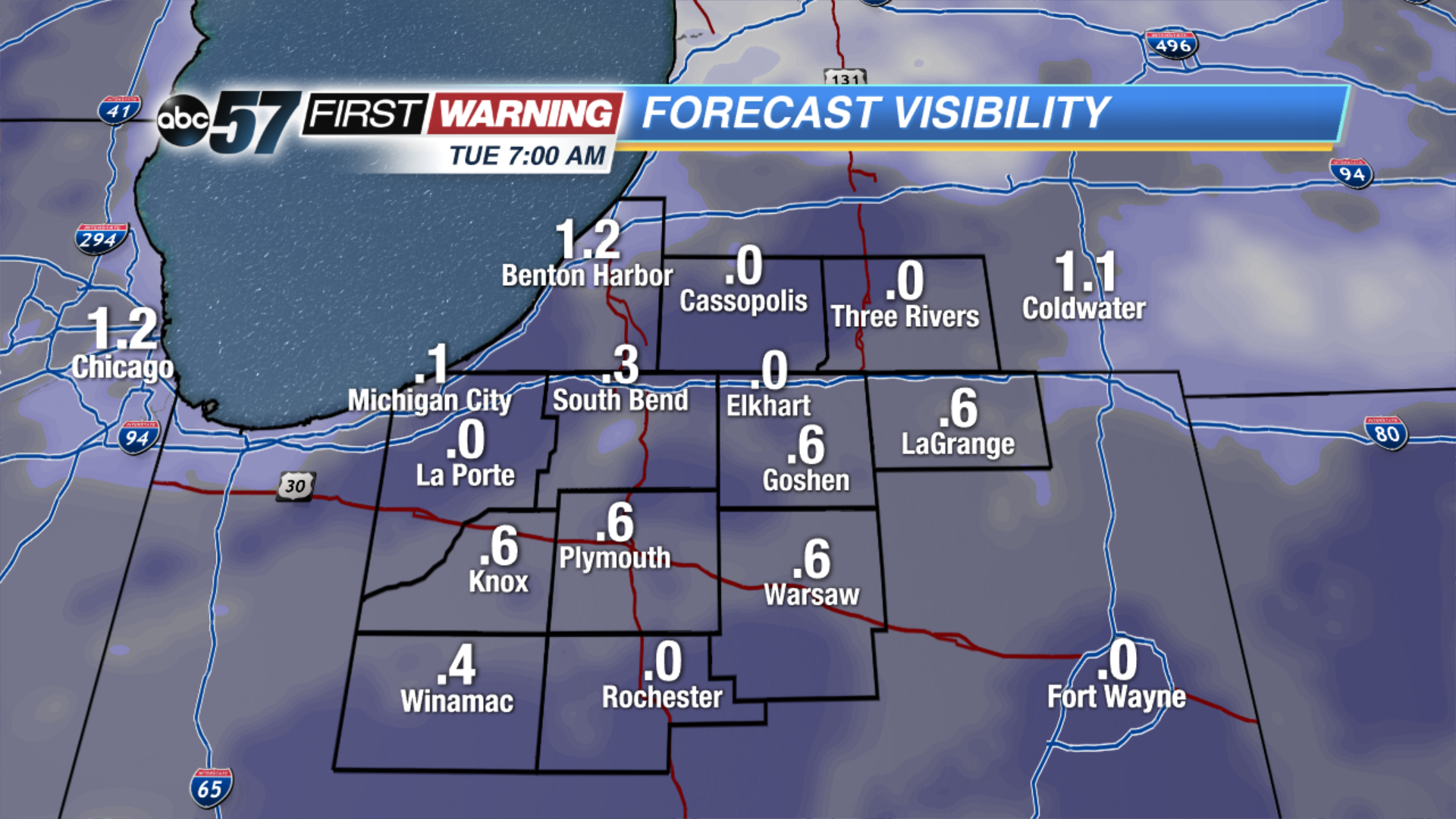 Forecast visibility Tuesday morning. The more clouds break, the more likely there could be dense fog.
Tuesday: Mostly sunny, high of 48.
Wednesday: Rain likely, high of 50.
Thursday: Mostly sunny, highs in the mid-40s. 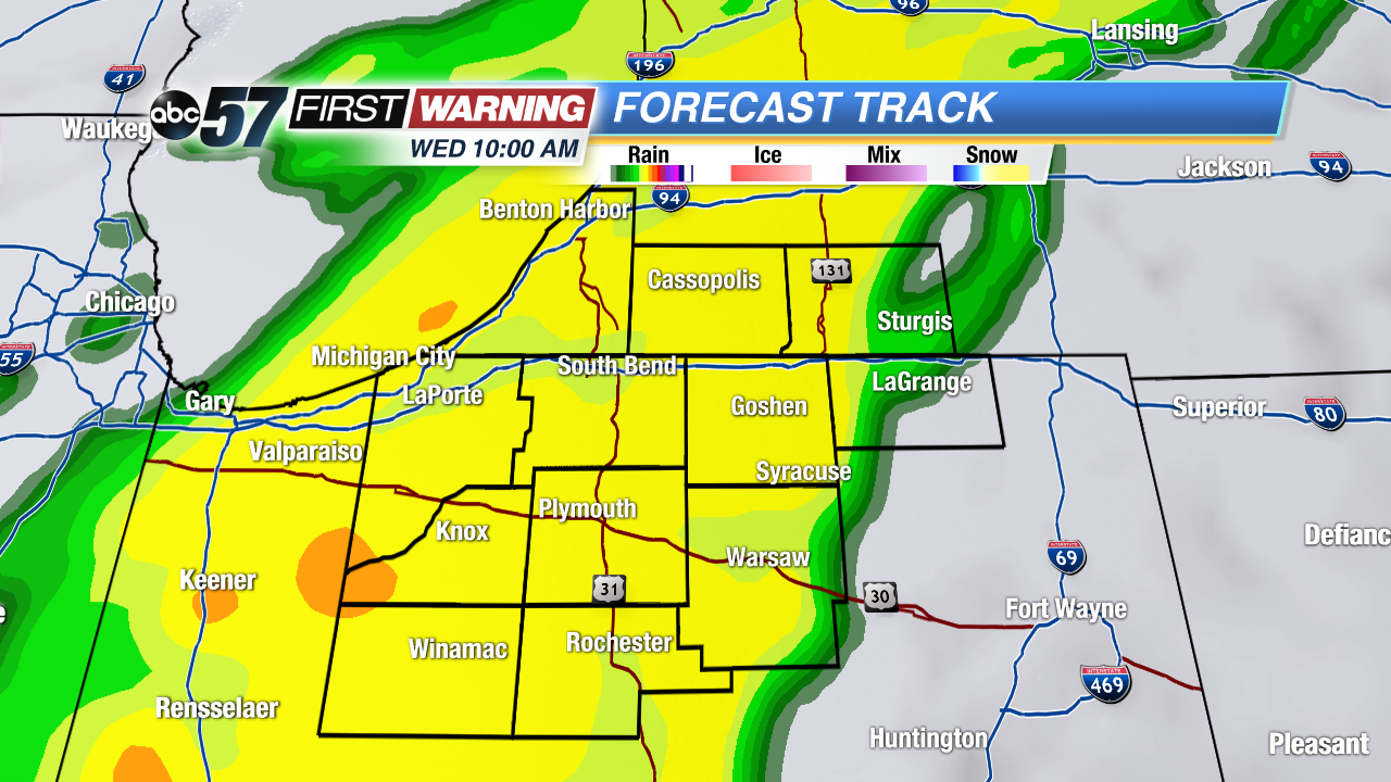 Swath of rain Wednesday could be moderate to heavy.