
-
1:44

Overnight storms clear smoke
-
1:02

Lingering smoke out the door
-
2:30

Storms return Monday overnight into Tuesday
-
1:46

Leadership, discipline and responsibility: 4-H leads the way...
-
1:17

Quiet end to the weekend, despite the haze
-
2:08

World Cup final brings the Elkhart community together to watch...
-
1:21

A would-be pleasant day...if not for the smoke
-
1:04

Still smoky this morning
-
2:13

Beach Bash fundraiser supports Veterans and First Responders
-
1:33

Smoky skies have returned
-
1:51

Rescheduled fireworks, Jazz Fest encore draw crowds to downtown...
-
0:43

27th annual Firefighters Blues Festival raises funds for children...

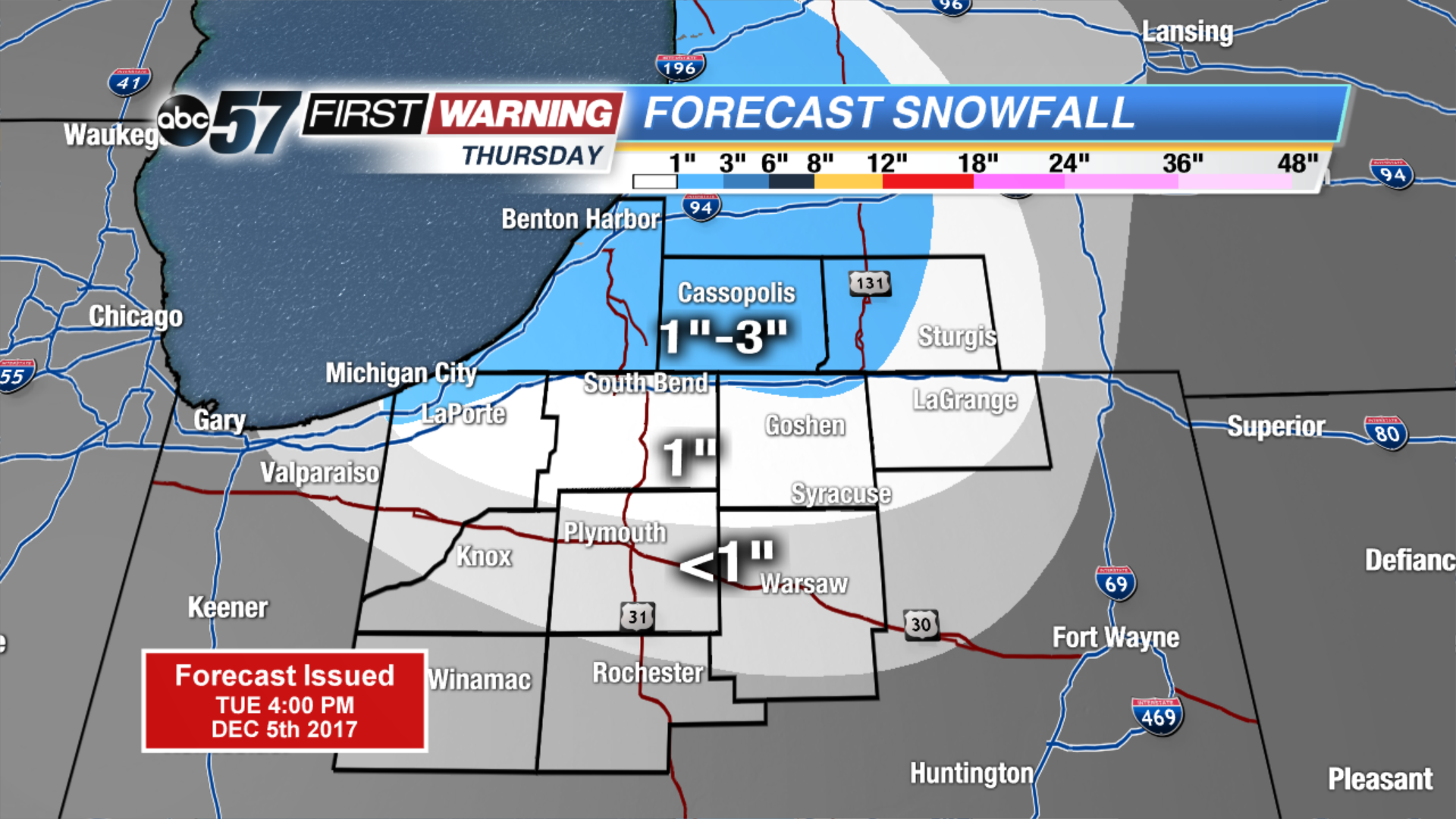
Winter is here to stay as the forecast stays near or below freezing for the next two weeks. Wednesday will still be breezy but the wind does gradually calm into the evening. Lake effect snow is likely to start Wednesday night and last through Thursday. Lake effect zones will see measurable snowfall of one inch or more, some could see up to three inches. The next focus for widespread snow will be Saturday.
Tonight: Partly cloudy, breezy, low 24.
![]()
Wednesday: Mostly cloudy, breezy, chance of lake effect snow, high of 34.
Thursday: Lake effect snow showers, high of 28.
Friday: Partly cloudy, highs in the upper 20s.
Sign up for the ABC 57 Newsletter