
-
1:48

Scattered showers this evening, Much cooler overnight
-
1:50

Showers and storms this afternoon
-
0:20

One person injured in shooting
-
0:36

Eddies Circuit Robotics holds competition Saturday
-
0:32

21st annual Nappanee Model Train Show
-
0:38

Local boys basketball team headed to IHSAA state finals
-
3:49

Midwest Meowfest brings kitten advocacy to attendees, new homes...
-
1:52

Mild tonight, showers tomorrow
-
1:43

Pleasant to start the weekend
-
3:06

Pulaski County weighs stricter solar rules amid resident concerns
-
0:40

Marian High School hosts World Down Syndrome Awareness Walk
-
2:33

South Bend leaders call for an end to gun violence

Cool and sunny Wednesday, and chilly again Wednesday night. A clipper system will bring a blast of cold air Thursday night into Friday and that could be a few snow flurries. Snow is not expected to be significant but with lows in the 20s Friday morning, flakes off the lake are possible. The pattern remains cold through the weekend, a chance of snow changing to all rain Sunday.
Tonight: Partly to mostly clear, low 30.
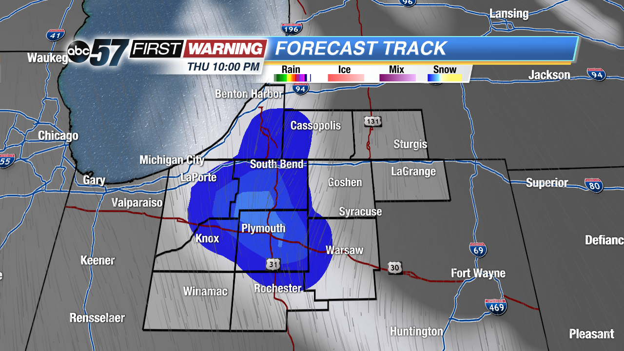 Lake effect flurries are possible Thursday night
Wednesday: Sunny, highs of 46.
Thursday: Partly cloudy, chance of mix/snow late, high 42.
Friday: Morning flurries, highs in the mid-30s.
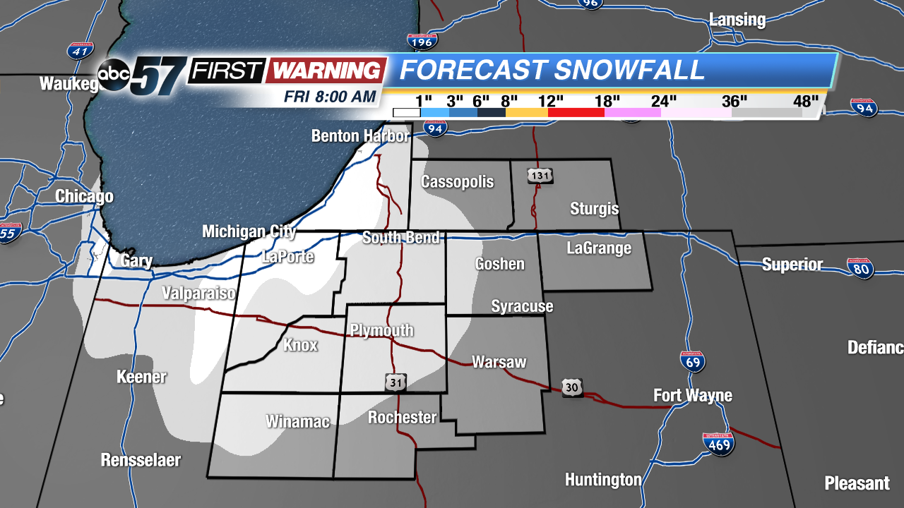 Early snowfall estimates are minimal, little if any accumulation.
Sign up for the ABC 57 Newsletter