Another warm winter means snow is once again behind schedule

-
0:26

Niles Community Schools announce public interviews for superintendent...
-
2:28

How to avoid scammers during cleanup for severe weather
-
2:46

Community mourns loss of oldest roller rink in Michigan after...
-
4:00

Tuesday’s confirmed EF-1 tornado leaves damage behind in Twin...
-
3:33

Voter turnout low ’even by primary standards’ in Michiana
-
1:30

Cooler, rainy end of the week
-
3:14

EF-2 tornado rips roof and siding off of Portage shopping center
-
5:22

John Young Middle School is holding multiple musicals this weekend
-
2:13

Dense fog this morning, more rain on the way tonight
-
2:26

Mike Braun celebrates primary success
-
2:39

Tornadoes touch down, leave extensive damage at FedEx facility
-
2:12

St. Joseph County Commission primary results

Stop me if you've heard this one before: it's been too warm for a lot of snow to fall across Michiana.
This is the refrain that we heard last winter, and the winter before that, too. And, so far this winter, there's been little change in the pattern.
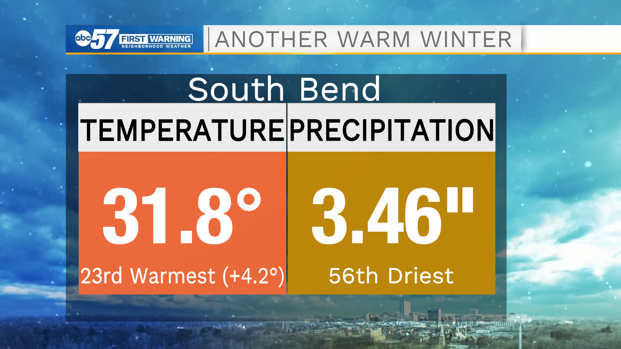
As we approach the midpoint of winter in Michiana, temperatures are running well above normal. South Bend is in the midst of the 23rd warmest winter to date.
In terms of snowfall, South Bend is sitting just below 20 inches of accumulation since July 1 (what we call "seasonal" snowfall).
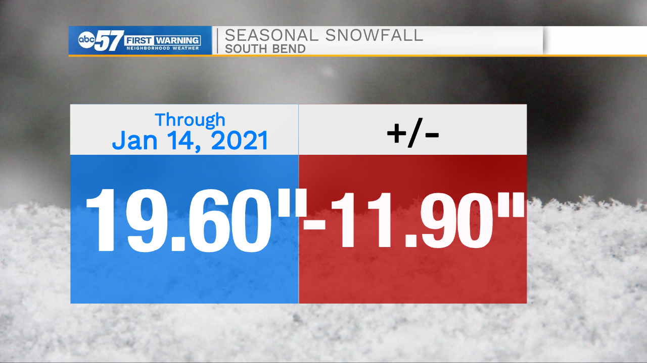
That's about 8" behind schedule for the winter (since December 1) and close to a foot below normal for the snow season.
We really haven't needed the snow blower or even the shovel that much this season, either. We've only had nine days of measurable snow (snow greater than 0.1 inch) through January 14, which is the 5th fewest snow days on record.
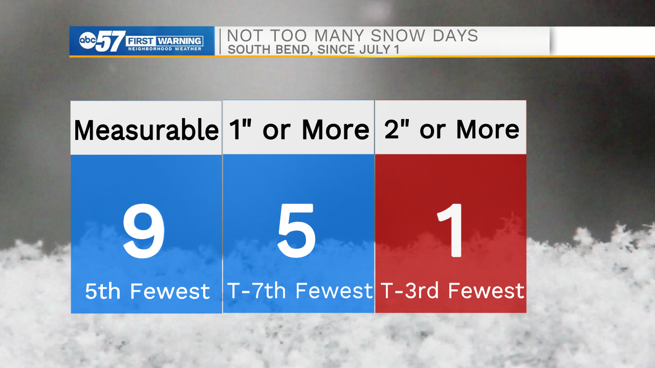
Additionally, we've only had ONE day this season where snow accumulations eclipsed two inches (Christmas Day).
There are plenty of chances for snow in the forecast, but significant accumulations are not expected.
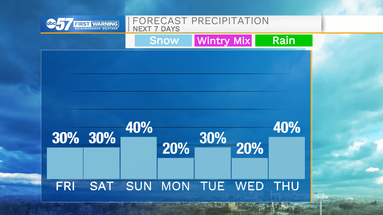
Hopefully, it'll be the best of both worlds: snow will be falling at times, but it won't slow you down too much!