
-
1:06

Marshall County Humane Society reschedules Dog Egg Hunt
-
2:01

Martin Luther King Dream Center hosts MLK March in South Bend
-
1:54

South Bend Cubs opener postponed by weather, but fans still find...
-
2:01

Sights and sounds from South Bend Cubs Opening Day
-
1:32

NIPSCO ’flatly rejected’ further negotiations, USW workers...
-
3:36

The art of groundskeeping at Four Winds Field
-
3:32

The history behind America’s only ballpark synagogue turned...
-
1:59

South Bend opens season against Quad Cities in familiar Midwest...
-
4:21

South Bend Cubs owner discusses $48M stadium expansion, changes...
-
3:19

A look into the new South Bend Cubs 2026 roster
-
5:17

Expansion goes beyond Four Winds Field, new restaurants, bars,...
-
6:18

What’s new this season? South Bend Cubs unveil major improvements...

Scattered showers and thunderstorms will last through late Tuesday afternoon and into the evening. The intensity of storms is not expected to be as strong as Monday night but heavy downpours and gusty wind are still a possibility. Storm activity fades after 10 PM.
Wednesday will start a bit gloomy with patchy fog and drizzle. The pattern for the next seven days is very August-like. High warm into the low to mid 80s, muggy with a chance of pop-up showers and storms in the afternoon. The forecast does trend slightly cooler and drier into early next week.
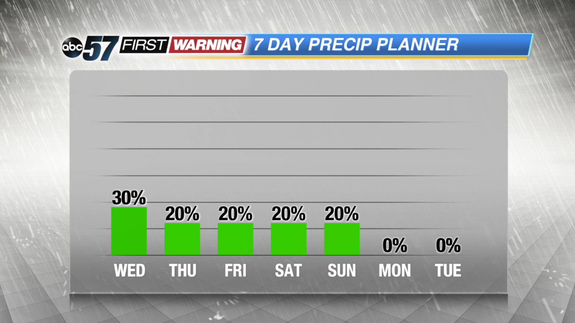
Tonight: Mostly cloudy, lingering shower, low of 66.
Wednesday: AM fog and drizzle, highs near 80.
Thursday: Partly cloudy, isolated PM storms, high of 84.
Friday: Partly cloudy, isolated PM storms, high of 86.