
-
1:51

Warm and sunny stretch with a few showers possible this weekend
-
0:30

Prayer vigil held for domestic violence victim in South Bend
-
1:10

Bristol Town Council voting in favor tonight for the annexation...
-
0:52

Official ribbon cutting for The Delta neighborhood in Elkhart
-
1:08

Traveling or booking a trip soon? Here’s what to know
-
0:27

Elkhart Police Department investigating a hit and run on Cassopolis...
-
2:40

Recovery efforts continue after EF-1 tornado devastated Edwardsburg
-
1:22

The March rollercoaster continues
-
0:55

Mishawaka High School Theatre presents ’Chicago! Teen’
-
19:10

How public records requests increase government transparency
-
2:25

Local chef showcasing her food at Pacers game
-
3:46

Local farmers concerned war with Iran will impact fertilizer

Nearly as cold or colder tonight, clouds will break, which will mean lows plummeting to or below zero, except closer to Lake Michigan.
There is a slight warm-up to end the week but high temperatures are unlikely to break 20. Light snow showers also stay in the forecast, accumulation of more than one inch each day is unlikely. A reinforcing punch of arctic air is set to impact the central and eastern U.S. for New Year’s Day, temperature will likely dive below zero to start 2018. A break from this frigid pattern still shows up in the models for mid-January.
Tonight: Partly cloudy, flurries, lows near or below zero.
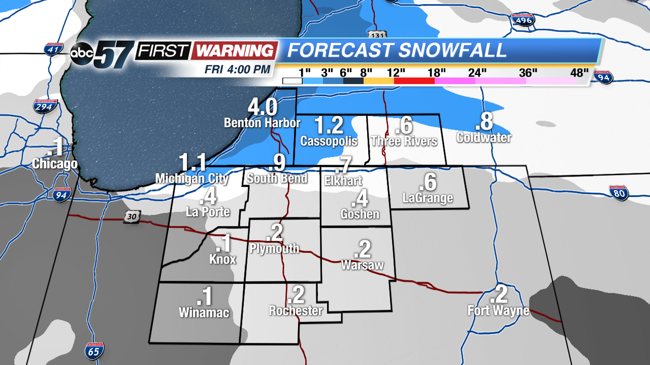 Only minor snowfall through Friday, mostly off Lake Michigan.
Thursday: Partly cloudy, chance of snow late, high of 12.
Friday: Light snow showers, high of 18.
Saturday: Light show showers, highs in the mid-teens.