
-
1:43

Pleasant to start the weekend
-
3:06

Pulaski County weighs stricter solar rules amid resident concerns
-
0:40

Marian High School hosts World Down Syndrome Awareness Walk
-
2:33

South Bend leaders call for an end to gun violence
-
2:01

Tae Johnson, Notre Dame secondary stands out as Irish open spring...
-
2:21

Backup quarterback competition, position battles highlight Notre...
-
2:25

A new Pathway to the Golden Dome
-
2:33

Howard Park aims to install bandshell
-
1:37

March Madness and gambling responsibly
-
1:19

There are two big temperatures drops next week
-
1:48

Longer days for the first day of Spring
-
1:30

Country music star Jake Owen to play at Blue Gate Performing...

Relief from the humidity the next two days before our next chance of storms Thursday. Tuesday and Wednesday will see typical July temperatures but lower humidity making the days and nights pleasant. Humidity climbs Wednesday into Thursday, fueling the next round of rain and thunderstorms. Mild and dry weather returns for the weekend.
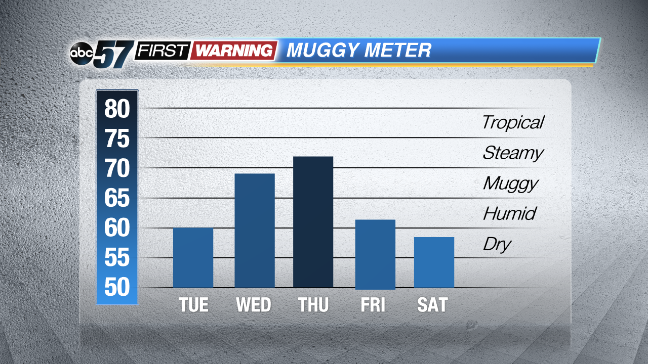 Humidity rises Wednesday into Thursday, otherwise the forecast is fairly comfortable.
Tonight: Mostly clear, low 57.
Tuesday: Mostly sunny, high 82.
Wednesday: Mostly sunny, high 86, chance of storms late.
Thursday: Thunderstorms likely, highs in the low 80s.
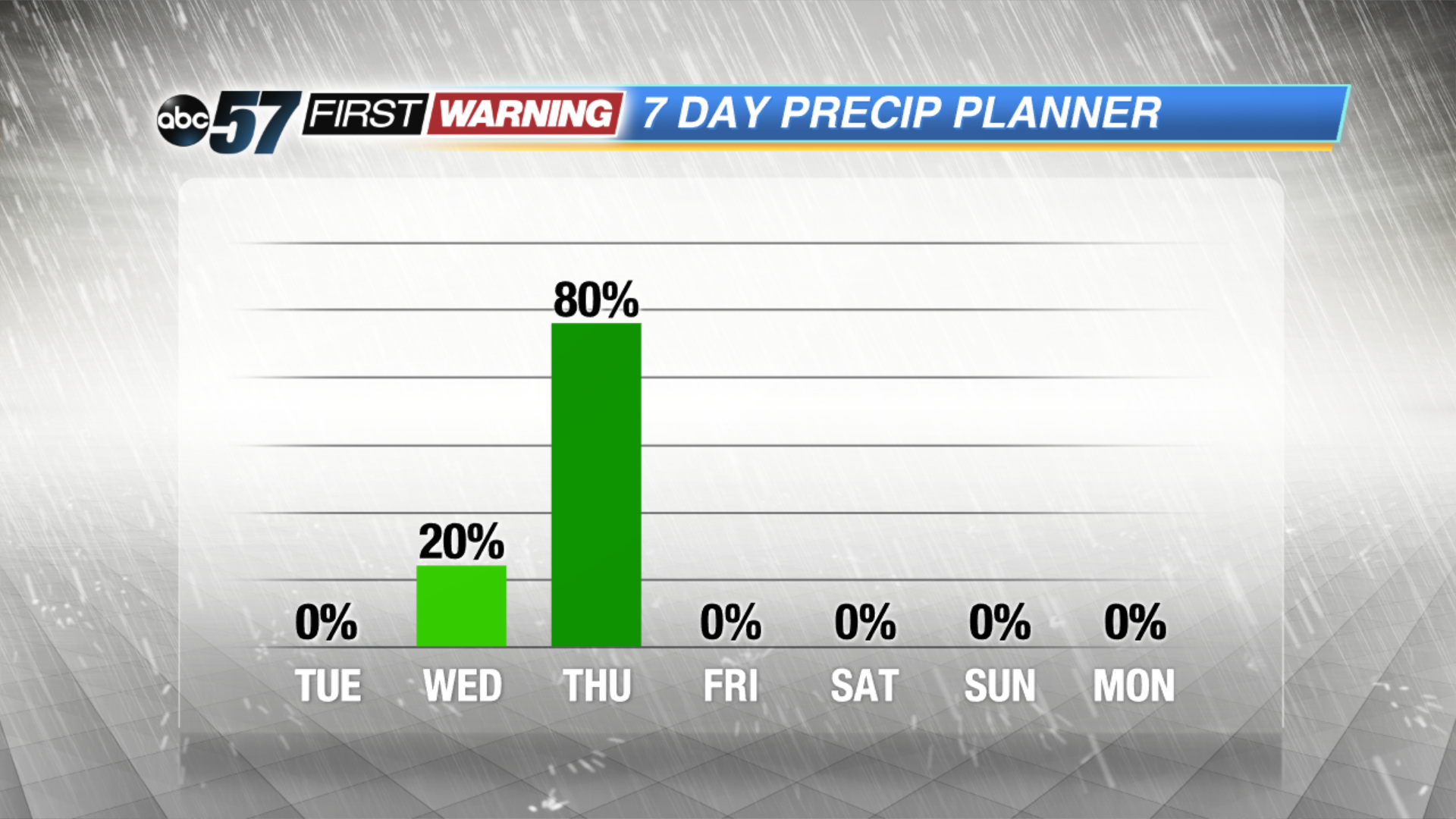 The surge in humidity brings our next round of rain Thursday.
Sign up for the ABC 57 Newsletter