Wintry mix and cold temperatures on the way for this week

-
1:52

While the rain is over, the cooling temperatures are not
-
2:28

Public forum hosted by John Glenn High School students
-
3:34

Kickoff preview with ABC57’s Allison Hayes
-
0:57

Completion of Martin Luther King Jr. Dream Center one step closer
-
0:36

Niles High School students network with local professionals
-
3:59

Political group asks Indiana Democrats to vote in Republican...
-
3:01

New Buffalo Area Schools to build workforce housing
-
2:37

City seeks feedback for final Potawatomi Park plan
-
7:27

Center for the Homeless hosting Dancing With Our Stars
-
2:10

More wet weather arriving later tonight, but sunnier skies after
-
3:16

Public input on the proposal to restart the Palisades Nuclear...
-
1:35

Dari Fair opened Wednesday for 2024 season, temperatures cool...

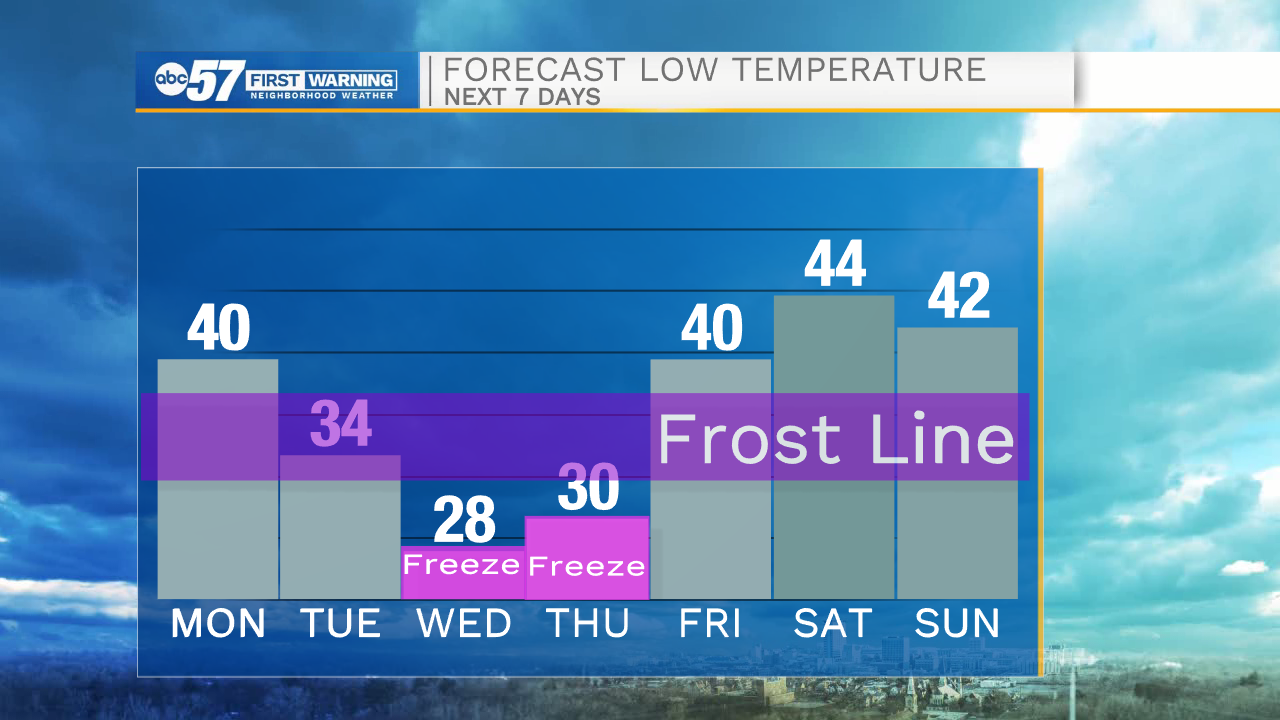
Tonight, cloud cover will increase slightly helping to keep temperatures tomorrow morning in the upper 30s to lower 40s. Tomorrow afternoon high temperatures will top out in the lower 60s under mostly sunny skies. Rain chances return tomorrow afternoon, primarily in our northern Michiana counties. As we head into Tuesday morning some of that rain will turn over to a wintry mix as temperatures drop closer to freezing. Wintry mix and snow showers will remain in our forecast till Wednesday morning, with a few small chances for some flurries Wednesday afternoon. 1-3 inches of snow are possible for most of Michiana. Slick spots are likely on bridges and overpasses, especially as temperatures fall well below freezing into Wednesday morning. Lows to start your Wednesday will be in the mid to upper 20s. The fruit crop that is near or at bloom now could be greatly impacted with the cold temperatures Wednesday morning.
Tonight: Partly cloudy. Low 40.
Tomorrow: Mostly sunny. High 60.
Tuesday: Wintry mix. High 39.
Wednesday: AM Snow. High 40.