Winter storm with heavy snow reaches Michiana this evening


Overnight, some areas accumulated 1-2” of snow, but there is more to come later this evening. Tonight, some areas will accumulate more than 6 inches of snow.
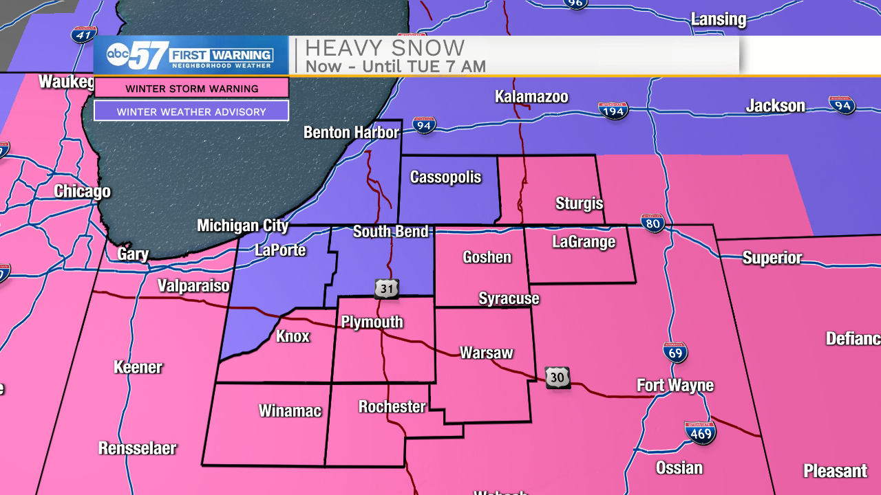
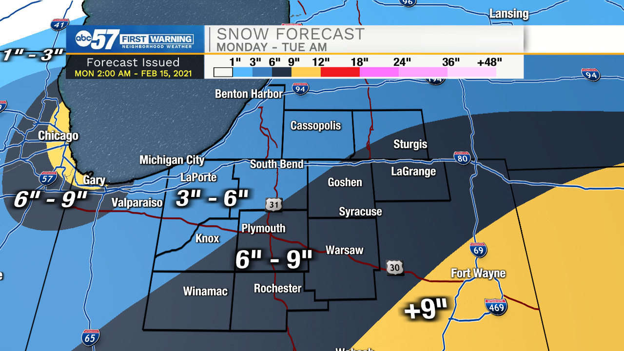
There is a Winter Storm Warning in place now through 7 a.m. Tuesday. These areas are highlighted in pink in this map.
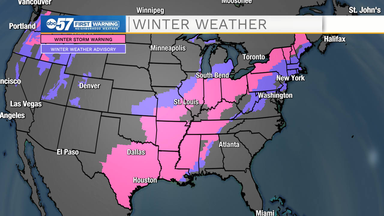
It isn't just us facing the storm. States like Texas, Oklahoma, and Arkansas are already battling this system and have the same warnings.
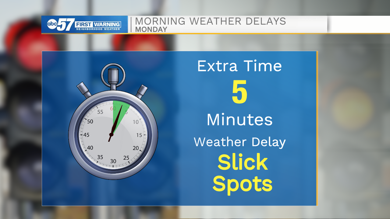
Focusing on this morning, the roads could be slick in a few spots because of the overnight snow. An extra 5 minutes should be enough to get you to work safely. There is a brief lull in snow later this morning and early afternoon.
The system reaches Michiana after 5 p.m., but the heaviest snow is from 7 p.m. through midnight.
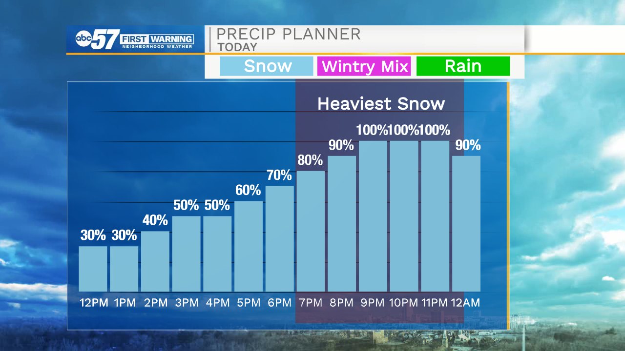
Your drive home could be a bit slow going. Be very cautious with any overnight travel during the heaviest periods. Parts of Michiana could pick up more than 6” of snow with this system.
A few snow showers linger into early Tuesday morning. Watch for blowing/drifting snow and some slick spots on Tuesday’s commute. The rest of Tuesday and Wednesday should stay dry.
Our next chance for snow comes Wednesday overnight and through the day Thursday.
Today: Snow showers in the morning. Heavier snow in the evening. High 14.
Tonight: Snow, especially before midnight. Breezy. Low 6.
Tuesday: Few AM snow showers possible. Mostly cloudy. High 18.
Wednesday: Mostly cloudy. Overnight snow. High 20.