Windy, wet start to Labor Day; drying out this afternoon

-
2:32

County Council asks questions on 900-acre Granger rezoning and...
-
0:56

Notre Dame women’s basketball team holds end-of-season awards...
-
0:45

Idea Week kicks off with networking at launch party
-
2:59

SBPD officer takes in six puppies while SBARC remains on Parvo...
-
1:45

How rain is hampering planting progress
-
2:43

From classrooms to rental units in Chikaming Township
-
1:47

Cooler and drier midweek, milder and wetter weekend
-
2:36

Aspiring chefs are cultivating their dreams at Ivy Tech
-
1:40

Rainy and breezy Tuesday
-
0:58

Hockey team hosts ’Rally for Rudy’ car wash
-
1:06

South Bend School Board of Trustees reviewing the code of conduct
-
2:33

Newly annexed land in Mishawaka could see a Gurley Leep auto...

It was a windy, wet start to Monday as a cold front passes Michiana. Temperatures have stalled in the low to mid 70s most of the morning, and there likely won't be much of a warm up this afternoon. The high today is 73 degrees.
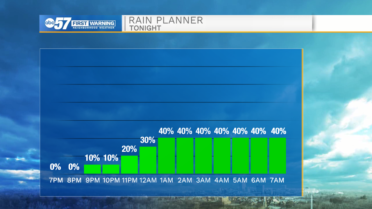
A few more isolated showers are possible through noon, although many will stay dry during this period. Conditions improve this afternoon-- most stay dry and clouds break up slightly. Overnight, there are more rain and thunderstorm chances. Temperatures dip into the upper 50s overnight.
Tuesday there are scattered showers and thunderstorms. There are isolated shower chances Wednesday and Thursday. Friday looks dry to end the week. Daytime highs this week stay in the mid 70s.
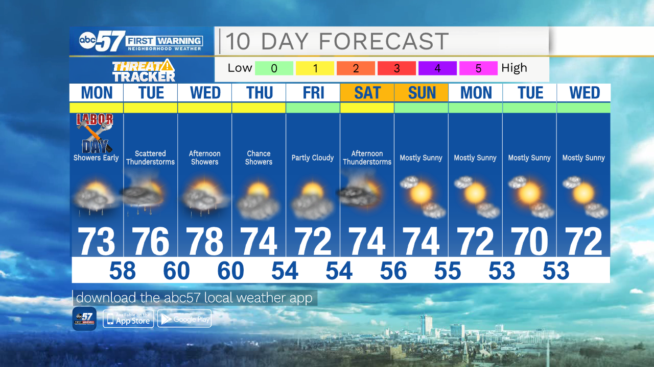
Labor Day Monday: AM showers. Partly cloudy afternoon. High 73.
Tonight: Scattered showers and thunderstorms. Low 58.
Tuesday: Scattered showers and thunderstorms. High 76.
Wednesday: Partly cloudy with afternoon showers. High 78.