Wet and windy tonight, colder with a chance of snow, Friday
Posted: Dec 14, 2022 5:37 PM EDT

-
0:54

Goodwill ’Little Black Dress’ event raises funds for community...
-
1:45

Cheers Bar and Grill liquor license renewed following controversy
-
2:40

Kyle Rudolph weighs in on fellow Irish, Joe Alt, ahead of NFL...
-
0:58

Contractors prepare bids for multi-million-dollar Four Winds...
-
3:11

Caleb Williams and Marvin Harrison Jr. weigh in on upcoming draft
-
3:18

New settlement with Indiana allows Landmark to apply for recertification
-
2:32

NFL Analysts break down Joe Alt’s stock
-
1:21

Fair Thursday wet / windy weekend
-
2:52

Union Township sues UNAS over ambulance stripped for parts
-
1:32

Bridging the healthcare gap in Michiana
-
1:44

Drier but cooler weather returns for Wednesday
-
2:32

County Council asks questions on 900-acre Granger rezoning and...

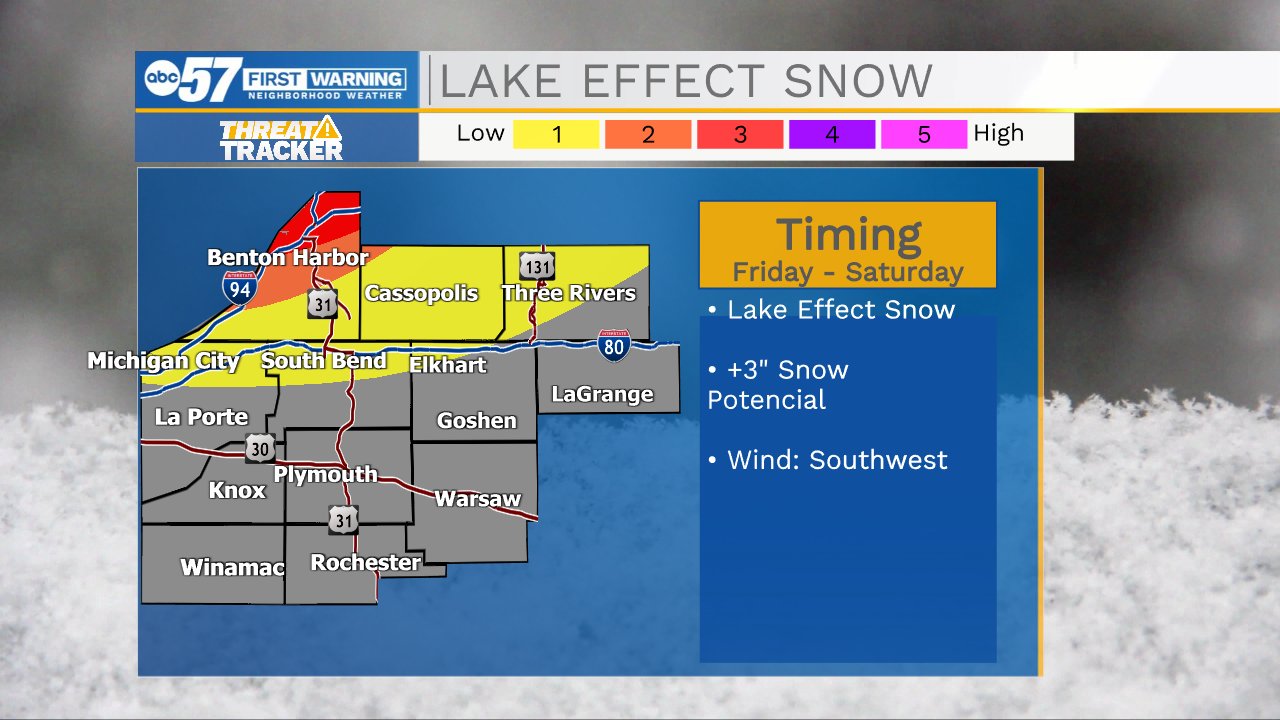
Thursday is transition day before the cold, mundane and cloudy. Friday is colder and temperatures linger near the freezing mark, trending colder through the weekend. The cold Friday night through Sunday morning will produce snow squalls and lake effect snow, but the lake effect snow is mostly directed at West Michigan and northern Berrien County. Next week is MUCH colder, and a winter storm is possible late next week, stay tuned.
Tonight: Rainy, windy. Low 36.
Thursday: Mostly cloudy. High 40.
Friday: Colder. Lake effect snow showers. High 32.
Sign up for the ABC 57Newsletter