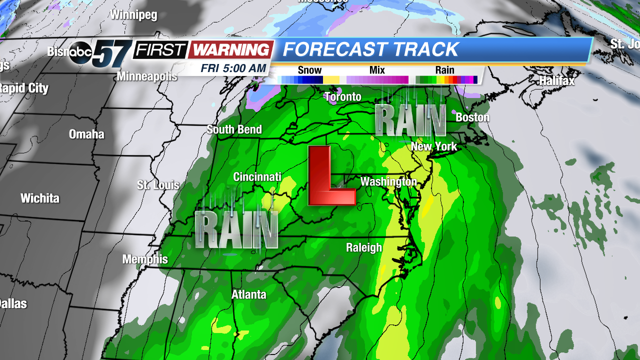
Strong low pressure and widespread rainfall Friday morning.
A strong storm system will greet the eastern half of the United States late this week as winter officially gets underway. Fortunately, the bulk of the system's precipitation will be in the form of rain. That bodes well for anyone who has travel plans, whether it be by car, train or plane. Still, it won't be pretty for millions of people beginning Wednesday. Rain will impact parts of the Southeast Wednesday evening as an area of low pressure develops. The low will quickly strengthen Thursday, adding strong wind gusts to the rain for all of the Southeast and much of the Tennessee and Ohio River Valleys.
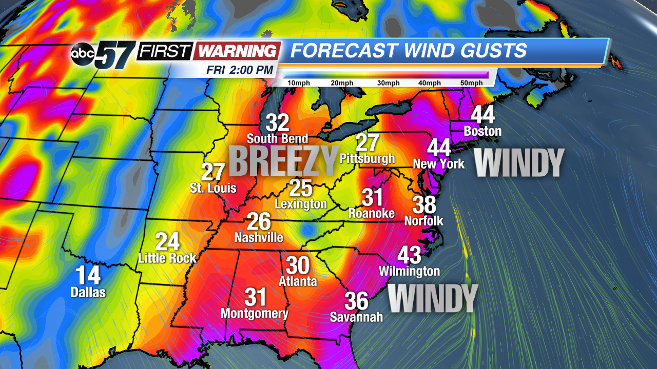
Millions will experience breezy to windy weather Thursday thru Saturday.
The moderate to even heavy rain and the strong wind gusts will spread northward and eastward Thursday night into Friday as low pressure moves across the Appalachian Mountains. This will result in a wet and miserable day across the Mid-Atlantic, Ohio Valley, Northeast, and New England. Again, it will be mainly rain with this system, but traffic and flight delays are still expected, especially with wind gusts of 25-45 MPH virtually everywhere east of the Mississippi River.
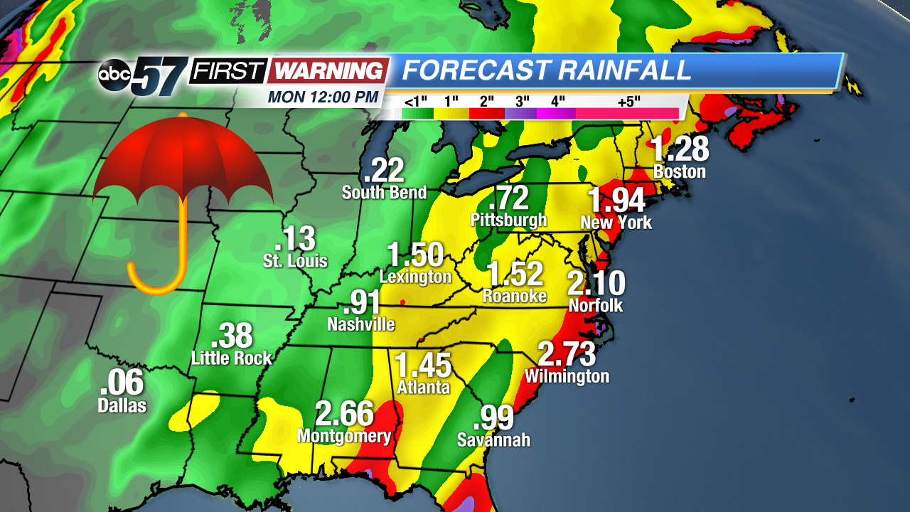
Total rainfall through Monday morning.
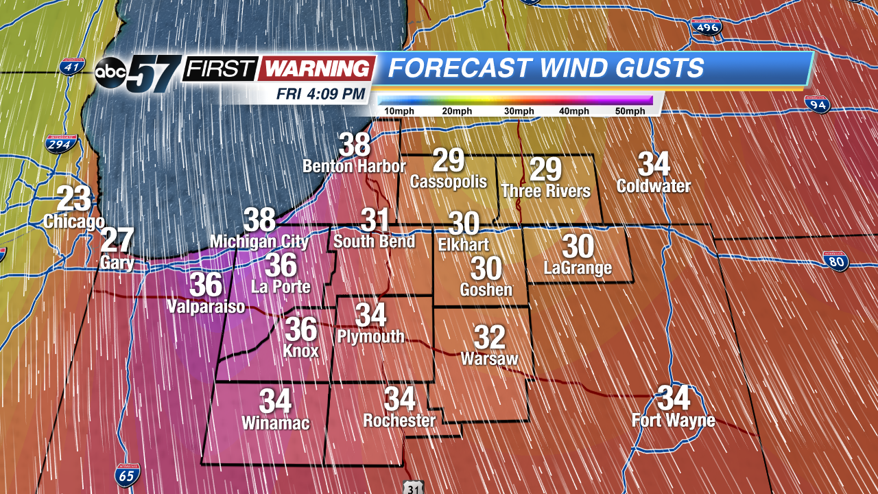
The heaviest rain and strongest wind gusts from this system will be roughly along and east of the I-75 corridor. That's where widespread rain totals of 1-3" and wind gusts of 30-50 mph will be. That keeps Michiana out of the worst conditions. There will still be breezy winds upwards of 30-40 mph and some rain, possibly mixed with snowflakes on Friday. But we will miss out on the worst of the storm as it looks now with only low impacts expected.
Maximum wind gusts Friday.
If you do have any shopping or traveling to do, Thursday and Friday won't exactly be ideal weather days, but it could certainly be significantly worse this time of year. What this system will do is allow colder air to filter in by this weekend. It doesn't look like an Arctic blast with extreme cold, but highs will return to the 30s with lows in the 20s. Unfortunately, the chances of a White Christmas are looking bleak beyond the chance of a few snowflakes Friday.


 Strong low pressure and widespread rainfall Friday morning.
 Millions will experience breezy to windy weather Thursday thru Saturday.
 Total rainfall through Monday morning.
 Maximum wind gusts Friday.