Warming trend this week; dry through Friday
By: Maci Tetrick
Posted: Jun 14, 2020 6:38 AM EDT

-
1:40

Rainy and breezy Tuesday
-
0:21

Westbound lanes on Indiana Toll Road reopen after crash
-
0:58

Hockey team hosts “Rally for Rudy“ car wash
-
1:06

South Bend School Board of Trustees reviewing the code of conduct
-
2:33

Newly annexed land in Mishawaka could see a Gurley Leep auto...
-
3:48

Farmers react to recent trend of farmland sales in St. Joseph...
-
2:47

Reaction to potential TikTok ban
-
2:49

Michigan City Fire Department holds “Firefighter for a Day“...
-
1:27

Ivy Tech program building future auto technicians
-
2:43

Elkhart elated about Big Balloon Build
-
1:34

Volunteers use Earth Day to spruce up Woodlawn Park Trail
-
3:50

Labor complaint filed over “student athletes“ classification

Temperatures stay below normal to end our weekend. Sunday morning early temperatures are in the low 50s. We reach the 60s by noon, and an afternoon high of 73. It will be another sunny day.
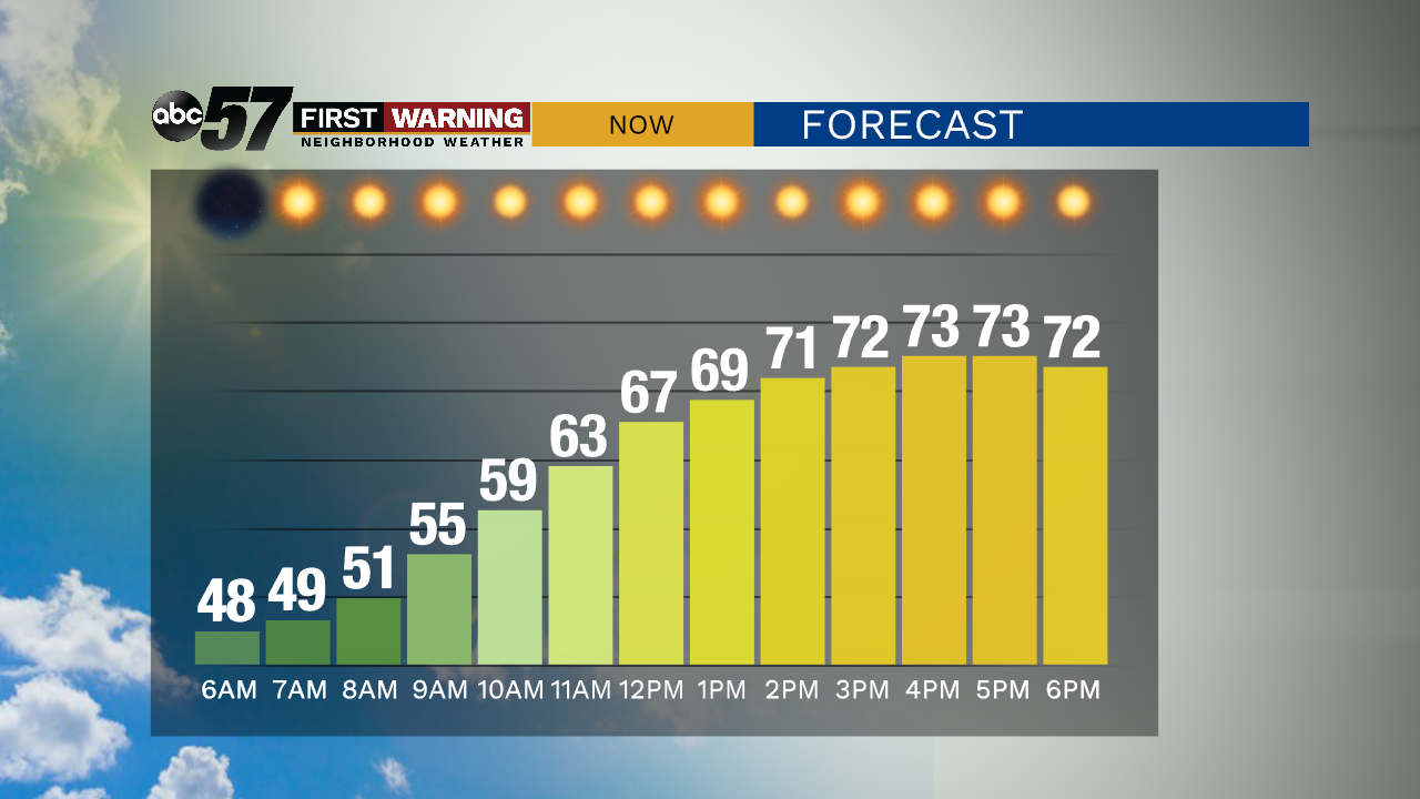
Overnight, temperatures will fall to a low around 50 with clear skies.
The dry, sunny streak continues this week. There is a slight chance for an afternoon or evening shower Monday, but likely the day is dry.
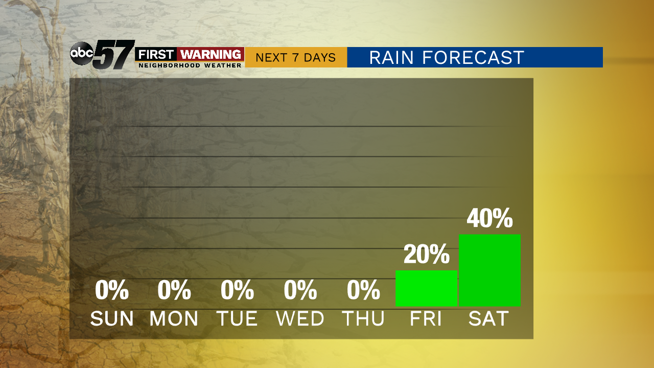
Temperatures warm slightly each day of the week, reaching the upper 80s by Thursday and Friday. Friday evening there is a chance for evening thunderstorms or showers. Showers and thunderstorms will likely continue next weekend.
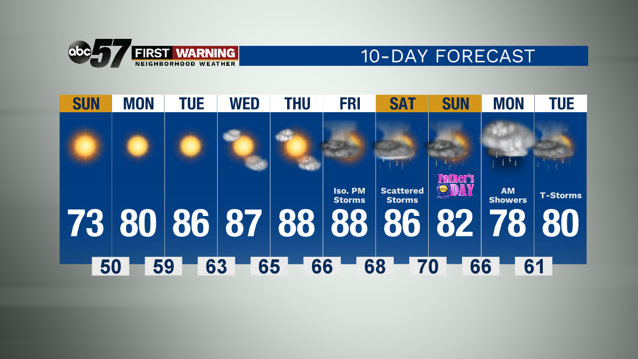
Today: Sunny. High 73.
Tonight: Clear skies, cool. Low 50.
Monday: Sunny. High 80.
Tuesday: Sunny, warmer. High 86.
Sign up for the ABC 57Newsletter