Warming trend continues heading into the work week

-
3:01

New Buffalo Area Schools to build workforce housing
-
2:37

City seeks feedback for final Potawatomi Park plan
-
7:27

Center for the Homeless hosting Dancing With Our Stars
-
2:10

More wet weather arriving later tonight, but sunnier skies after
-
3:16

Public input on the proposal to restart the Palisades Nuclear...
-
1:35

Dari Fair opened Wednesday for 2024 season, temperatures cool...
-
1:22

Another round of rain, then a cool weekend
-
4:33

Should Indiana’s abortion records be public?
-
2:52

Trailblazing promotions at the South Bend Fire Department
-
1:30

Downtown South Bend and Notre Dame to see improved connectivity
-
1:44

Storm threat today holds relatively low severe risk
-
0:30

Officials share opioid settlement funding plan

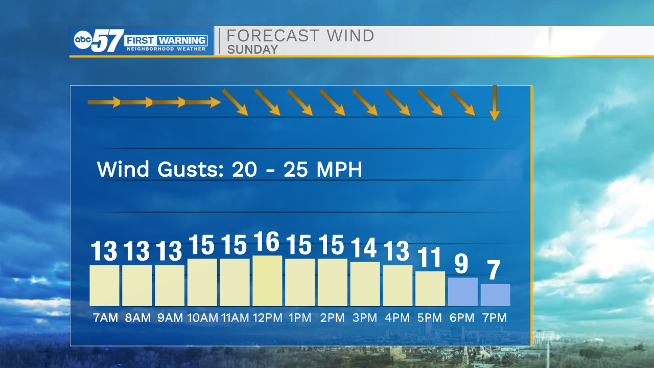
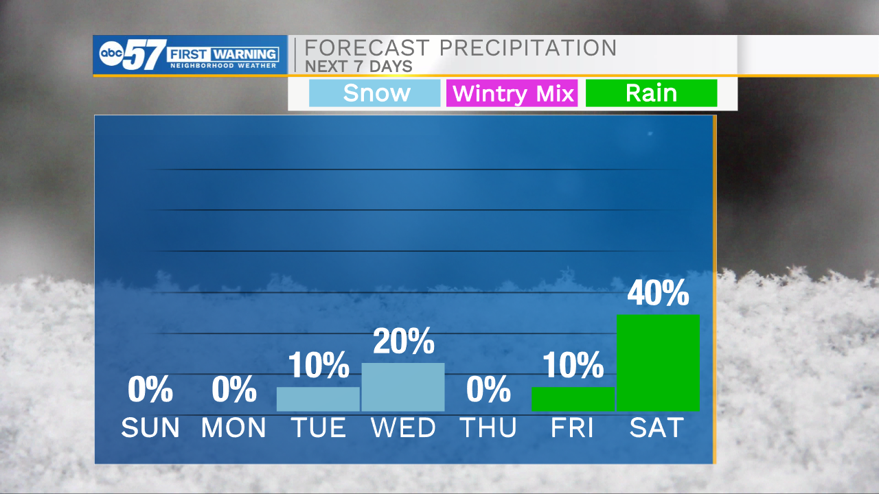
It’s another cold start to the day with temperatures in the 20s and feel like temperatures in the teens. We are tracking more sunshine on the way for today, which will help warm highs into the mid to upper 30s again this afternoon. Winds will stay persistent into the afternoon with occasional gusts reaching 20-25mph. This will keep the wind chill a few degrees cooler throughout the day. Temperatures this week will stay on a warming trend with highs hitting the mid 40s on Wednesday and then the lower 50s by Saturday. Our next best chance for showers and even a few isolated thunderstorms will arrive next Saturday.
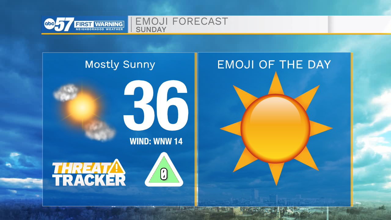
Today: Mostly sunny. High 36.
Tonight: Mostly clear. Low 20.
Tomorrow: Mostly sunny. High 40.
Tuesday: Partly cloudy. High 42.