Warm and windy, before showers and storms

-
1:52

While the rain is over, the cooling temperatures are not
-
2:28

Public forum hosted by John Glenn High School students
-
3:34

Kickoff preview with ABC57’s Allison Hayes
-
0:57

Completion of Martin Luther King Jr. Dream Center one step closer
-
0:36

Niles High School students network with local professionals
-
3:59

Political group asks Indiana Democrats to vote in Republican...
-
3:01

New Buffalo Area Schools to build workforce housing
-
2:37

City seeks feedback for final Potawatomi Park plan
-
7:27

Center for the Homeless hosting Dancing With Our Stars
-
2:10

More wet weather arriving later tonight, but sunnier skies after
-
3:16

Public input on the proposal to restart the Palisades Nuclear...
-
1:35

Dari Fair opened Wednesday for 2024 season, temperatures cool...

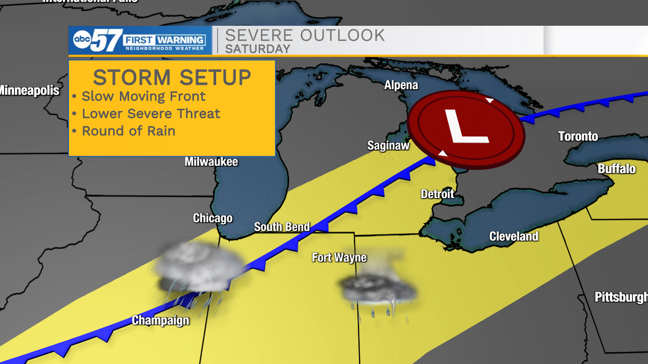
The Focus on Friday has shifted to Saturday, with what is now evolving into more of a heavy rain, less of a severe thunderstorm threat. Friday is hot, humid, and breezy as temperatures surge near 90. There could be an isolated morning thunderstorm, but the daytime hours are likely dry. A cold front slowly moves into the area Friday evening, and the chance of rain increases into Saturday morning. The timing lowers the severe threat, minus a few isolated cells Friday evening, rain with downpours is more likely Saturday morning. A slow-moving front could mean multiple rounds of heavy rain during the day Saturday, lasting into the evening. Drier, and milder weather returns Sunday.
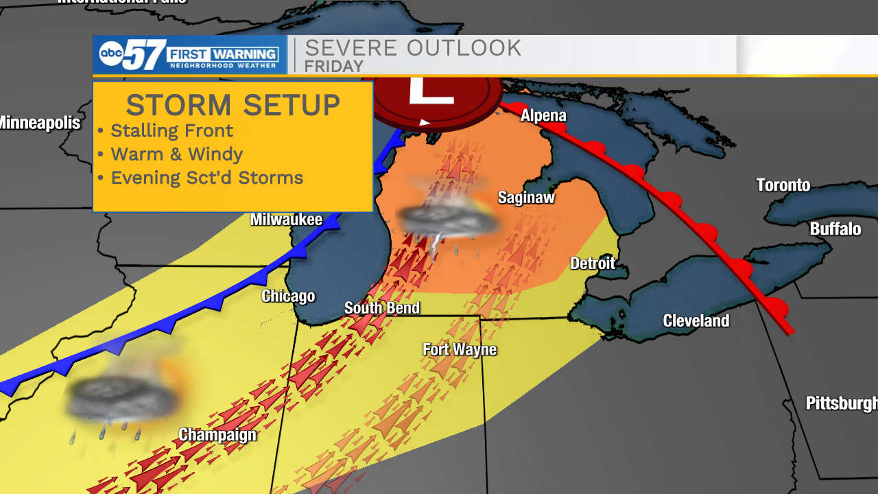
Tonight: Partly cloudy, becoming humid. Low 68.
Friday: Breezy, PM T-Storms. High 88.
Saturday: Rounds of rain / T-showers. High 68.
Sunday: Partly cloudy. High 62.
Monday: Mostly sunny. High 66