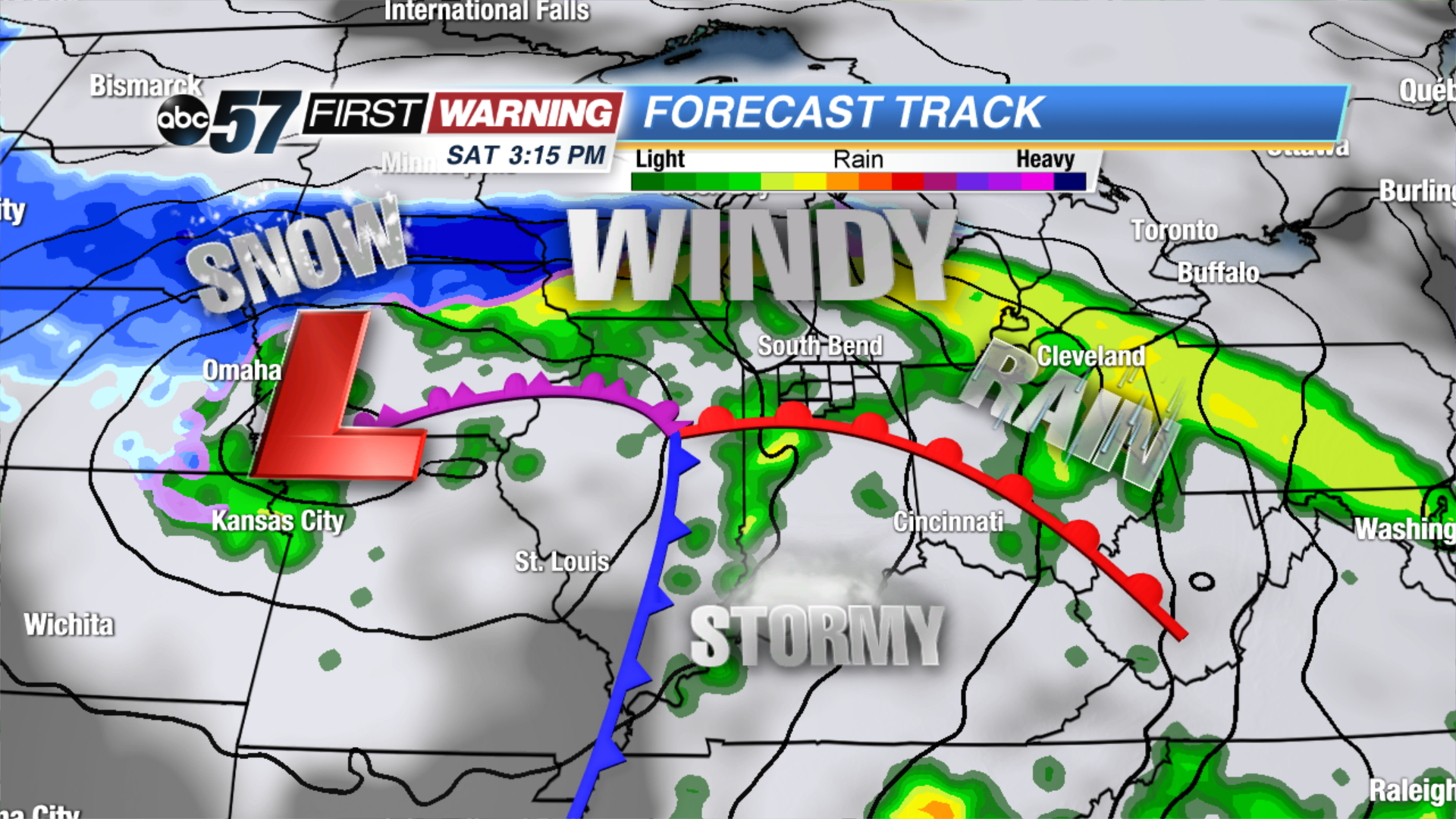
A very strong area of low pressure will affect the Midwest, Great Lakes, Ohio Valley, Tennessee Valley, and Deep South Friday thru Sunday. It will bring a wide variety of impacts, ranging from heavy snow to strong wind gusts to flooding rain and severe thunderstorms. For Michiana, we will be in the "warm sector" of the system, meaning no frozen precipitation this go-around.
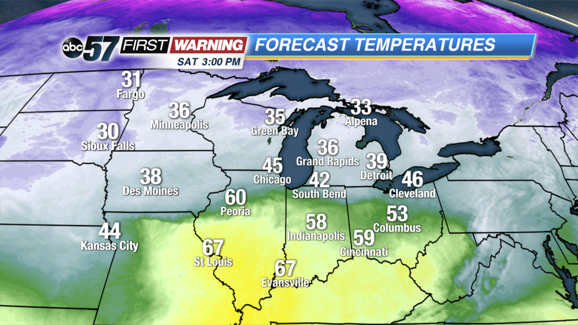
Temperatures at 3 p.m. Saturday.
The worst part of the day will be from 8 a.m. until 3 p.m. During this window, expect persistent moderate to even heavy rain and strong winds. Not only that, but temperatures will be in the 30s and lower 40s thru the mid-afternoon hours. In other words, the first half of Saturday is shaping up to be disgusting.
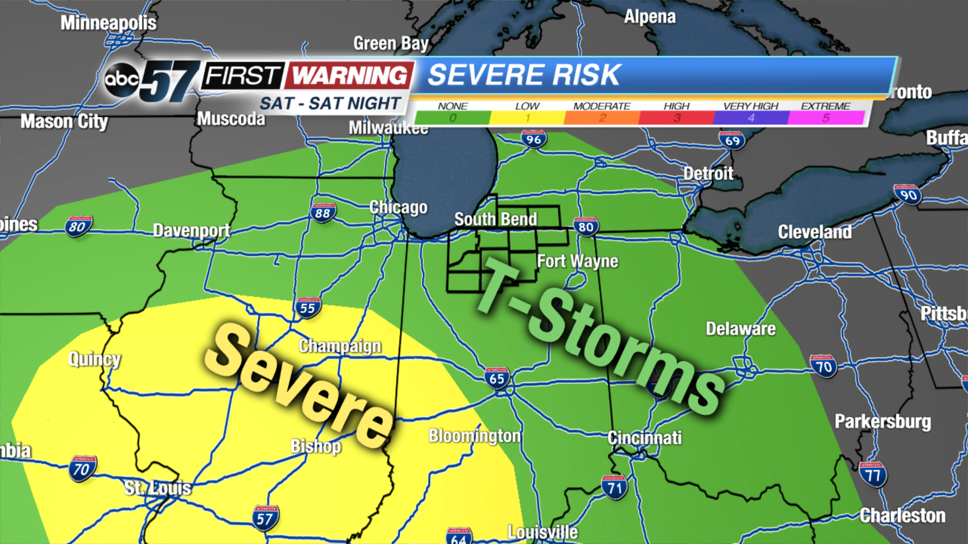
Severe weather outlook for Saturday.Storm Prediction Center
While a rumble of thunder is very possible with the morning and early afternoon rain, the best chance at seeing a few thunderstorms comes late in the afternoon and evening. All of Michiana is under a risk for general thunderstorms, but there is currently no risk for severe weather. However, there is a risk for severe weather just a few hundred miles to the southwest. Areas like Indianapolis, Bloomington, Terre Haute, Evansville, and a good chunk of Illinois have been placed in a low (marginal) risk for severe weather late in the day Saturday. Damaging wind gusts, hail and a few tornadoes are possible in those locations.
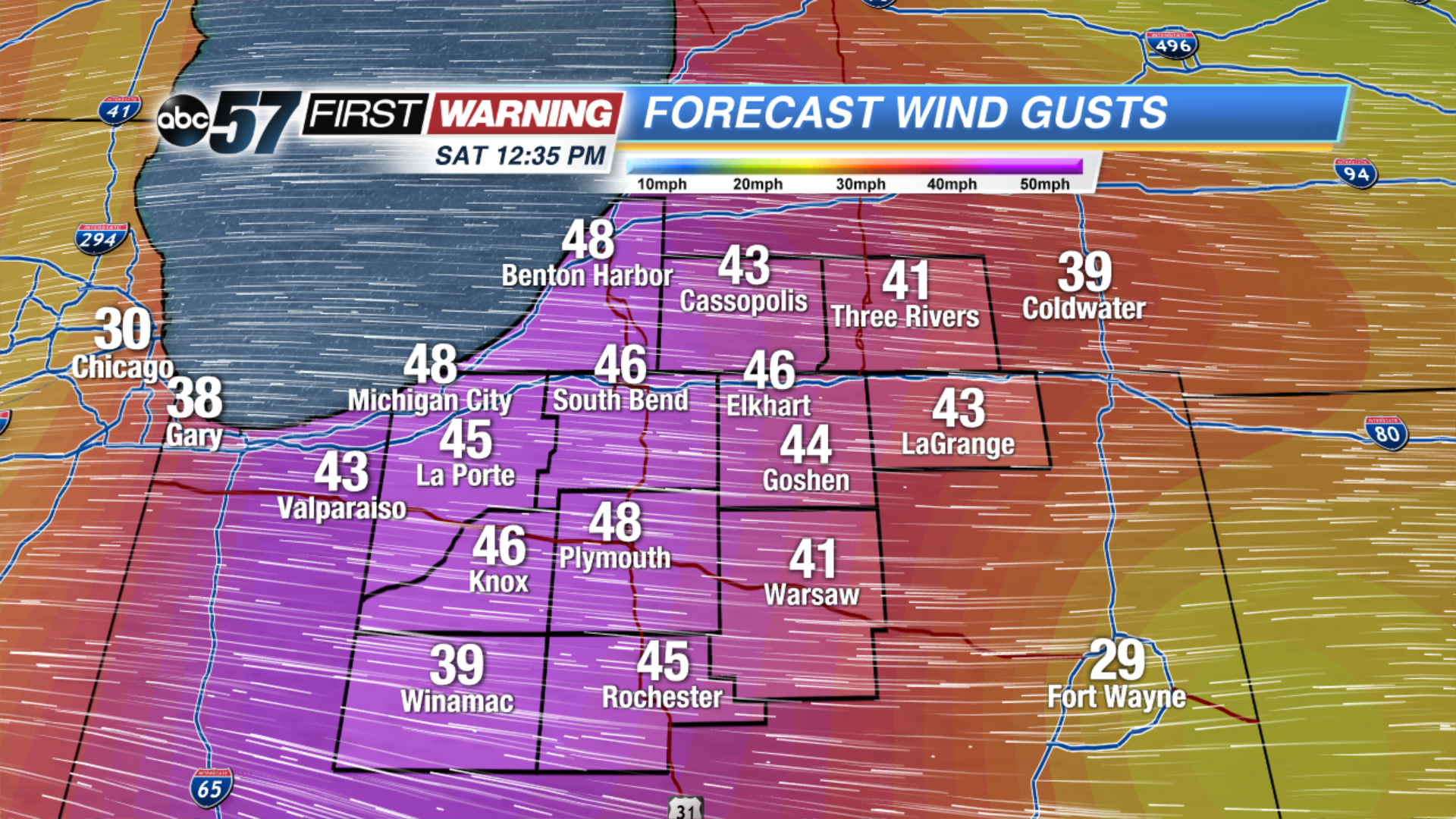
Peak wind gusts Saturday early afternoon.
And despite Michiana not being included in the severe risk, it is not out of the question that we see a stronger storm or two capable of hail and strong winds. This risk is conditional on several factors coming together, but there is certainly a chance. Even without any strong thunderstorms, wind gusts of 30-50 mph are expected during the morning and afternoon hours. With the ground being saturated, winds of that magnitude could down weaker trees and possibly power lines. This could lead to a isolated power outages across the region.
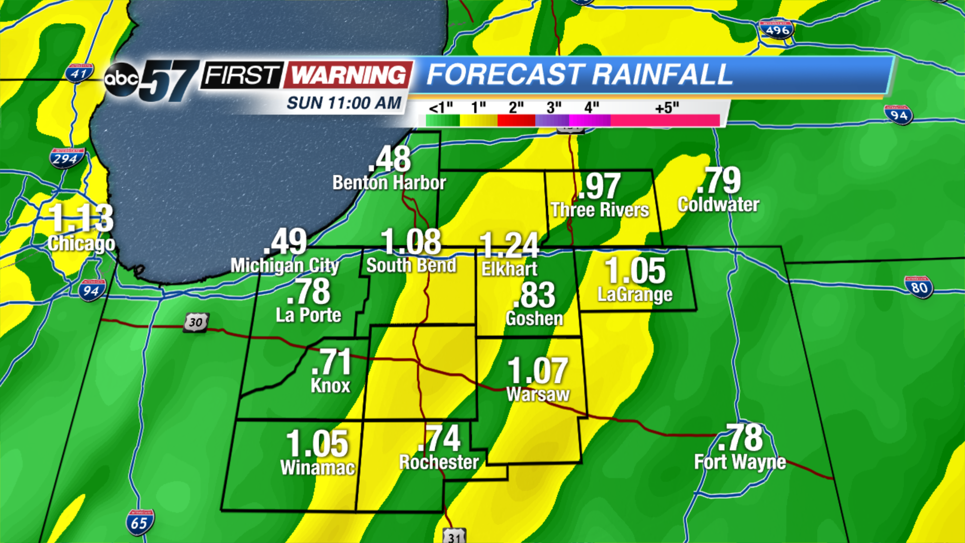
Total rainfall from Saturday's system.
By the time the system begins moving away Sunday, upwards of an inch of rainfall, if not more, will haven fallen across the area. This will likely lead to several instances of river rises, minor river flooding, lowland and field flooding, and areas of high water on roadways. The steady precipitation will be done by Sunday morning with only a few areas of showers and possibly snow showers for Sunday and Monday.


 Temperatures at 3 p.m. Saturday.
 Severe weather outlook for Saturday.
 Peak wind gusts Saturday early afternoon.
 Total rainfall from Saturday's system.