Turning active through the weekend and heating up

-
1:32

Bridging the healthcare gap in Michiana
-
1:44

Drier but cooler weather returns for Wednesday
-
2:32

County Council asks questions on 900-acre Granger rezoning and...
-
0:56

Notre Dame women’s basketball team holds end-of-season awards...
-
0:45

Idea Week kicks off with networking at launch party
-
2:59

SBPD officer takes in six puppies while SBARC remains on Parvo...
-
1:45

How rain is hampering planting progress
-
2:43

From classrooms to rental units in Chikaming Township
-
1:47

Cooler and drier midweek, milder and wetter weekend
-
2:36

Aspiring chefs are cultivating their dreams at Ivy Tech
-
1:40

Rainy and breezy Tuesday
-
0:58

Hockey team hosts ’Rally for Rudy’ car wash

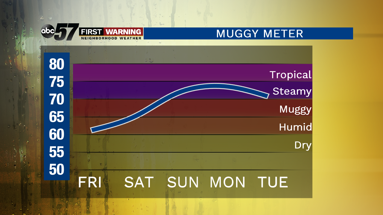
Areas of dense fog this morning could slow down your morning commute. We’ll briefly see sunshine before clouds increase. Isolated showers and thunderstorms are possible after midday. A stronger storm cannot be ruled out. Isolated showers and storms are possible Saturday with more widespread storms Sunday morning. Even with the chance of rain, the weekend is not a washout.
Over the weekend the heat and humidity start to rise. Daytime highs make it into the mid 80s by Sunday and upper 80s Monday. Heat indices will likely climb into the 90s. Temperatures cool down after the next system on Tuesday.
Today: Increasing clouds, isolated showers and storms, high of 78.
Tonight: Mostly cloudy, chance of a shower/storms, low of 64.
Saturday: Isolated showers and storms, high of 82.
Sunday: Scattered showers and storms, high of 86.