Tuesday storm threat, then the humidity drops
Posted: Aug 19, 2019 5:22 PM EDT

-
2:32

County Council asks questions on 900-acre Granger rezoning and...
-
0:56

Notre Dame women’s basketball team holds end-of-season awards...
-
0:45

Idea Week kicks off with networking at launch party
-
2:59

SBPD officer takes in six puppies while SBARC remains on Parvo...
-
1:45

How rain is hampering planting progress
-
2:43

From classrooms to rental units in Chikaming Township
-
1:47

Cooler and drier midweek, milder and wetter weekend
-
2:36

Aspiring chefs are cultivating their dreams at Ivy Tech
-
1:40

Rainy and breezy Tuesday
-
0:58

Hockey team hosts ’Rally for Rudy’ car wash
-
1:06

South Bend School Board of Trustees reviewing the code of conduct
-
2:33

Newly annexed land in Mishawaka could see a Gurley Leep auto...

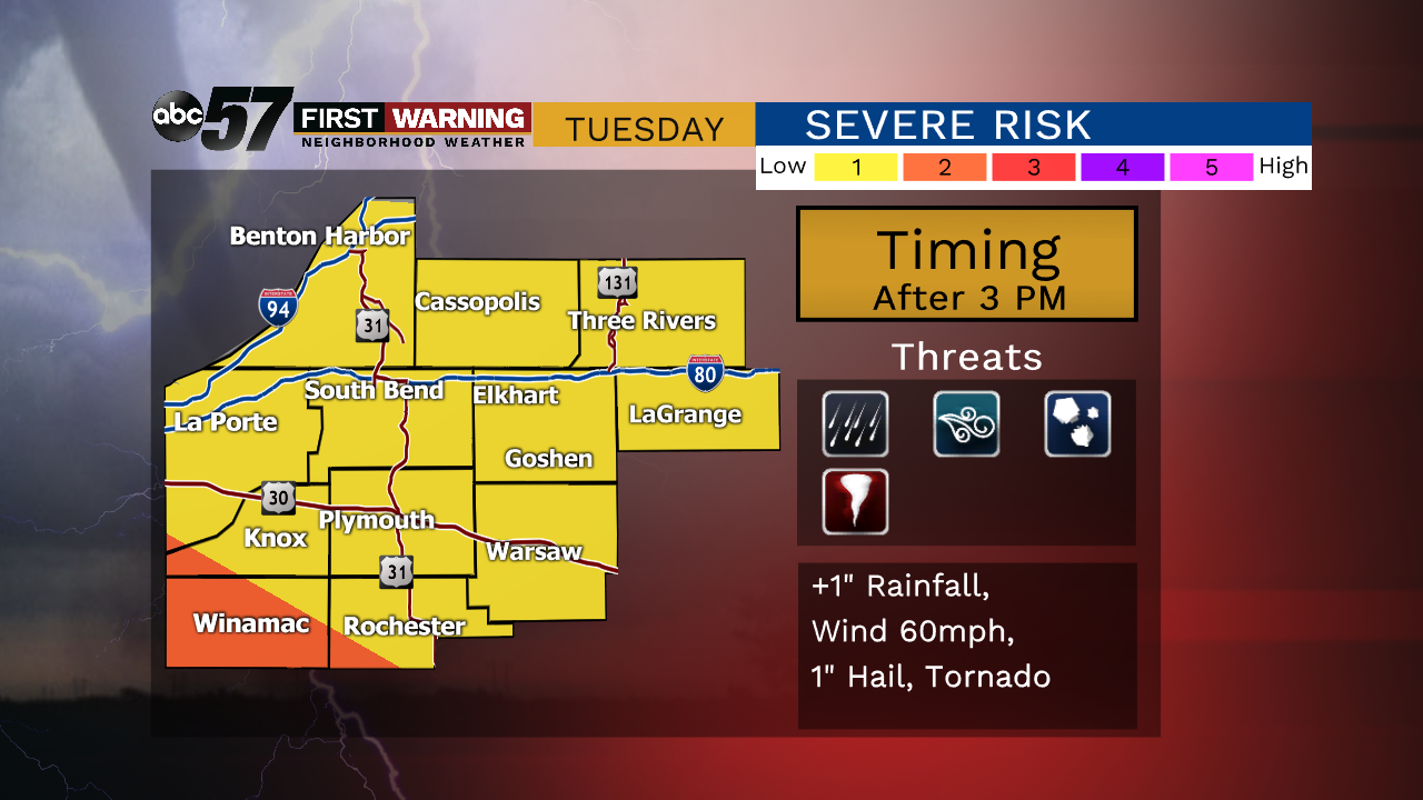
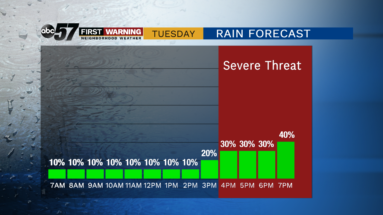
One more day of mugginess with the chance of showers and thunderstorms. An overnight complex of storms could clip the area early Tuesday, otherwise focus will be on afternoon / evening thunderstorm development. Scattered storms bring a low threat of severe weather that includes heavy rain and gusty wind. The pattern changes to end the week, as skies clear the milder temps return.
Tonight: Mostly clear, lows in the mid-60s.
Tuesday: A chance of showers in the morning, then scattered storms in the afternoon, high of 86.
Wednesday: Chance of showers early, partly cloudy, high of 80.
Thursday: Mostly sunny, high of 75.
Sign up for the ABC 57Newsletter