Tuesday afternoon thunderstorms


It’s the first day of September, and we’ll start the month with showers and thunderstorms.
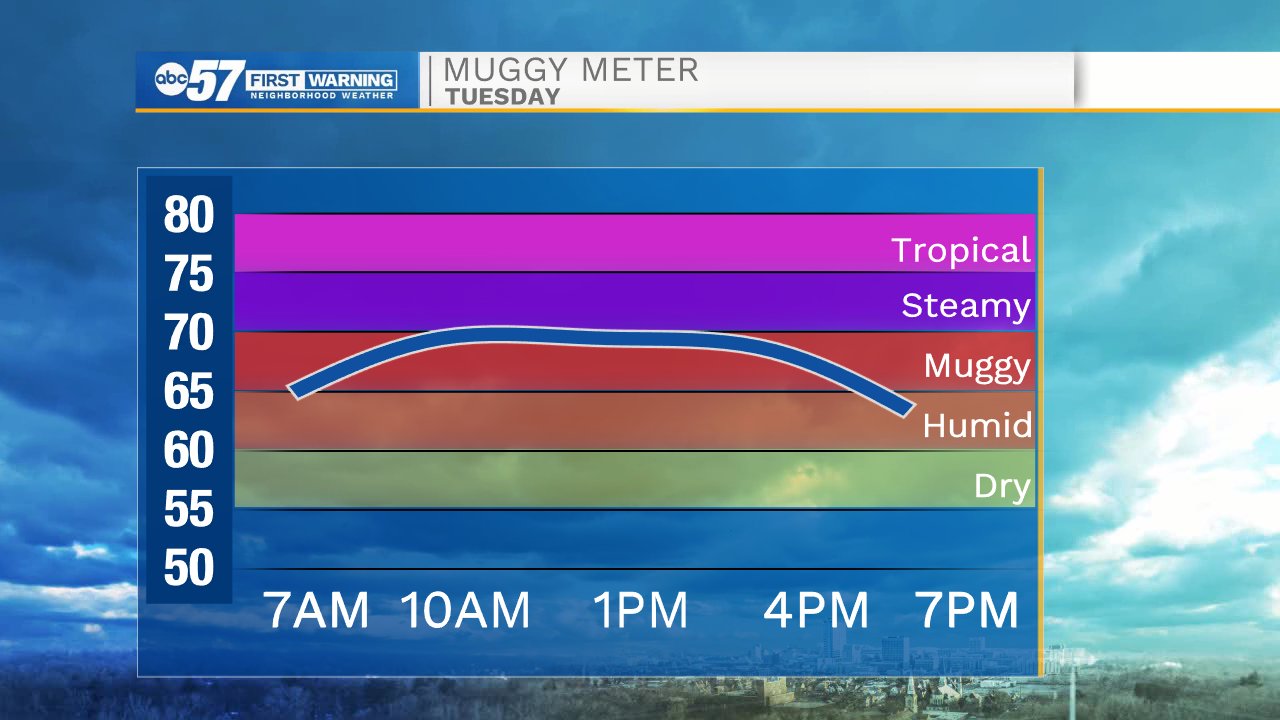
There is increased humidity—it will feel a little muggy as you step outside. This could create some fog this morning.
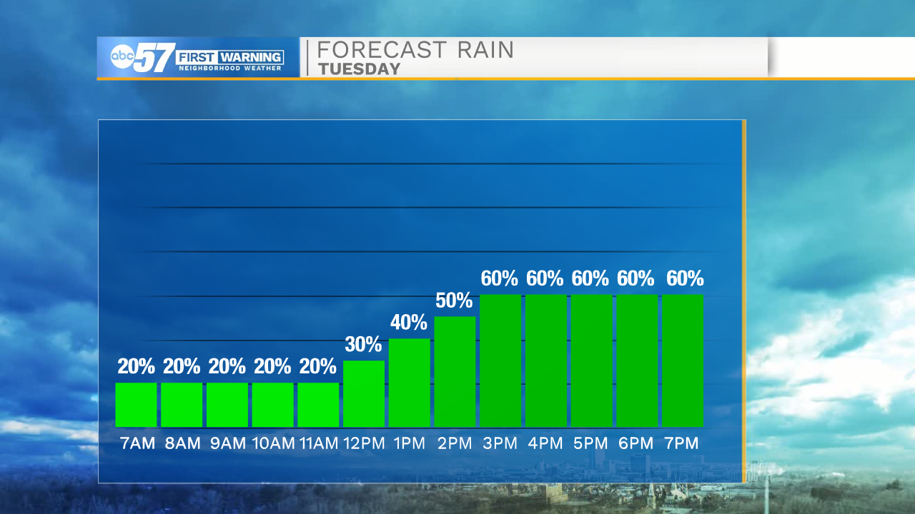
Temperatures start in the upper 60s this morning. We’ll warm to a high this afternoon around 80 degrees. There’s a chance for a few showers this morning, so grab your umbrella as you head out the door.
This afternoon we’ll see more widespread thunderstorms and showers. The threat for severe storms is very low, and the biggest impacts from today’s storms include gusty winds, heavy rain, and potential localized flooding. The bulk of the storms should fall between 2 to 6 p.m.
Showers (and possibly a thunderstorm) will linger through the overnight hours. Tonight temperatures are in the mid 60s. It's a good idea to grab your umbrella Wednesday morning while there are a few more showers. Showers and clouds clear by Wednesday afternoon.
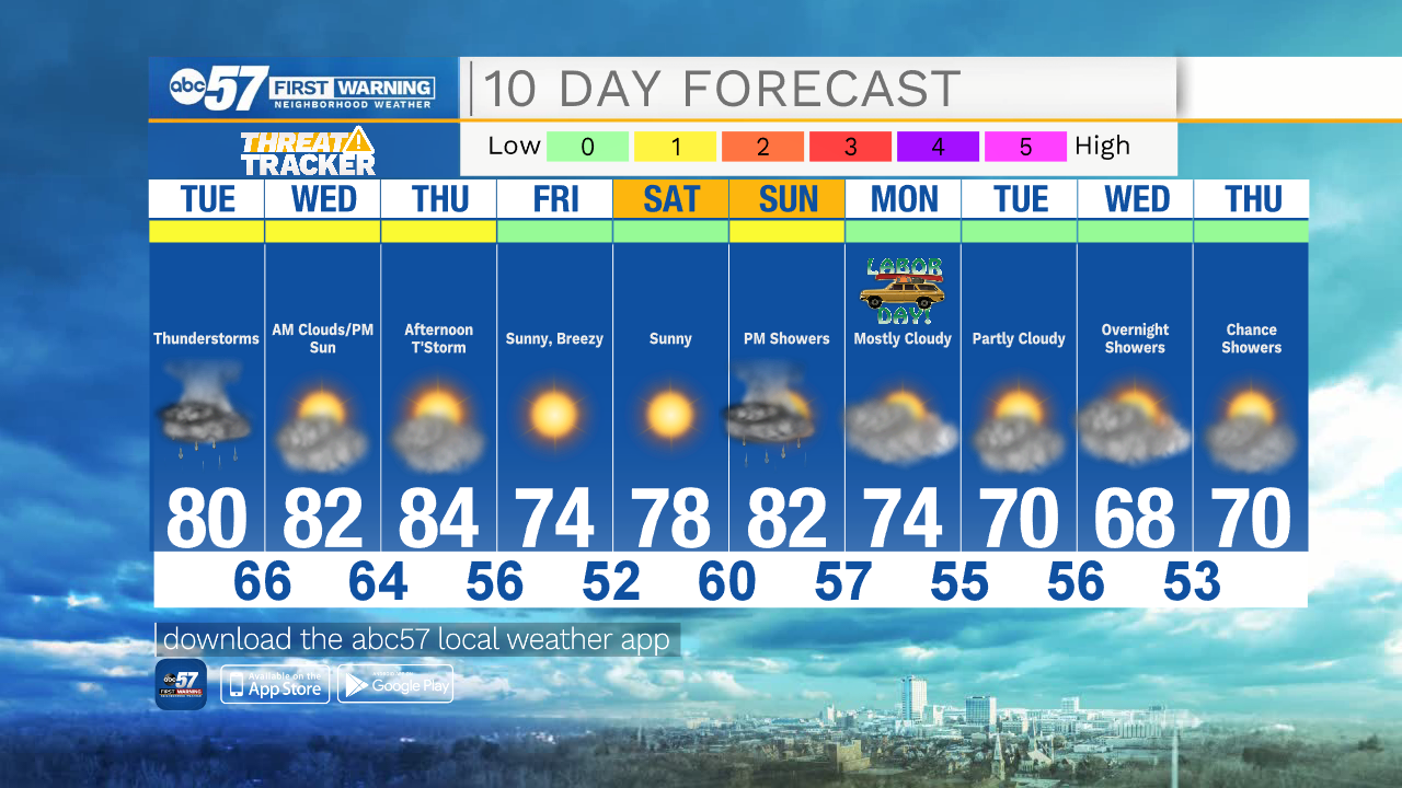
Today: Morning showers, mostly cloudy, scattered afternoon thunderstorms. High 80.
Tonight: Mostly cloudy with showers and possibly a thunderstorm overnight. Low 66.
Wednesday: Partly cloudy. High 82.
Thursday: Partly cloudy. Afternoon isolated thunderstorm possible. Breezy. High 84.