Tracking wet snow Wednesday into Thursday
By: Emily Kennedy
Posted: Feb 4, 2020 3:12 AM EDT

-
1:44

Showers, storms, wind and a cool down
-
1:58

Rain returns tonight, storm chances picking up into tomorrow
-
2:20

Indiana Fever select Caitlin Clark #1 overall in WNBA Draft
-
5:31

Interview with Rep. Bill Huizenga over Israel-Iran conflict
-
1:05

Students perform in first-time joint concert event
-
2:31

Neighbors react after man barricaded himself in crashed vehicle
-
1:52

St. Joseph River at near-flood stage in Niles
-
1:03

Construction set to start on intersection at State Road 933 and...
-
1:54

Event honoring Vietnam War veterans to be held in New Carlisle
-
2:44

St. Joe marinas await completion of Bicentennial Bridge construction
-
2:05

The storm threat is shifting to Wednesday
-
1:24

WNBA Draft looking to impact the next generation of female athletes
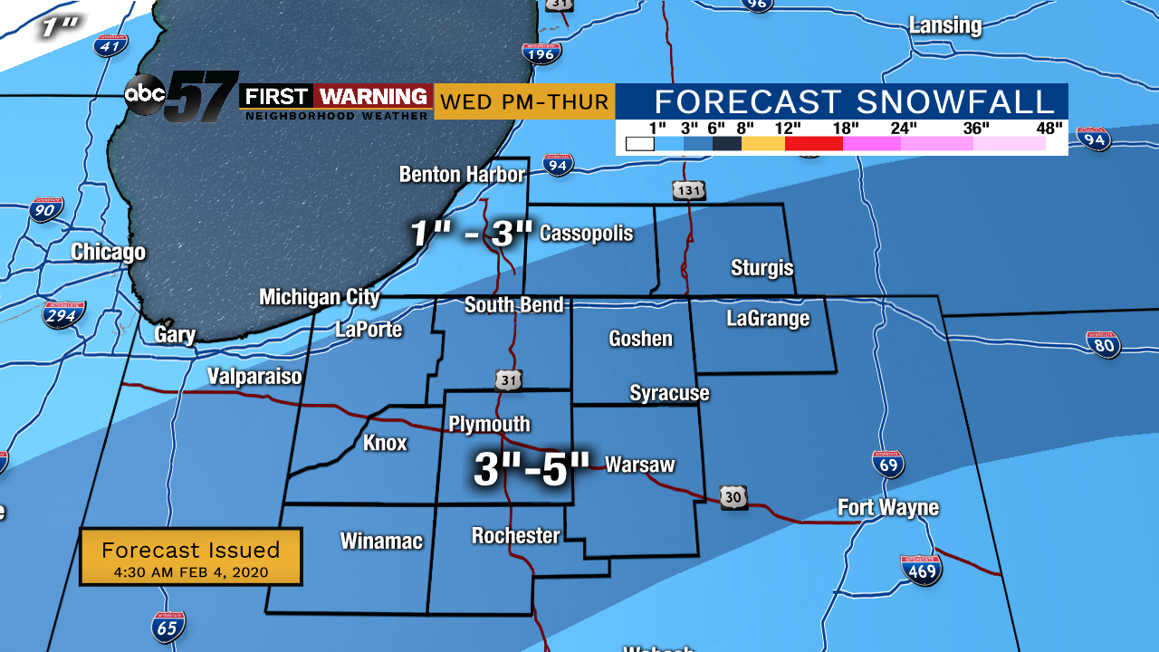
Tuesday, February 4th, 2020
Colder air begins to move back in today, keeping our temperatures in the 30s. We could see a quick chance of rain/snow mix, mainly after midday. The higher impacting system moves in Wednesday evening, bringing wet snow. The heaviest snow is expected Wednesday night into Thursday morning. Snow could add up over 3” along and south of US-30. This will likely lead to slow commutes Thursday morning. A slight chance of snow again on Friday. We’ll finally see some sunshine again on Sunday.
Today: Mostly cloudy with a chance of rain/snow mix. High of 38.
Tonight: Cloudy. Low of 25.
Wednesday: Cloudy, PM snow showers. High 32.
Thursday: Snow showers, especially in the morning. High 32.
Sign up for the ABC 57Newsletter