Tracking a snowy Wednesday

-
1:40

Rainy and breezy Tuesday
-
0:21

Westbound lanes on Indiana Toll Road reopen after crash
-
0:58

Hockey team hosts “Rally for Rudy“ car wash
-
1:06

South Bend School Board of Trustees reviewing the code of conduct
-
2:33

Newly annexed land in Mishawaka could see a Gurley Leep auto...
-
3:48

Farmers react to recent trend of farmland sales in St. Joseph...
-
2:47

Reaction to potential TikTok ban
-
2:49

Michigan City Fire Department holds “Firefighter for a Day“...
-
1:27

Ivy Tech program building future auto technicians
-
2:43

Elkhart elated about Big Balloon Build
-
1:34

Volunteers use Earth Day to spruce up Woodlawn Park Trail
-
3:50

Labor complaint filed over “student athletes“ classification
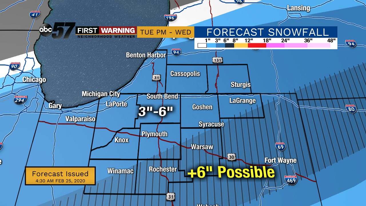
Tuesday, February 25th, 2020
Areas of drizzle are possible this morning, otherwise another round of rain turning to a wintry mix moves through this evening. That will then turn to snow around midnight. Snow showers will then last throughout much of Wednesday and could be heavier at times. It looks like most will see 3-6” of snow with higher amounts possible in our southeast counties. Lake effect snow then develops Wednesday into Thursday as cold air rushes in behind the system. Lake effect snow will likely last into Friday morning.
Daytime highs will only top out in the mid 20s for Thursday through Saturday. We’ll start to see more sunshine this weekend with temperatures gradually warming for early next week.
Today: A few early morning showers. Evening rain/wintry mix. High 37.
Tonight: Snow showers. Low 30.
Wednesday: Snow throughout the day. High 33
Thursday: Cloudy with lake effect snow. High 25.