For the third time in just over 10 days, a powerful nor'easter pummeled parts of the Northeast and New England. This particular low underwent "bombogenesis" as its central pressure dropped more than 24 millibars in 24 hours. Heavy snow, strong wind gusts and large waves affected parts of New Jersey, New York, Connecticut, Rhode Island, Massachusetts, New Hampshire, and Maine. The snow fell so heavily at times that whiteout conditions were seen for long periods of time.
Poor Massachusetts road conditions.massDOT
Numerous roads, highways and interstates across New England saw difficult and treacherous driving conditions all morning and afternoon long. At times, the heaviest snow bands were producing 2-4" of snow per hour! That is as heavy as it gets when it comes to snow rates. Add frequent wind gusts over 35 MPH and you have a recipe for a blizzard. By definition, a blizzard occurs when snow and/or blowing snow causes visibilities to drop to 1/4 of a mile or less while wind gusts of at least 35 MPH frequently occur. These have to be the predominant conditions for at least three consecutive hours. According to the National Weather Service, multiple areas like Boston and Plymouth witnessed blizzard conditions Tuesday afternoon.
Some snowfall totals as of 3 PM Tuesday.
Power outages were seen across New England, trees were blown over and accidents popped up across the region. As of 3 PM Tuesday afternoon, snow totals of at least 10" were common. The highest totals were in parts of Rhode Island, Connecticut, New Hampshire, Long Island, and Massachusetts. However, it's important to know these totals will likely need to be increased as snow continued falling for hours after these totals were recorded. For the latest totals, click here and here.
Select snowfall totals as of 3 PM Tuesday.
Milford, Massachusetts, is the winner thus far in the snowfall department with a whopping 19.7". By the time the nor'easter departs entirely Tuesday night, there will be multiple reports of 1-2 feet of snow. Snow isn't the whole story, though. Some wind gusts reached EF0 tornado strength and category 1 hurricane strength along the coast!
Maximum observed wind gusts as of 2 PM Tuesday.
Those intense wind gusts have led to travel disruptions, power outages and rough seas. The rough seas caused and continue to cause coastal flooding and beach erosion. Conditions are expected to improve Tuesday night and Wednesday across the Northeast and New England.


 I-93 in New Hampshire
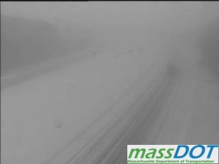 Poor Massachusetts road conditions.
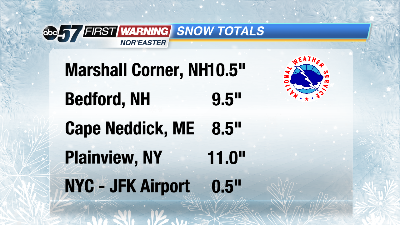 Some snowfall totals as of 3 PM Tuesday.
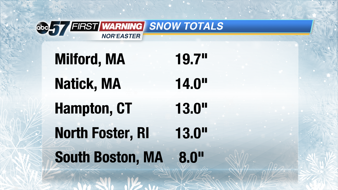 Select snowfall totals as of 3 PM Tuesday.
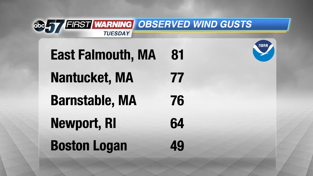 Maximum observed wind gusts as of 2 PM Tuesday.