The Mess: Heavy rain tonight, heavy snow Thursday

-
1:22

Another round of rain, then a cool weekend
-
1:30

Downtown South Bend and Notre Dame to see improved connectivity
-
1:44

Storm threat today holds relatively low severe risk
-
0:30

Officials share opioid settlement funding plan
-
1:04

Bonneyville Mill opens for the 2024 season
-
0:32

Increase in federal funding coming to improve local hiking and...
-
3:07

Gun violence on the decline in South Bend
-
1:18

Severe weather could visit Midwest again Wednesday
-
1:44

Showers, storms, wind and a cool down
-
1:58

Rain returns tonight, storm chances picking up into tomorrow
-
2:20

Indiana Fever select Caitlin Clark #1 overall in WNBA Draft
-
5:31

Interview with Rep. Bill Huizenga over Israel-Iran conflict

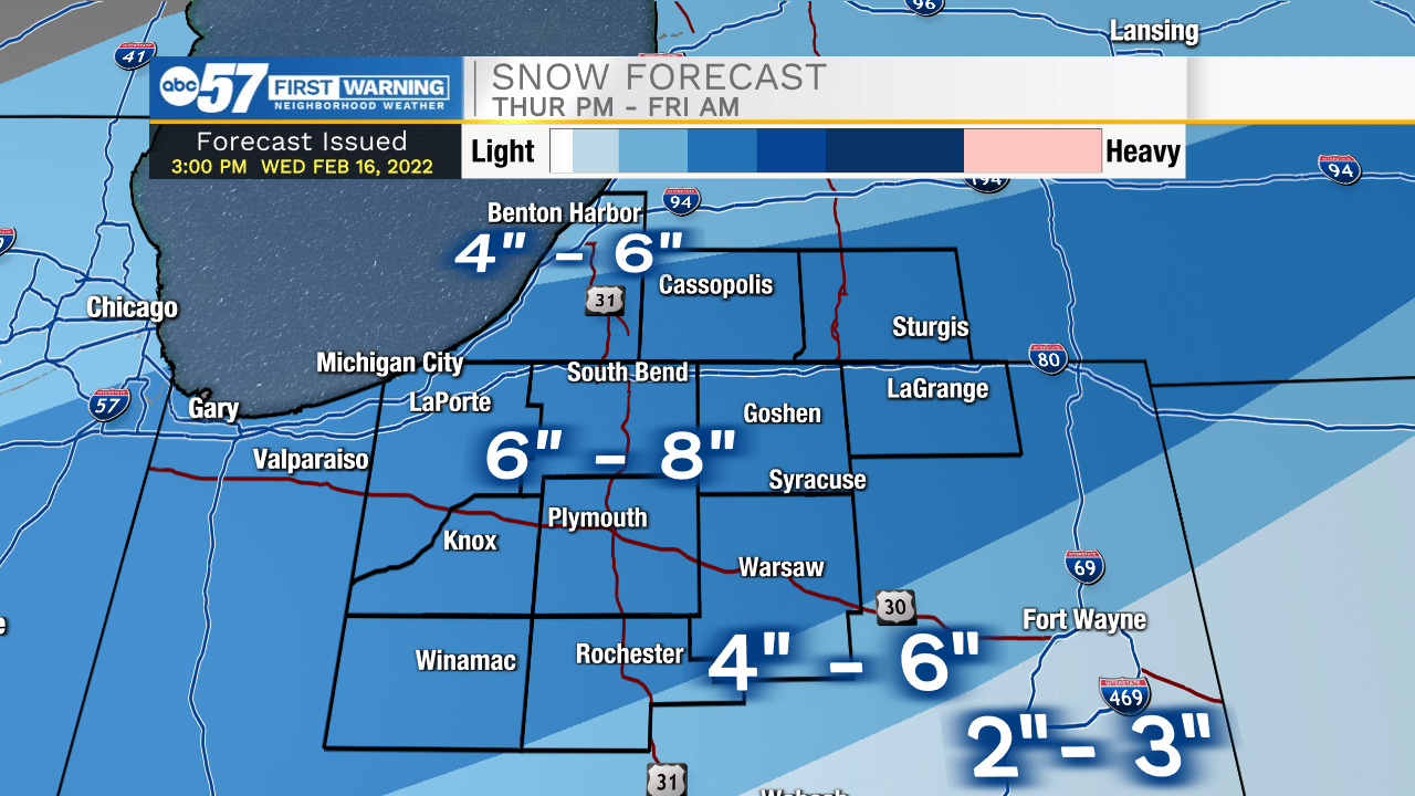
Heavy rain overnight will lead to flooding / standing water in low lying areas. In total more than two inches of combined melt-water and rainfall will be released. Temperatures fall from 50 in the early morning Thursday, to the 20s by Thursday afternoon. The rapid cool-down brings concern for anything wet to freeze. The rapid cool-down also has boosted snow potential. The entire area is in the heavy snow zone, like at least six inches likely. A burst of heavy snow is likely Thursday afternoon, a high impact for the evening commute. Temperatures plummet to the lower teens Friday morning, the snow ends around midnight, but there will still be slick impacts.
The weekend is fair and quiet, cold Friday and Saturday but another warm-up Sunday. There could be more melt-rain-flood concerns next week.
Tonight: Rain and wind. Low 34.
Thursday: Rain ending in the morning, snow starting in the afternoon. Heavy after 3:00 PM Temperatures in the 30s fall to the 20s by afternoon.
Friday: Clouds clearing. High 24.
Saturday: Partly cloudy. High 26