The Mess begins, warm and windy Wednesday
Posted: Feb 15, 2022 5:52 PM EDT

-
2:32

County Council asks questions on 900-acre Granger rezoning and...
-
0:56

Notre Dame women’s basketball team holds end-of-season awards...
-
0:45

Idea Week kicks off with networking at launch party
-
2:59

SBPD officer takes in six puppies while SBARC remains on Parvo...
-
1:45

How rain is hampering planting progress
-
2:43

From classrooms to rental units in Chikaming Township
-
1:47

Cooler and drier midweek, milder and wetter weekend
-
2:36

Aspiring chefs are cultivating their dreams at Ivy Tech
-
1:40

Rainy and breezy Tuesday
-
0:58

Hockey team hosts ’Rally for Rudy’ car wash
-
1:06

South Bend School Board of Trustees reviewing the code of conduct
-
2:33

Newly annexed land in Mishawaka could see a Gurley Leep auto...

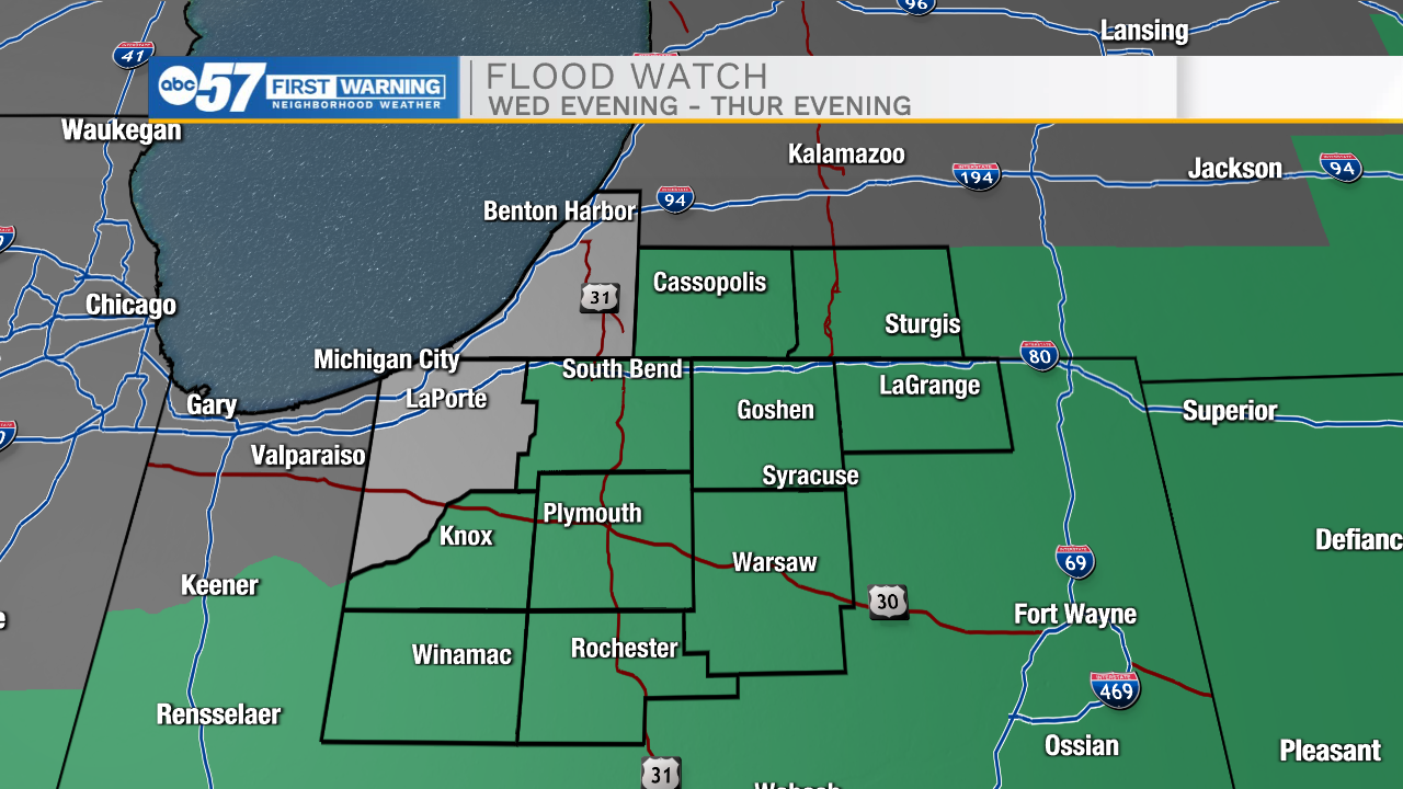
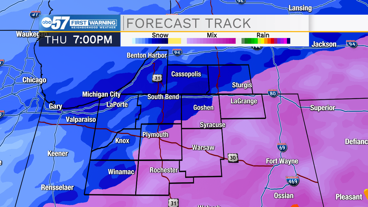
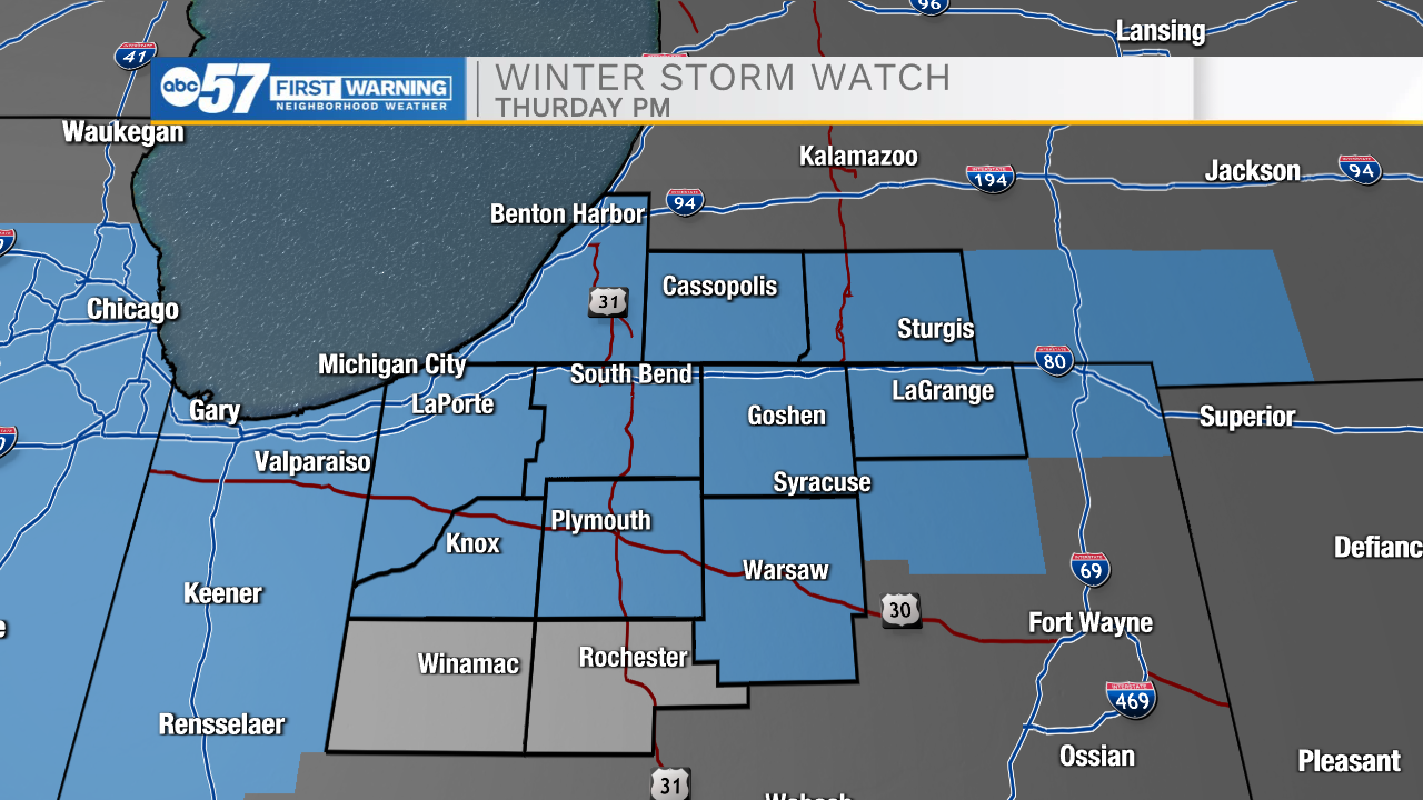
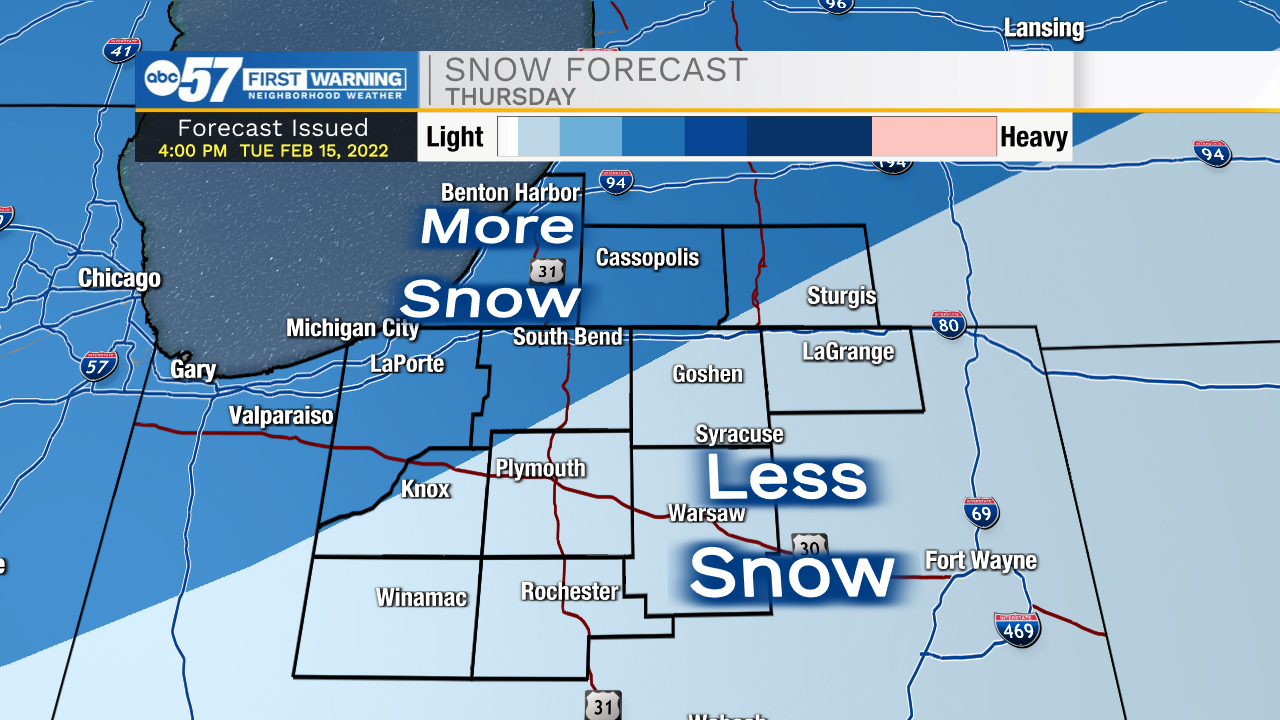
The Mess this week is a moving target of wind, rain, mix, snow and a temperature swing. The timeline of these events impacts the subsequent next part of the forecast. Roughly it plays out like this.
- Southey wind gusts +35 mph Wednesday
- Temperatures warm to 50 through early Thursday morning
- Rain starts Wednesday evening, the heaviest overnight into Thursday.
- Flooding is a concern with +1" of rainfall, combined with rapid snow-melt, in total 2"-3" of water.
- Temperatures plummet Thursday morning
- 30s in the morning, 20s afternoon, teens overnight.
- A burst of snow Thursday afternoon could bring quick accumulation Thursday afternoon-evening.
- A BIG, if is how quick is the refreeze and the impact on snowfall and potential ice.
Friday is likely off to a slick start, but the forecast is fair through the weekend.
Tonight: Temperatures rise to 40, increasing clouds and wind.
Wednesday: Windy, rain by the evening. High 50.
Thursday: Falling temperatures, rain/snow showers. A burst of heavy snow possible. 28 by the afternoon.
Friday: Cold and sunny. High 24.
Sign up for the ABC 57Newsletter