The deep freeze begins, snowy pattern ahead

-
1:52

While the rain is over, the cooling temperatures are not
-
2:28

Public forum hosted by John Glenn High School students
-
3:34

Kickoff preview with ABC57’s Allison Hayes
-
0:57

Completion of Martin Luther King Jr. Dream Center one step closer
-
0:36

Niles High School students network with local professionals
-
3:59

Political group asks Indiana Democrats to vote in Republican...
-
3:01

New Buffalo Area Schools to build workforce housing
-
2:37

City seeks feedback for final Potawatomi Park plan
-
7:27

Center for the Homeless hosting Dancing With Our Stars
-
2:10

More wet weather arriving later tonight, but sunnier skies after
-
3:16

Public input on the proposal to restart the Palisades Nuclear...
-
1:35

Dari Fair opened Wednesday for 2024 season, temperatures cool...

The deep freeze begins Thursday, with subfreezing temperatures for the foreseeable future, some nights will fall below zero. The first of many rounds of snow starts Thursday afternoon, a weak clipper will bring a range of one to three inches to the lake effect zones. More of the same through the weekend, systems spacing themselves by roughly 24 hours apart. Monday snow might be the most widespread and impactful snow but that will come down to the track of the storm. Stay tuned and stay warm, the heart of winter is here.
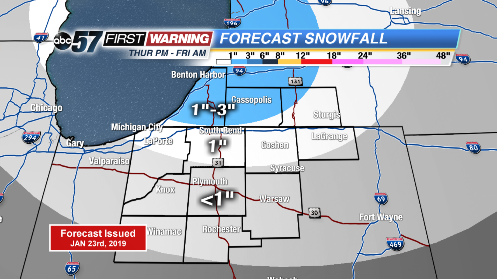
Tonight: Mostly cloudy with a chance of snow showers. Low of 16.
Thursday: Mostly cloudy with snow showers starting in the evening. High of 24.
Friday: Morning snow showers. High of 8.
Saturday: Morning show showers. High of 16.