Temperatures on the rise with a chance of storms midweek

-
7:27

Center for the Homeless hosting Dancing With Our Stars
-
2:10

More wet weather arriving later tonight, but sunnier skies after
-
3:16

Public input on the proposal to restart the Palisades Nuclear...
-
1:35

Dari Fair opened Wednesday for 2024 season, temperatures cool...
-
1:22

Another round of rain, then a cool weekend
-
4:33

Should Indiana’s abortion records be public?
-
2:52

Trailblazing promotions at the South Bend Fire Department
-
1:30

Downtown South Bend and Notre Dame to see improved connectivity
-
1:44

Storm threat today holds relatively low severe risk
-
0:30

Officials share opioid settlement funding plan
-
1:04

Bonneyville Mill opens for the 2024 season
-
0:32

Increase in federal funding coming to improve local hiking and...

Monday, June 1st, 2020
Clouds increase past midday with isolated showers possible this evening. You'll need your A/C back on tomorrow as temperatures climb into the mid 80s with humidity on the rise as well. Wednesday brings in the chance of a couple of showers and thunderstorms but the day does not look to be a washout. We are back to sunshine Thursday before the next chance of storms arrives Friday afternoon. That'll bring some relief from the heat heading into the weekend.
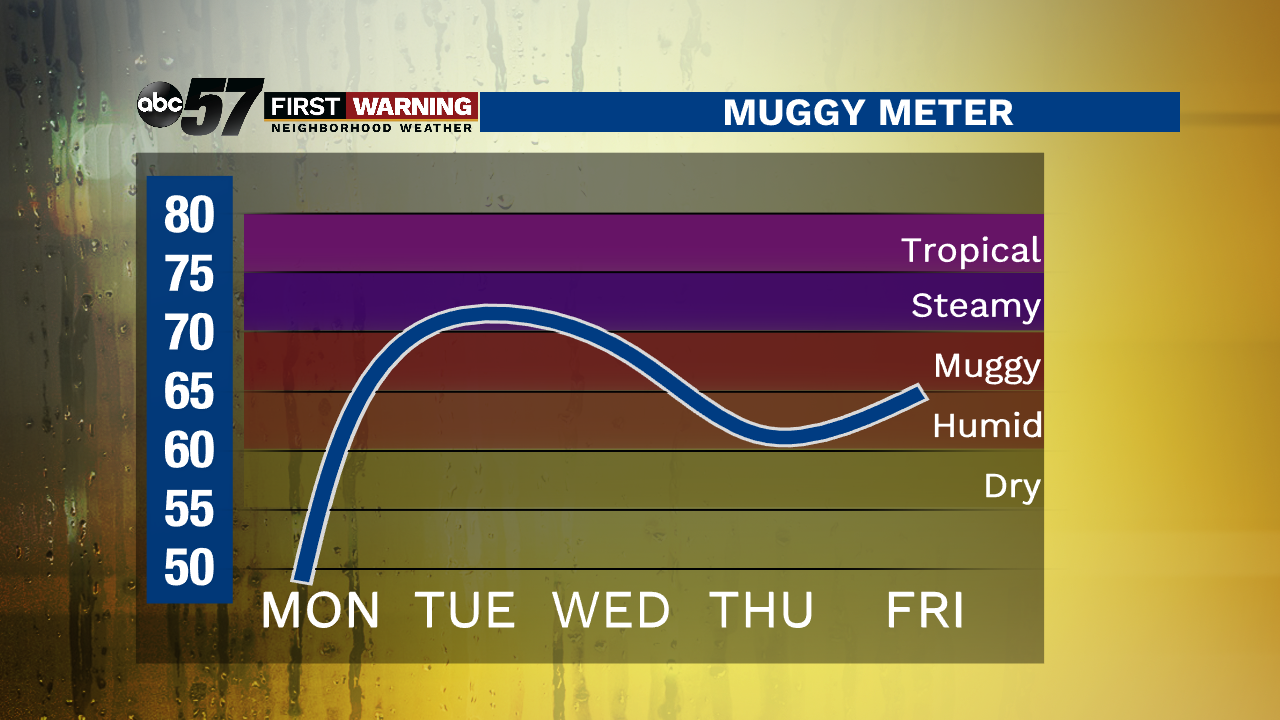
Today: Mostly sunny early. Increasing cloud cover with a chance of evening showers. High of 74.
Tonight: Mostly cloudy, showers possible. Low of 60.
Tuesday: Partly cloudy, breezy. Humidity returns. High of 86.
Wednesday: Couple of showers and thunderstorms, especially in the afternoon. High of 82.