
-
2:28

Public forum hosted by John Glenn High School students
-
3:34

Kickoff preview with ABC57’s Allison Hayes
-
0:57

Completion of Martin Luther King Jr. Dream Center one step closer
-
0:36

Niles High School students network with local professionals
-
3:59

Political group asks Indiana Democrats to vote in Republican...
-
3:01

New Buffalo Area Schools to build workforce housing
-
2:37

City seeks feedback for final Potawatomi Park plan
-
7:27

Center for the Homeless hosting Dancing With Our Stars
-
2:10

More wet weather arriving later tonight, but sunnier skies after
-
3:16

Public input on the proposal to restart the Palisades Nuclear...
-
1:35

Dari Fair opened Wednesday for 2024 season, temperatures cool...
-
1:22

Another round of rain, then a cool weekend

Temperatures climb and the humidity spikes this weekend. Highs in the 90s and a heat index near 100 will make for hazardously hot conditions. Practice heat safety keeping cool and staying hydrated. The chance of isolated showers and storms will also be in the forecast, the best chance coming early Saturday.
The heat breaks Monday night with a strong cold front that is likely to produce a line of thunderstorms that could be strong to severe. Timing of the front will critical in forecasting the likelihood of severe weather.
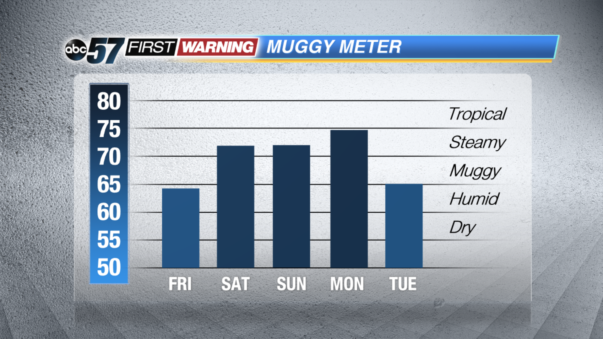
Tonight: Mostly clear, low of 60.
Friday: Mostly sunny, high of 86.
Saturday: Partly cloudy, mainly AM isolated t-storms, high of 90.
Sunday: Hot and humid, highs in the low to mid 90s, heat index near 100.
Sign up for the ABC 57Newsletter