Summer warmth surges ahead of Friday's storm threat

-
1:58

Rain returns tonight, storm chances picking up into tomorrow
-
2:20

Indiana Fever select Caitlin Clark #1 overall in WNBA Draft
-
5:31

Interview with Rep. Bill Huizenga over Israel-Iran conflict
-
1:05

Students perform in first-time joint concert event
-
2:31

Neighbors react after man barricaded himself in crashed vehicle
-
1:52

St. Joseph River at near-flood stage in Niles
-
1:03

Construction set to start on intersection at State Road 933 and...
-
1:54

Event honoring Vietnam War veterans to be held in New Carlisle
-
2:44

St. Joe marinas await completion of Bicentennial Bridge construction
-
2:05

The storm threat is shifting to Wednesday
-
1:24

WNBA Draft looking to impact the next generation of female athletes
-
2:31

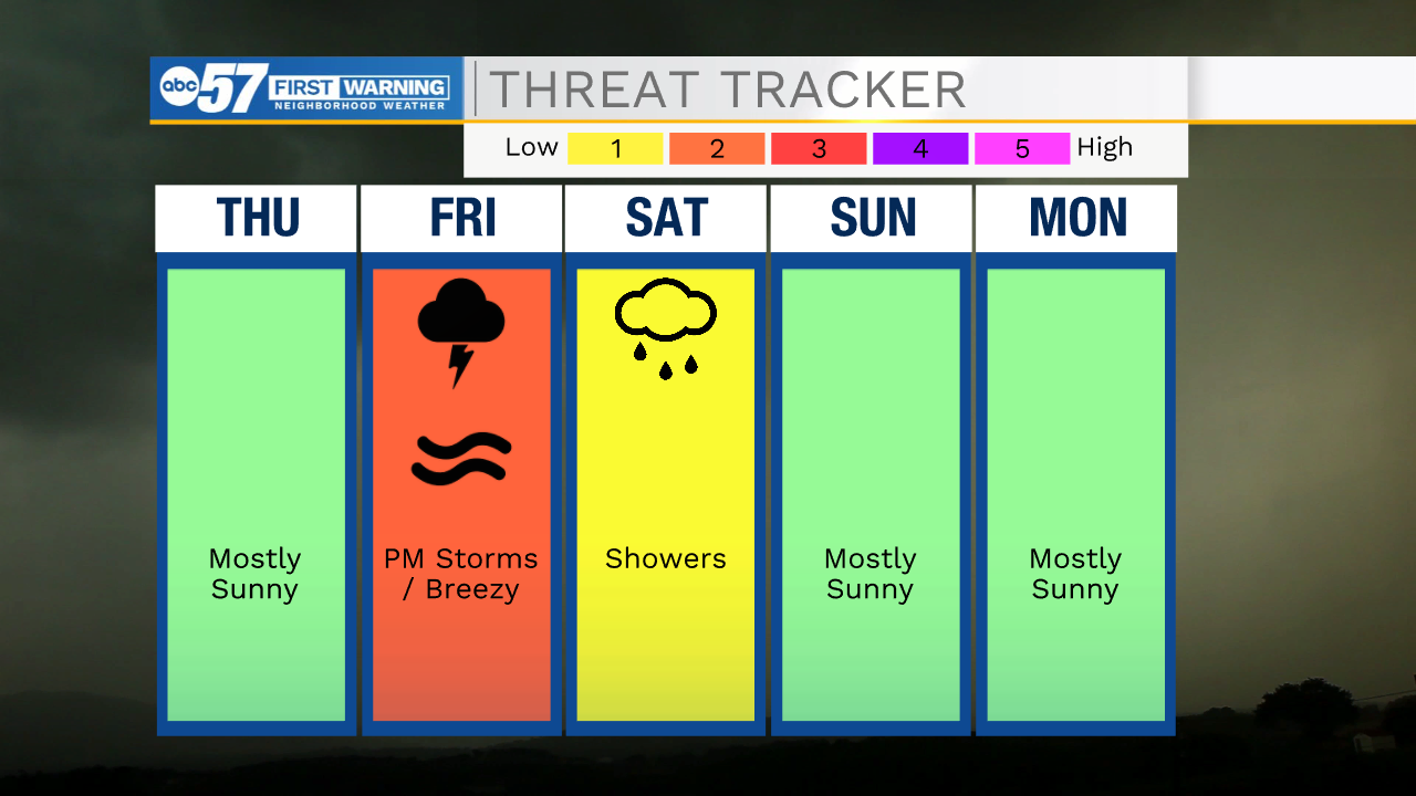
One last quiet, pleasant day before storms return tomorrow

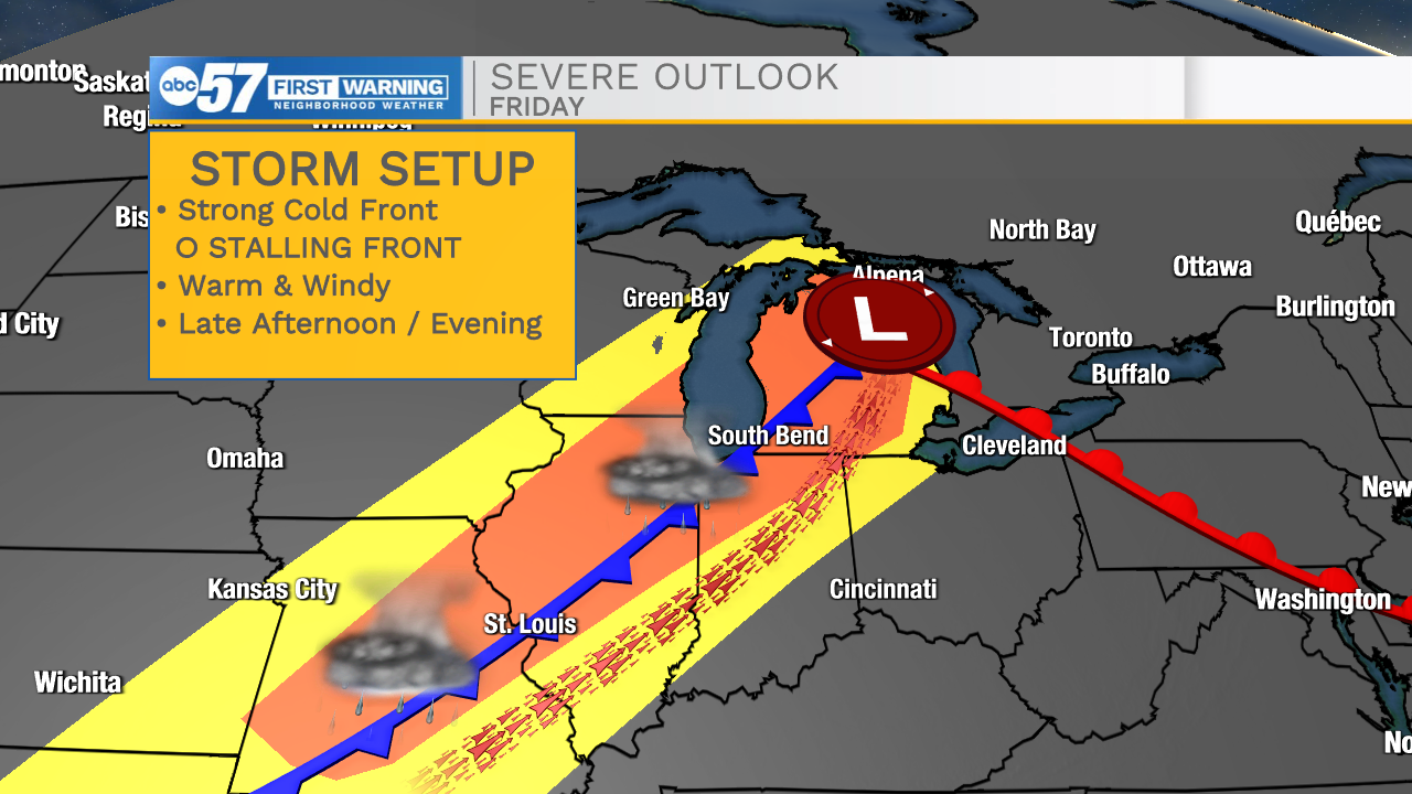
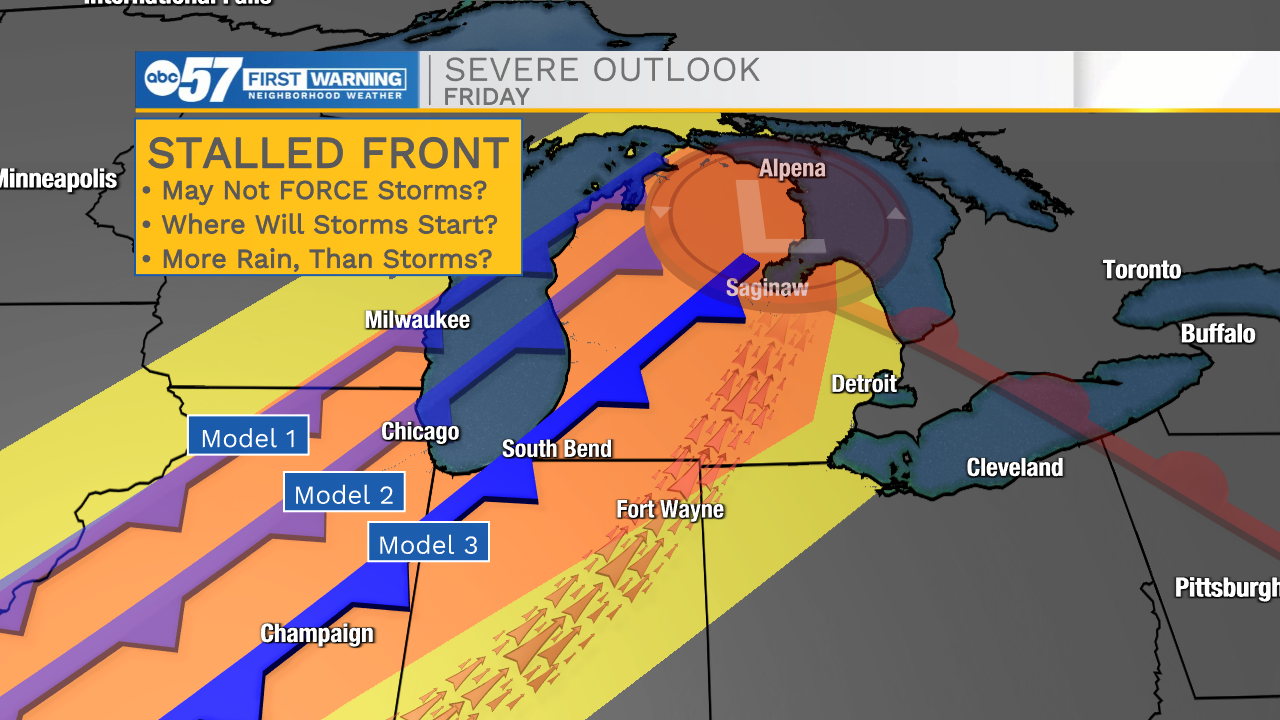
Temperatures spike and highs warm into the 80s Thursday and Friday. Thursday is dry, as is more of Friday until showers and storms develop with an approaching cold front. The possibility of severe weather remains an concern, with a strong cold front (80s on one side, 60s the other). There will be plenty of storm energy ahead of the front, yet doubt remains that severe storms may actually develop. Models reflect low confidence despite favorable storm ingredients. One factor may be a lagging to stalling cold front, that may lack the force to start storms. There is a definite 'bust' factor and widespread severe weather ( it may not happen), but widespread rain through Saturday is looking more likely with the slower front.
Tonight: Showers early. Low 52.
Thursday: Mostly sunny. High 82.
Friday: Breezy, PM T-Storms. High 88.
Saturday: T-Showers. High 66.
Sunday: Partly cloudy. High 62.