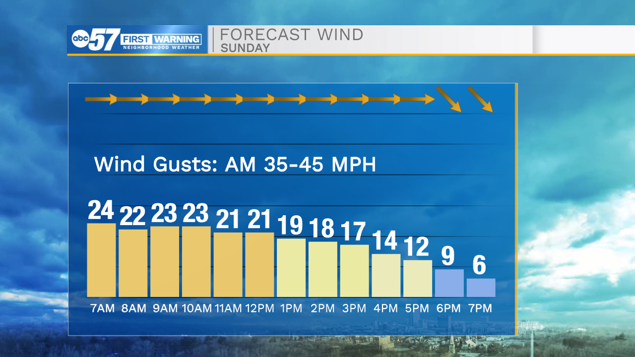
Strong winds remain in place through this morning

-
1:52

While the rain is over, the cooling temperatures are not
-
2:28

Public forum hosted by John Glenn High School students
-
3:34

Kickoff preview with ABC57’s Allison Hayes
-
0:57

Completion of Martin Luther King Jr. Dream Center one step closer
-
0:36

Niles High School students network with local professionals
-
3:59

Political group asks Indiana Democrats to vote in Republican...
-
3:01

New Buffalo Area Schools to build workforce housing
-
2:37

City seeks feedback for final Potawatomi Park plan
-
7:27

Center for the Homeless hosting Dancing With Our Stars
-
2:10

More wet weather arriving later tonight, but sunnier skies after
-
3:16

Public input on the proposal to restart the Palisades Nuclear...
-
1:35

Dari Fair opened Wednesday for 2024 season, temperatures cool...

This morning winds are still gusting into the 40-50mph range, and will continue to do so until 11am this morning. Due to the strong winds throughout the first half of the day, make sure to refrain from burning anything as fires can get out of control at a very rapid pace. Temperatures will mostly stay in the 40s today. Tonight another round of rain will move in, then turn to mixed wintry precip and snow by Monday morning. A few isolated lake effect snow showers will persist into Monday evening. Snow accumulations could total close to 1-2 inches in northwestern Michiana. We will clear things out into Tuesday and Wednesday as sunshine and 40 degree temperatures return. Most of this week looks dry and quiet, until we get to Thursday night and Friday. Another front will bring snow chances and colder temperatures heading into next weekend.
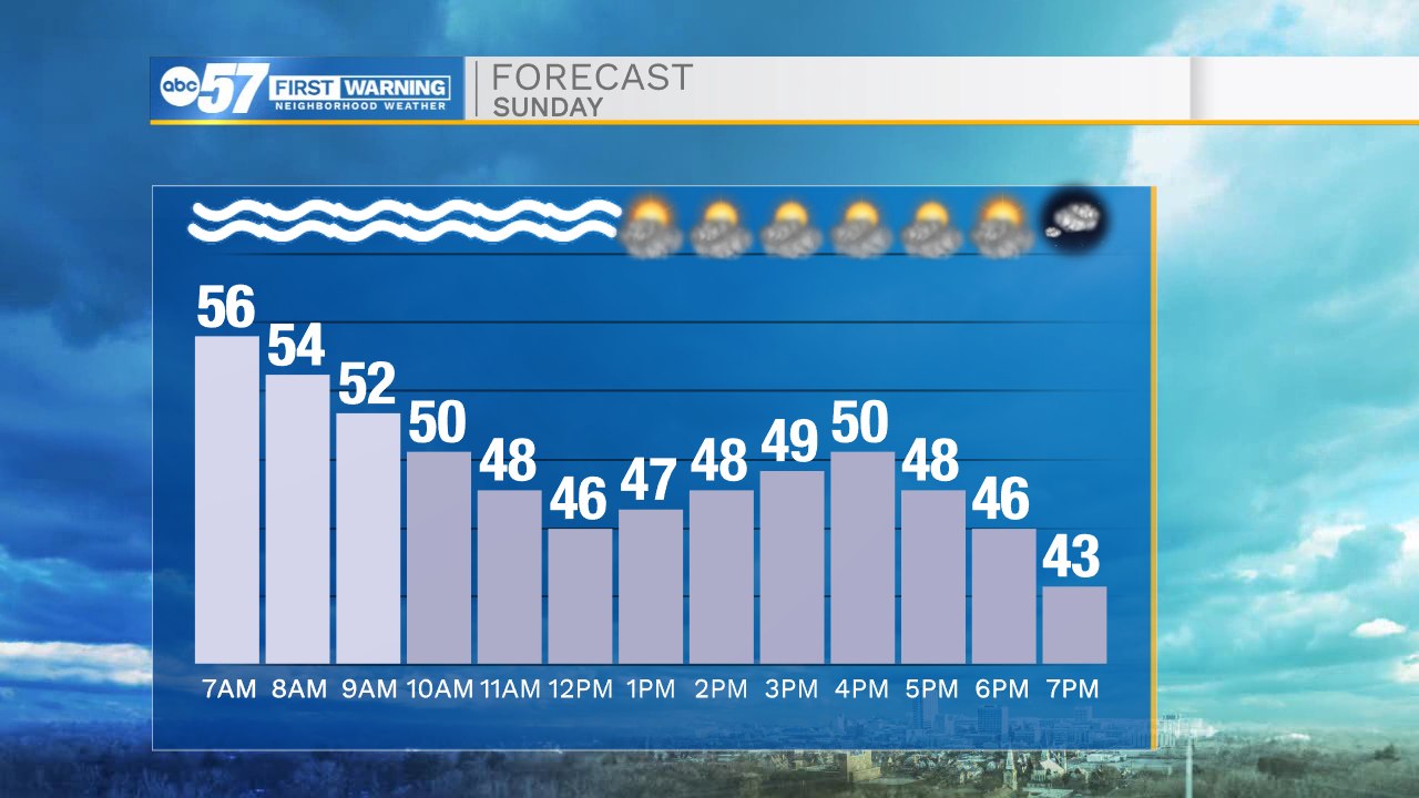
Today: Mostly cloudy/windy. High 50.
Tonight: Rain/snow. Low 36.
Tomorrow: Isolated snow showers. High 38.
Tuesday: Mostly sunny. High 42.