Strong winds and cold temperatures for the start of the weekend

-
2:28

Public forum hosted by John Glenn High School students
-
3:34

Kickoff preview with ABC57’s Allison Hayes
-
0:57

Completion of Martin Luther King Jr. Dream Center one step closer
-
0:36

Niles High School students network with local professionals
-
3:59

Political group asks Indiana Democrats to vote in Republican...
-
3:01

New Buffalo Area Schools to build workforce housing
-
2:37

City seeks feedback for final Potawatomi Park plan
-
7:27

Center for the Homeless hosting Dancing With Our Stars
-
2:10

More wet weather arriving later tonight, but sunnier skies after
-
3:16

Public input on the proposal to restart the Palisades Nuclear...
-
1:35

Dari Fair opened Wednesday for 2024 season, temperatures cool...
-
1:22

Another round of rain, then a cool weekend

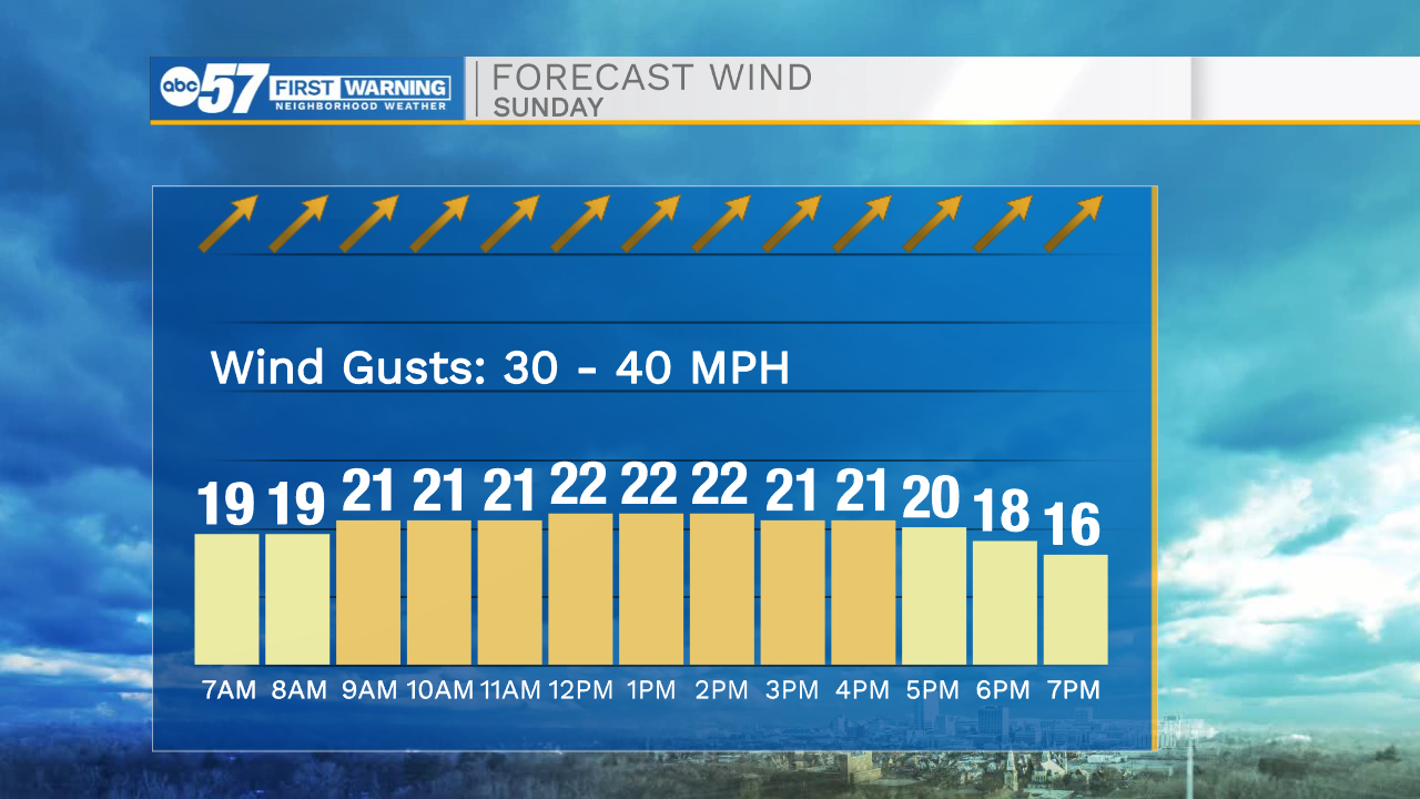
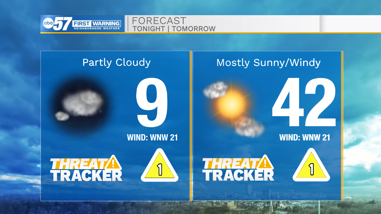
This morning is cold and windy with a few isolated light snow showers. Temperatures are dropping into the teens with feel like temperatures in the single digits. Winds are steadily blowing in the 20-25mph with gusts in the 30s. This will cause concern for blowing and drifting especially on county roads. Leave yourself plenty of extra time, if you are traveling in rural areas. Winds will die down as we move into the late afternoon and evening. Highs this afternoon will struggle to hit the lower 20s. Tomorrow will be another very windy day for us here in Michiana. Gusts tomorrow afternoon will range from 30-40mph. Along with the strong winds, warm air will surge into Michiana helping to warm temperatures into the lower 40s. Early next week will be our next chance for rain showers to move into Michiana. This rain could cause more concern for flooding, especially as it’s mixed with more snow melt. Highs by Tuesday afternoon could top out near the 50s.
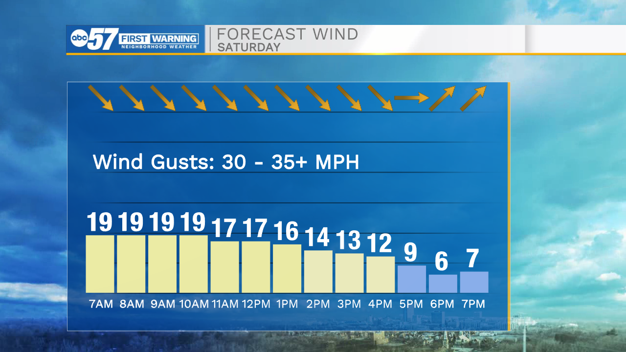
Today: Cold/windy. High 20.
Tonight: Partly cloudy. Low 9.
Tomorrow: Windy/warm. High 42.
Monday: Rain showers. High 45.