Strong to severe storms possible this afternoon and evening

-
1:58

Rain returns tonight, storm chances picking up into tomorrow
-
2:20

Indiana Fever select Caitlin Clark #1 overall in WNBA Draft
-
5:31

Interview with Rep. Bill Huizenga over Israel-Iran conflict
-
1:05

Students perform in first-time joint concert event
-
2:31

Neighbors react after man barricaded himself in crashed vehicle
-
1:52

St. Joseph River at near-flood stage in Niles
-
1:03

Construction set to start on intersection at State Road 933 and...
-
1:54

Event honoring Vietnam War veterans to be held in New Carlisle
-
2:44

St. Joe marinas await completion of Bicentennial Bridge construction
-
2:05

The storm threat is shifting to Wednesday
-
1:24

WNBA Draft looking to impact the next generation of female athletes
-
2:31

One last quiet, pleasant day before storms return tomorrow

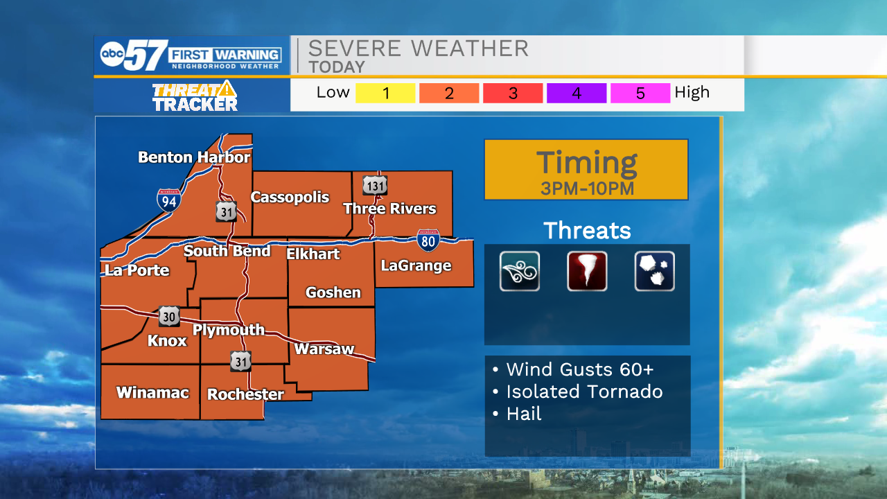
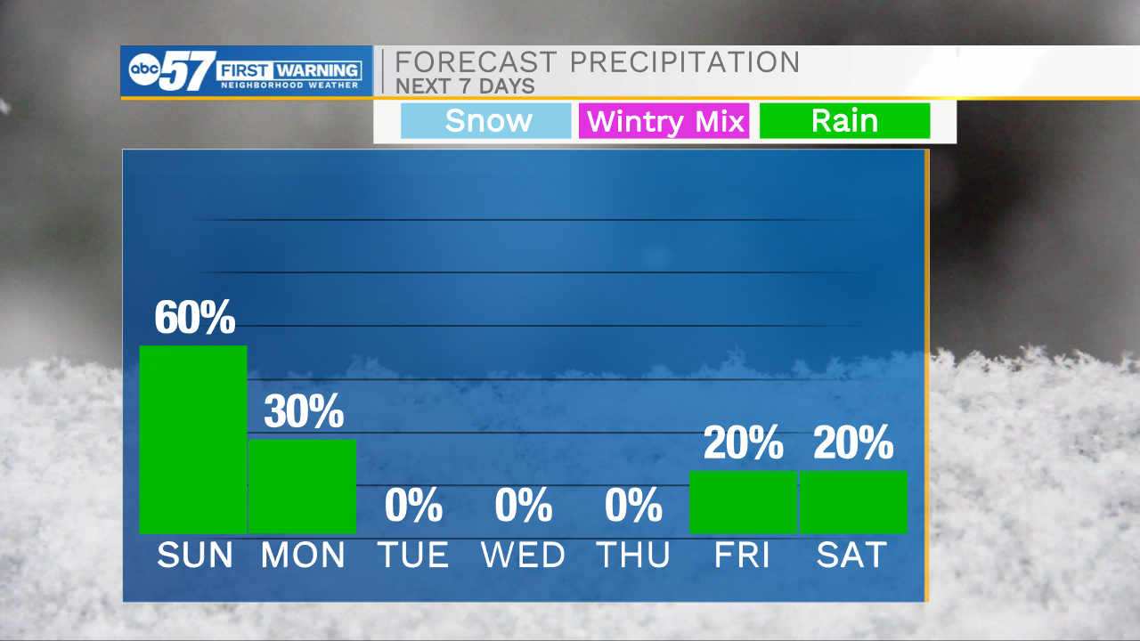
It is a very warm start to the day with temperatures in the mid 60s. This warm air will mix with plenty of moisture moving in out of the south and a cold front arriving this afternoon. This will spark rain and storm chances throughout Michiana during the early afternoon and evening. A few of these storms could be on the strong to severe side with the two main threats being damaging winds and a possible tornado or two. Showers and storm will stick around through the overnight, but after 10pm our severe threat will diminish. Rain showers should clear before lunchtime tomorrow. High temperatures will drop into the 50s for Monday and the 40s for Tuesday and Wednesday. This week looks mostly dry, but then rain chances return to the forecast heading into next weekend. Highs will rebound back into the lower 60s by Friday.
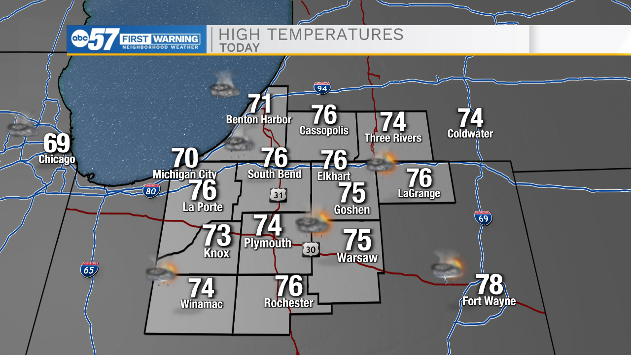
Today: PM Thunderstorms. High 76.
Tonight: Scattered showers. Low 50.
Tomorrow: AM Rain. High 58.
Tuesday: Partly cloudy. High 48.