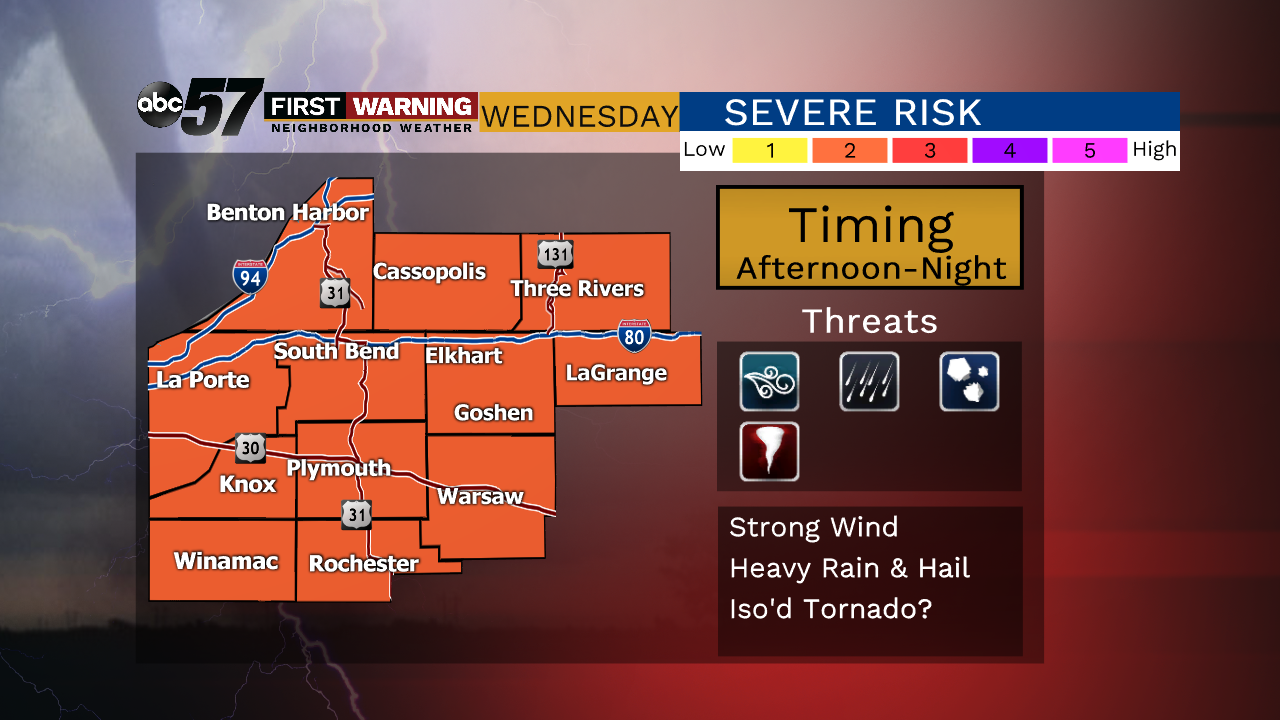
Strong to severe storm potential late Wednesday


We're still watching the chance for storms Wednesday afternoon into the overnight hours, primarily before midnight Thursday. All of Michiana remains in the orange shade, indicating a 2 out of 5 on our Threat Tracker. Now, in the afternoon and evening, any pop-up storms could become strong enough to produce downpours, localized strong wind and hail. When the line moves through Wednesday night with the cold front, that'll be our best chance for more widespread damaging winds and hail, along with more downpours.
 The top concern continues to be damaging wind, especially as the cold front moves through during the evening and overnight hours.
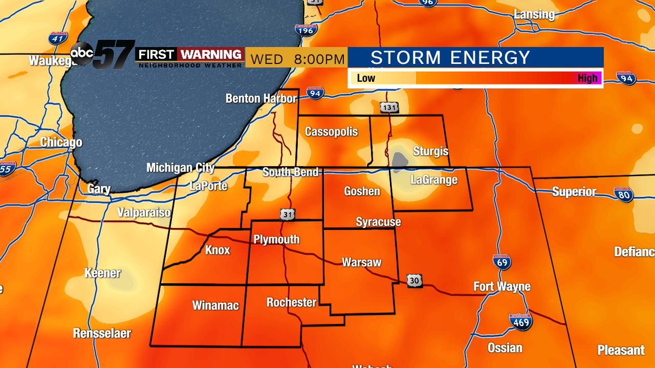 There will be storm energy in place through sunset. Afterwards, expect remaining storms to slowly weaken.
The timing, once again, will be critical when we're talking about storm strength. Since we're expecting a few storms in the afternoon and evening, those could be the most intense while being localized. If the cold front moves into the western portions of Michiana before sunset, we'll have the best chance for severe weather. If it's only a couple hours later than expected, scattered heavy rain and some stronger wind gusts may be the only two things we'll see.
Let's take a look at the biggest concern with tomorrow's storms. Strong wind and heavy rain take the number one and two spots, followed by hail. Tornadoes are possible with this round of strong storms, but the best chance will be north and west of Michiana, closer to Wisconsin and the U.P. of Michigan.
 Damaging wind potential with the line of storms will likely be higher west of Highway 31 early Wednesday night
The damaging wind threat will be localized with any storms that fire up during the late afternoon and evening. Much more of Michiana will likely see the wind pick up as the cold front moves in Wednesday evening into Wednesday night. Gusts of 30 mph or more are possible throughout the entire event, with conditions calming dramatically after midnight.
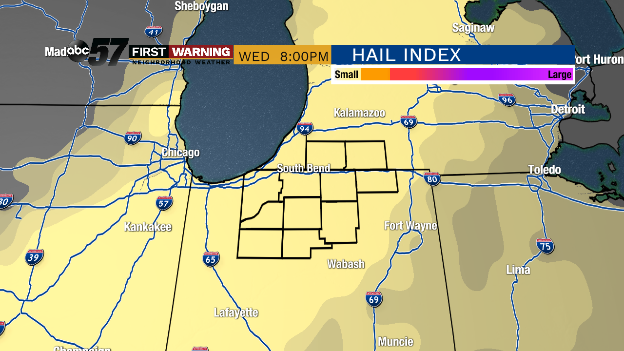
The other threat is the hail. It's not our primary concern as models show hail size will most likely be the largest to the west with any developing storms. But, small hail is still possible for Michiana through the evening into the early overnight hours.
Of course, stay with us for more updates tonight and tomorrow morning, ahead of the upcoming weather. Be sure to download the ABC 57 First Warning Neighborhood Weather App for updates, severe weather alerts, and forecasts when you're away from your TV.